212.22.11.2 - IP Lookup: Free IP Address Lookup, Postal Code Lookup, IP Location Lookup, IP ASN, Public IP
Country:
Region:
City:
Location:
Time Zone:
Postal Code:
IP information under different IP Channel
ip-api
Country
Region
City
ASN
Time Zone
ISP
Blacklist
Proxy
Latitude
Longitude
Postal
Route
Luminati
Country
Region
eng
City
romford
ASN
Time Zone
Europe/London
ISP
Digital Space Group Limited
Latitude
Longitude
Postal
IPinfo
Country
Region
City
ASN
Time Zone
ISP
Blacklist
Proxy
Latitude
Longitude
Postal
Route
IP2Location
212.22.11.2Country
Region
england
City
basildon
Time Zone
Europe/London
ISP
Language
User-Agent
Latitude
Longitude
Postal
db-ip
Country
Region
City
ASN
Time Zone
ISP
Blacklist
Proxy
Latitude
Longitude
Postal
Route
ipdata
Country
Region
City
ASN
Time Zone
ISP
Blacklist
Proxy
Latitude
Longitude
Postal
Route
Popular places and events near this IP address
Whitchurch-on-Thames
Oxfordshire village on The Thames
Distance: Approx. 2340 meters
Latitude and longitude: 51.49,-1.087
Whitchurch-on-Thames is a village and civil parish on the Oxfordshire bank of the River Thames, about 5.5 miles (9 km) northwest of Reading, Berkshire, in close proximity to Whitchurch Hill. Opposite Whitchurch on the Berkshire bank is the village of Pangbourne.

Basildon, Berkshire
Civil parish in England
Distance: Approx. 1447 meters
Latitude and longitude: 51.496973,-1.136999
Basildon is a civil parish in the English county of Berkshire. It comprises the small villages of Upper Basildon and Lower Basildon, named for their respective heights above the River Thames.

Lower Basildon
Village in Berkshire, England
Distance: Approx. 669 meters
Latitude and longitude: 51.50396,-1.12397
Lower Basildon is a small English village in the civil parish of Basildon, near Pangbourne, in the county of Berkshire.
Gatehampton Railway Bridge
Bridge in Lower Basildon, Berkshire
Distance: Approx. 1514 meters
Latitude and longitude: 51.51166667,-1.12791667
Gatehampton Railway Bridge, otherwise referred to as Gatehampton Viaduct, is a railway bridge carrying the Great Western Main Line over the River Thames in Lower Basildon, Berkshire, England. It takes the line between the stations at Goring and Streatley and Pangbourne, and crosses the Thames on the reach between Whitchurch Lock and Goring Lock. The western viaduct is the older of the two, having been engineered by Isambard Kingdom Brunel and was constructed at the same time as Maidenhead Railway Bridge and Moulsford Railway Bridge.
Goring Rural District
Historical rural district
Distance: Approx. 2159 meters
Latitude and longitude: 51.51,-1.09
Goring was a rural district in Oxfordshire, England from 1894 to 1932. It was formed from that part of the Bradfield rural sanitary district which was in Oxfordshire, with the Berkshire part going to the Bradfield Rural District. It consisted of the three parishes of Goring, Mapledurham and Whitchurch.

Hartslock
Wood and nature reserve in Oxfordshire, UK
Distance: Approx. 907 meters
Latitude and longitude: 51.507,-1.11
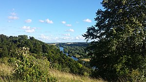
Hartslock, also known as Hartslock Woods, is a 41.8-hectare (103-acre) biological Site of Special Scientific Interest (SSSI) in a wooded area on the north bank of the River Thames to the south-east of Goring-on-Thames in the English county of Oxfordshire. An area of 29.4 hectares (73 acres) is a Special Area of Conservation and an area of 10 hectares (25 acres) is a nature reserve owned and managed by the Berkshire, Buckinghamshire and Oxfordshire Wildlife Trust (BBOWT). The site is well known for the variety of wild orchids that grow on its sloping grassland, and especially for the monkey orchid (Orchis simia) that grows in very few other places in England.

St Bartholomew's Church, Lower Basildon
Redundant church in Berkshire, England
Distance: Approx. 935 meters
Latitude and longitude: 51.50833333,-1.11833333
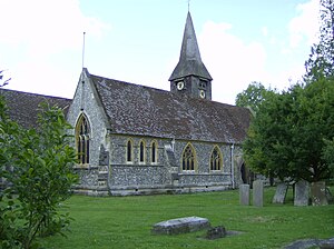
St Bartholomew's Church is the redundant Church of England parish church of Basildon in the English county of Berkshire. It lies in the hamlet of Lower Basildon and is now owned by the Churches Conservation Trust. The church is designated by Historic England as a Grade I listed building.

Beale Wildlife Park
Zoo in Reading, Berkshire
Distance: Approx. 580 meters
Latitude and longitude: 51.5,-1.10833333
Beale Wildlife Park is situated by the River Thames, between the villages of Pangbourne and Lower Basildon in Berkshire, England. It has three main areas of attraction: collections of small exotic animals, farm animals and birds; landscaped gardens and woodlands; and children's play areas. In 1956, Beale Park was formed by Gilbert Beale who decided to give the 350-acre (140 ha) Thames-side park land to ‘the people’ by converting it from private farmland into a non-profit making, charitable trust.

A329 road
East-west road in Southern England
Distance: Approx. 378 meters
Latitude and longitude: 51.5027,-1.12
The A329 is an east–west road in Southern England that runs from Wentworth in Surrey to Thame in Oxfordshire.

Basildon Park
Historic house museum in West Berkshire, England
Distance: Approx. 436 meters
Latitude and longitude: 51.4989,-1.12274
Basildon Park is a country house situated 2 miles (3 kilometres) south of Goring-on-Thames and Streatley in Berkshire, between the villages of Upper Basildon and Lower Basildon. It is owned by the National Trust and is a Grade I listed building. The house was built between 1776 and 1783 for Sir Francis Sykes and designed by John Carr in the Palladian style at a time when Palladianism was giving way to the newly fashionable neoclassicism.

Pangbourne College Boat Club
British rowing club
Distance: Approx. 2173 meters
Latitude and longitude: 51.486954,-1.093387
Pangbourne College Boat Club is a rowing club based on the River Thames at Pangbourne College Boathouse, Shooters Hill, Pangbourne, Berkshire.

Bowden House, Berkshire
Grade II* listed country house in Berkshire, England
Distance: Approx. 2218 meters
Latitude and longitude: 51.480102,-1.1149698
Bowden House, previously called both "Bowden Green" and "Port Jackson", is an English country house. It is a historic Grade II* listed building. The house is located southwest of Pangbourne, Berkshire.
Weather in this IP's area
broken clouds
8 Celsius
8 Celsius
6 Celsius
10 Celsius
1025 hPa
96 %
1025 hPa
1018 hPa
1400 meters
0.51 m/s
50 degree
75 %

