212.18.246.230 - IP Lookup: Free IP Address Lookup, Postal Code Lookup, IP Location Lookup, IP ASN, Public IP
Country:
Region:
City:
Location:
Time Zone:
Postal Code:
ISP:
ASN:
language:
User-Agent:
Proxy IP:
Blacklist:
IP information under different IP Channel
ip-api
Country
Region
City
ASN
Time Zone
ISP
Blacklist
Proxy
Latitude
Longitude
Postal
Route
db-ip
Country
Region
City
ASN
Time Zone
ISP
Blacklist
Proxy
Latitude
Longitude
Postal
Route
IPinfo
Country
Region
City
ASN
Time Zone
ISP
Blacklist
Proxy
Latitude
Longitude
Postal
Route
IP2Location
212.18.246.230Country
Region
auvergne-rhone-alpes
City
bains
Time Zone
Europe/Paris
ISP
Language
User-Agent
Latitude
Longitude
Postal
ipdata
Country
Region
City
ASN
Time Zone
ISP
Blacklist
Proxy
Latitude
Longitude
Postal
Route
Popular places and events near this IP address

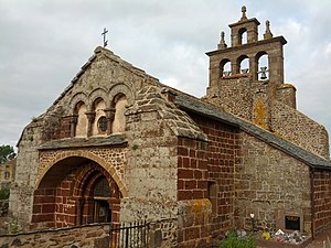
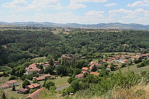
Bains, Haute-Loire
Commune in Auvergne-Rhône-Alpes, France
Distance: Approx. 116 meters
Latitude and longitude: 45.0103,3.7758
Bains (French pronunciation: [bɛ̃s]) is a commune in the Haute-Loire department in south-central France.
Ceyssac
Commune in Auvergne-Rhône-Alpes, France
Distance: Approx. 5830 meters
Latitude and longitude: 45.0386,3.8364
Ceyssac (French pronunciation: [sesak]) is a commune in the Haute-Loire department of south-central France.

Chaspuzac
Commune in Auvergne-Rhône-Alpes, France
Distance: Approx. 6920 meters
Latitude and longitude: 45.0692,3.7497
Chaspuzac (French pronunciation: [ʃaspyzak]) is a commune in the Haute-Loire department in south-central France.
Saint-Christophe-sur-Dolaizon
Commune in Auvergne-Rhône-Alpes, France
Distance: Approx. 3881 meters
Latitude and longitude: 44.9978,3.8211
Saint-Christophe-sur-Dolaizon (French pronunciation: [sɛ̃ kʁistɔf syʁ dɔlɛzɔ̃]; Auvergnat: Sant Cristofòri de Dolason, before 2025: Saint-Christophe-sur-Dolaison) is a commune in the Haute-Loire department in south-central France.

Saint-Jean-Lachalm
Commune in Auvergne-Rhône-Alpes, France
Distance: Approx. 7226 meters
Latitude and longitude: 44.9578,3.7194
Saint-Jean-Lachalm (French pronunciation: [sɛ̃ ʒɑ̃ laʃalm]; Auvergnat: Sant Joan de la Chalm) is a commune in the Haute-Loire department in south-central France.
Saint-Privat-d'Allier
Commune in Auvergne-Rhône-Alpes, France
Distance: Approx. 7765 meters
Latitude and longitude: 44.9908,3.6797
Saint-Privat-d'Allier (French pronunciation: [sɛ̃ pʁiva dalje], literally Saint-Privat of Allier; Occitan: Sent Privat d'Alèir) is a commune in the Haute-Loire department in south-central France. On 1 January 2017, the former commune of Saint-Didier-d'Allier was merged into Saint-Privat-d'Allier.
Saint-Vidal
Commune in Auvergne-Rhône-Alpes, France
Distance: Approx. 7629 meters
Latitude and longitude: 45.0756,3.8008
Saint-Vidal (French pronunciation: [sɛ̃ vidal]; Occitan: Sant Vidal) is a commune in the Haute-Loire department in south-central France.
Sanssac-l'Église
Commune in Auvergne-Rhône-Alpes, France
Distance: Approx. 4792 meters
Latitude and longitude: 45.0525,3.7797
Sanssac-l'Église (French pronunciation: [sɑ̃sak leɡliz]) is a commune in the Haute-Loire department in south-central France.

Séneujols
Commune in Auvergne-Rhône-Alpes, France
Distance: Approx. 5470 meters
Latitude and longitude: 44.9608,3.7828
Séneujols (French pronunciation: [senøʒɔl]; Occitan: Senuèjol) is a commune in the Haute-Loire department in south-central France.

Vergezac
Commune in Auvergne-Rhône-Alpes, France
Distance: Approx. 4614 meters
Latitude and longitude: 45.0342,3.7275
Vergezac (French pronunciation: [vɛʁʒəzak]; Occitan: Vergesac) is a commune in the Haute-Loire department in south-central France.

Devès massif
Volcanic plateau in France
Distance: Approx. 7753 meters
Latitude and longitude: 44.94027778,3.76527778
The Devès is a vast basalt plateau in the Velay mountains of the Massif Central, located in Haute-Loire, forming a natural region of France. It reaches its highest point at Mont Devès at an altitude of 1,421 meters.
Mont Devès
Mountain in central France
Distance: Approx. 7755 meters
Latitude and longitude: 44.94027778,3.765
Mont Devès is a volcanic peak reaching an altitude of 1,421 meters in the French department of Haute-Loire. It is the highest point of the Devès massif in the Massif Central.
Weather in this IP's area
few clouds
-1 Celsius
-4 Celsius
-1 Celsius
-1 Celsius
1022 hPa
90 %
1022 hPa
912 hPa
10000 meters
2.15 m/s
1.99 m/s
185 degree
12 %


