212.18.112.175 - IP Lookup: Free IP Address Lookup, Postal Code Lookup, IP Location Lookup, IP ASN, Public IP
Country:
Region:
City:
Location:
Time Zone:
Postal Code:
IP information under different IP Channel
ip-api
Country
Region
City
ASN
Time Zone
ISP
Blacklist
Proxy
Latitude
Longitude
Postal
Route
Luminati
Country
ASN
Time Zone
Europe/Amsterdam
ISP
Fusix Networks B.V.
Latitude
Longitude
Postal
IPinfo
Country
Region
City
ASN
Time Zone
ISP
Blacklist
Proxy
Latitude
Longitude
Postal
Route
IP2Location
212.18.112.175Country
Region
noord-holland
City
zaanstad
Time Zone
Europe/Amsterdam
ISP
Language
User-Agent
Latitude
Longitude
Postal
db-ip
Country
Region
City
ASN
Time Zone
ISP
Blacklist
Proxy
Latitude
Longitude
Postal
Route
ipdata
Country
Region
City
ASN
Time Zone
ISP
Blacklist
Proxy
Latitude
Longitude
Postal
Route
Popular places and events near this IP address
Zaandijk
Town in North Holland, Netherlands
Distance: Approx. 1770 meters
Latitude and longitude: 52.46666667,4.8
Zaandijk (Dutch pronunciation: [zaːnˈdɛik]) is a town in the municipality of Zaanstad, province of North Holland, Netherlands. It lies about 11 kilometres (6.8 miles) northwest of Amsterdam and had a population of 8,686 in 2017. Zaandijk is one of the smallest villages in Zaanstad, having a surface area of 209 hectare.

Koog aan de Zaan
Village in North Holland, Netherlands
Distance: Approx. 1770 meters
Latitude and longitude: 52.46666667,4.8
Koog aan de Zaan (Dutch pronunciation: [ˈkoːx aːn də ˈzaːn]) is a town in the Dutch province of North Holland. It is a part of the municipality of Zaanstad, and lies about 11 km northwest of Amsterdam.

Czar Peter House (Netherlands)
Distance: Approx. 1878 meters
Latitude and longitude: 52.43733,4.823417
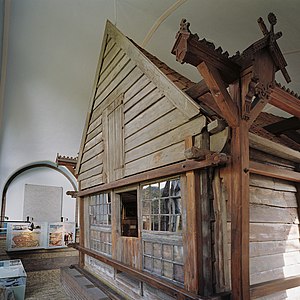
The Czar Peter House (Dutch: Czaar Peterhuisje) is a historical building in Zaandam, the Netherlands. It is best known as the place where Tsar Peter I of Russia resided in 1697 during his Grand Embassy. The building was constructed in 1632.

Zaandam railway station
Railway station in the Netherlands
Distance: Approx. 1584 meters
Latitude and longitude: 52.43888889,4.81472222
Zaandam is the main railway station of Zaandam, near Amsterdam, Netherlands. It is at the junction of the Den Helder–Amsterdam railway and the Zaandam–Enkhuizen railway.

Zaandam Kogerveld railway station
Railway station in the Netherlands
Distance: Approx. 575 meters
Latitude and longitude: 52.45666667,4.81972222
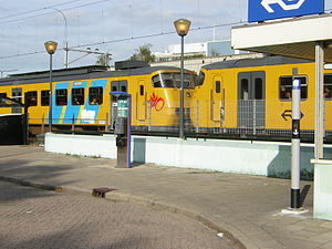
Zaandam Kogerveld is a railway station located in Zaandam, Netherlands. The station opened in 1989 on the Zaandam–Enkhuizen railway. The station is 2 km north of Zaandam railway station, and is in the Kogerveld neighbourhood.

Koog aan de Zaan railway station
Railway station in the Netherlands
Distance: Approx. 754 meters
Latitude and longitude: 52.45777778,4.80555556
Koog aan de Zaan (until 2016 Koog Bloemwijk) is a railway station in Koog aan de Zaan, Netherlands. Koog aan de Zaan was opened on 1 November 1869, on the Den Helder–Amsterdam railway between Zaandam and Uitgeest. The station had a rectangular station building from 1956 to 1986.

Zaandijk Zaanse Schans railway station
Railway station in the Netherlands
Distance: Approx. 1887 meters
Latitude and longitude: 52.46916667,4.80472222
Zaandijk Zaanse Schans railway station, until 2016 Koog-Zaandijk railway station, is a railway station in Koog aan de Zaan and Zaandijk, both neighbourhoods of the municipality of Zaandam, Netherlands. It is also the closest railway station to Zaanse Schans. The station opened on 1 November 1869 and is located on the Den Helder–Amsterdam railway between Zaandam and Uitgeest.
A8ernA
Distance: Approx. 1210 meters
Latitude and longitude: 52.4635,4.8084
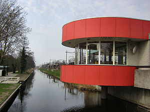
A8ernA is a public space in Koog aan de Zaan, Zaanstad, the Netherlands. The urban renewal project cost €2,700,000 and was a Joint Winner of the 2006 European Prize for Urban Public Space.

De Held Jozua, Zaandam
Paltrok mill in Zaandam, Netherlands
Distance: Approx. 1128 meters
Latitude and longitude: 52.443794,4.807006
De Held Jozua (English: The Hero Joshua) is a paltrok mill in Zaandam, Netherlands which has been restored to working order. As all Dutch paltrok mills it is a windpowered sawmill. The mill is listed as a Rijksmonument, number 40094.

Haaldersbroek
Hamlet in North Holland, Netherlands
Distance: Approx. 2018 meters
Latitude and longitude: 52.46666667,4.83333333
Haaldersbroek is a hamlet in Zaanstad, North Holland in the Netherlands. It is located in the southeast of Kalverpolder and next to Zaanse Schans. The hamlet was first mentioned in historical records in the late 14th century.

Houses on the Achterzaan
1871 painting by Claude Monet
Distance: Approx. 1611 meters
Latitude and longitude: 52.44011111,4.82408333
Houses on the Achterzaan is an 1871 painting by French artist Claude Monet. Done in oil on canvas, the work depicts riverside garden houses on the west shore of the Achterzaan river in Zaandam, the Netherlands. He painted it from the dam in the Zaan, facing northwest.
De Kade
Distance: Approx. 1759 meters
Latitude and longitude: 52.4395,4.82680556
De Kade was a 700-capacity live music venue located in Zaandam, Netherlands. It opened in 1997 and closed in 2013. Major artists performed at De Kade, including Glenn Hughes, Uriah Heep, Porcupine Tree and King Diamond.
Weather in this IP's area
few clouds
3 Celsius
3 Celsius
2 Celsius
4 Celsius
1001 hPa
66 %
1001 hPa
1001 hPa
10000 meters
1.03 m/s
20 %
