Country:
 Switzerland
Region:
City:
Latitude and Longitude:
Time Zone:
Postal Code:
IP information under different IP Channel
ip-api
Country
Region
City
ASN
Time Zone
ISP
Blacklist
Proxy
Latitude
Longitude
Postal
Route
IPinfo
Country
Region
City
ASN
Time Zone
ISP
Blacklist
Proxy
Latitude
Longitude
Postal
Route
MaxMind
Country
Region
City
ASN
Time Zone
ISP
Blacklist
Proxy
Latitude
Longitude
Postal
Route
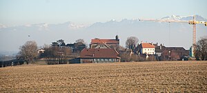
Luminati
Country
CHRegion
vd
City
mollens
ASN
Time Zone
Europe/Zurich
ISP
VTX Services SA
Latitude
Longitude
Postal
db-ip
Country
Region
City
ASN
Time Zone
ISP
Blacklist
Proxy
Latitude
Longitude
Postal
Route
ipdata
Country
Region
City
ASN
Time Zone
ISP
Blacklist
Proxy
Latitude
Longitude
Postal
Route
Popular places and events near this IP address
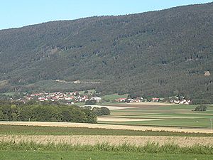
Ballens
Municipality in Vaud, Switzerland
Distance: Approx. 3248 meters
Latitude and longitude: 46.55,6.36666667
Ballens is a municipality in the district of Morges in the canton of Vaud in Switzerland.
Berolle
Municipality in Vaud, Switzerland
Distance: Approx. 3242 meters
Latitude and longitude: 46.55,6.33333333
Berolle is municipality in the Swiss canton of Vaud, located in the district of Morges.

Bière
Municipality in Vaud, Switzerland
Distance: Approx. 5002 meters
Latitude and longitude: 46.53333333,6.33333333
Bière is a municipality in the Swiss canton of Vaud, located in the district of Morges.
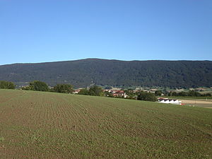
Mollens, Vaud
Municipality in Vaud, Switzerland
Distance: Approx. 1475 meters
Latitude and longitude: 46.58333333,6.36666667
Mollens is a municipality in the Swiss canton of Vaud. It is located in the district of Morges.
Sévery
Former municipality in Vaud, Switzerland
Distance: Approx. 6425 meters
Latitude and longitude: 46.58333333,6.43333333
Sévery is a former municipality of the canton of Vaud in Switzerland, located in the district of Morges. On 1 July 2021 the former municipalities of Apples, Cottens, Pampigny, Sévery, Bussy-Chardonney and Reverolle merged into the new municipality of Hautemorges.
Pampigny
Former municipality in Vaud, Switzerland
Distance: Approx. 6425 meters
Latitude and longitude: 46.58333333,6.43333333
Pampigny is a former municipality in the district of Morges in the canton of Vaud in Switzerland. On 1 July 2021 the former municipalities of Apples, Cottens, Pampigny, Sévery, Bussy-Chardonney and Reverolle merged into the new municipality of Hautemorges.
Mauraz
Municipality in Vaud, Switzerland
Distance: Approx. 5724 meters
Latitude and longitude: 46.6,6.41666667
Mauraz is a municipality of the canton of Vaud in Switzerland, located in the district of Morges.

Mont-la-Ville
Municipality in Vaud, Switzerland
Distance: Approx. 6766 meters
Latitude and longitude: 46.61666667,6.41666667
Mont-la-Ville is a municipality of the canton of Vaud in Switzerland, located in the district of Morges.

Montricher
Municipality in Vaud, Switzerland
Distance: Approx. 2884 meters
Latitude and longitude: 46.6,6.36666667
Montricher is a municipality of the canton of Vaud in Switzerland, located in the district of Morges.
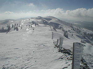
Mont Tendre
Mountain in Switzerland
Distance: Approx. 3647 meters
Latitude and longitude: 46.59472222,6.31
Mont Tendre is a mountain of the Jura, located between the valley of Joux and the basin of Lake Geneva in the canton of Vaud. With an elevation of 1,679 metres above sea level, it is the highest summit of the Swiss portion of the Jura Mountains and, therefore, the highest summit of Switzerland outside the Alps. It is also the most isolated mountain of the canton.

L'Isle Castle
Castle in L'Isle, Switzerland
Distance: Approx. 6671 meters
Latitude and longitude: 46.619153,6.411603
L'Isle Castle is a castle in the municipality of L'Isle of the Canton of Vaud in Switzerland. It is a Swiss heritage site of national significance.

Pampigny Castle
Distance: Approx. 6064 meters
Latitude and longitude: 46.5811,6.4289
Pampigny Castle is a castle in the former municipality of Pampigny (now part of Hautemorges) of the Canton of Vaud in Switzerland.
Weather in this IP's area
overcast clouds
9 Celsius
8 Celsius
9 Celsius
11 Celsius
1010 hPa
80 %
1010 hPa
910 hPa
10000 meters
2.75 m/s
6.38 m/s
233 degree
87 %
07:40:01
19:04:59