212.13.235.214 - IP Lookup: Free IP Address Lookup, Postal Code Lookup, IP Location Lookup, IP ASN, Public IP
Country:
Region:
City:
Location:
Time Zone:
Postal Code:
IP information under different IP Channel
ip-api
Country
Region
City
ASN
Time Zone
ISP
Blacklist
Proxy
Latitude
Longitude
Postal
Route
Luminati
Country
Region
061
City
ljubljana
ASN
Time Zone
Europe/Ljubljana
ISP
SOFTNET d.o.o.
Latitude
Longitude
Postal
IPinfo
Country
Region
City
ASN
Time Zone
ISP
Blacklist
Proxy
Latitude
Longitude
Postal
Route
IP2Location
212.13.235.214Country
Region
cerknica
City
cerknica
Time Zone
Europe/Ljubljana
ISP
Language
User-Agent
Latitude
Longitude
Postal
db-ip
Country
Region
City
ASN
Time Zone
ISP
Blacklist
Proxy
Latitude
Longitude
Postal
Route
ipdata
Country
Region
City
ASN
Time Zone
ISP
Blacklist
Proxy
Latitude
Longitude
Postal
Route
Popular places and events near this IP address

Cerknica
Town in Inner Carniola, Slovenia
Distance: Approx. 503 meters
Latitude and longitude: 45.79638889,14.35805556
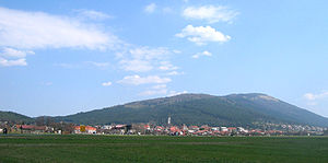
Cerknica (pronounced [ˈtseːɾknitsa] ; Italian: Circonio, German: Zirknitz) is a town in the Karst region of southwestern Slovenia, with a population of 4,018 (2016 census). It is the seat of the Municipality of Cerknica. It belongs to the traditional region of Inner Carniola.
Begunje pri Cerknici
Place in Inner Carniola, Slovenia
Distance: Approx. 2453 meters
Latitude and longitude: 45.81321389,14.37539722
Begunje pri Cerknici (pronounced [ˈbeːɡunjɛ pɾi ˈtseːɾknitsi]; German: Wigaun) is a settlement north of Cerknica in the Inner Carniola region of Slovenia.
Brezje, Cerknica
Place in Inner Carniola, Slovenia
Distance: Approx. 2393 meters
Latitude and longitude: 45.80929444,14.382775
Brezje (pronounced [ˈbɾeːzjɛ]) is a small village south of Begunje in the Municipality of Cerknica in the Inner Carniola region of Slovenia.

Dolenja Vas, Cerknica
Village in Inner Carniola, Slovenia
Distance: Approx. 1323 meters
Latitude and longitude: 45.78696667,14.34790833
Dolenja Vas (pronounced [dɔˈleːnja ˈʋaːs]; Slovene: Dolenja vas, German: Niederdorf) is a village southwest of Cerknica in the Inner Carniola region of Slovenia.
Dolenje Jezero
Village in Inner Carniola, Slovenia
Distance: Approx. 1775 meters
Latitude and longitude: 45.77739722,14.35856389
Dolenje Jezero (pronounced [dɔˈleːnjɛ ˈjeːzɛɾɔ]; German: Unterseedorf) is a village on the northern edge of Lake Cerknica in the Municipality of Cerknica in the Inner Carniola region of Slovenia.

Zelše
Place in Inner Carniola, Slovenia
Distance: Approx. 2708 meters
Latitude and longitude: 45.79386667,14.32763333
Zelše (pronounced [ˈzeːu̯ʃɛ]; in older sources also Želše, German: Selsach) is a village along the road linking Cerknica and Postojna, at the northwestern part of the karst Cerknica Polje in the Inner Carniola region of Slovenia. Zelše Caves (Zelške jame)—the source of Rak Creek, a sinking stream—lies west of the village. Big Karlovica Cave (Slovene: Velika Karlovica), receiving the waters of Stržen Creek, lies southwest of the village.
Martinjak
Village in Inner Carniola, Slovenia
Distance: Approx. 3606 meters
Latitude and longitude: 45.77610278,14.40204444
Martinjak (pronounced [maɾtiˈnjaːk], German: Martinsbach) is a village southeast of Cerknica, below Mount Slivnica in the Inner Carniola region of Slovenia. The local church in the settlement is dedicated to Saint Vitus and belongs to the Parish of Cerknica. It was first mentioned in written sources dating to 1581.

Slivnica (mountain)
Mountain in Slovenia
Distance: Approx. 3357 meters
Latitude and longitude: 45.79027778,14.40555556
Slivnica (pronounced [ˈslíːwnitsa]; 1,114 metres or 3,655 feet) is a peak in the Dinaric Alps in Slovenia, southeast of Cerknica on the edge of the plain defined by Lake Cerknica. Its southern and western slopes are covered in deciduous and pine forests, which also obstruct the view from the highest peak, Big Slivnica (Slovene: Velika Slivnica). A karst cave below the summit of Slivnica, known as Witches' Cave (Coprniška jama) was described by Valvasor in his The Glory of the Duchy of Carniola (1689) as a hole where storms were made.

Podskrajnik
Place in Inner Carniola, Slovenia
Distance: Approx. 1628 meters
Latitude and longitude: 45.79529722,14.34176667
Podskrajnik (pronounced [pɔtˈskɾaːi̯nik]) is a settlement on the western outskirts of Cerknica in the Inner Carniola region of Slovenia.

Topol pri Begunjah
Place in Inner Carniola, Slovenia
Distance: Approx. 4201 meters
Latitude and longitude: 45.81651944,14.40495833
Topol pri Begunjah (pronounced [ˈtɔːpɔu̯ pɾi ˈbeːɡunjax]) is a village east of Begunje in the Municipality of Cerknica in the Inner Carniola region of Slovenia.
Selšček
Village in Inner Carniola, Slovenia
Distance: Approx. 4070 meters
Latitude and longitude: 45.82059722,14.39706389
Selšček (pronounced [ˈseːu̯ʃtʃək]; German: Seuschtschek) is a settlement immediately east of Begunje pri Cerknici in the Municipality of Cerknica in the Inner Carniola region of Slovenia.

Municipality of Cerknica
Municipality of Slovenia
Distance: Approx. 833 meters
Latitude and longitude: 45.8,14.36666667
The Municipality of Cerknica (pronounced [ˈtseːɾknitsa] ; Slovene: Občina Cerknica) is a municipality in the Karst region of southwestern Slovenia, with a population of 11,350 in 2012. The seat of the municipality is the town of Cerknica. It belongs to the traditional region of Inner Carniola.
Weather in this IP's area
overcast clouds
1 Celsius
-2 Celsius
1 Celsius
1 Celsius
1005 hPa
97 %
1005 hPa
924 hPa
1119 meters
2.68 m/s
11.45 m/s
224 degree
100 %


