Country:
 Netherlands
Region:
City:
Latitude and Longitude:
Time Zone:
Postal Code:
IP information under different IP Channel
ip-api
Country
Region
City
ASN
Time Zone
ISP
Blacklist
Proxy
Latitude
Longitude
Postal
Route
IPinfo
Country
Region
City
ASN
Time Zone
ISP
Blacklist
Proxy
Latitude
Longitude
Postal
Route
MaxMind
Country
Region
City
ASN
Time Zone
ISP
Blacklist
Proxy
Latitude
Longitude
Postal
Route
Luminati
Country
NLRegion
nh
City
heemstede
ASN
Time Zone
Europe/Amsterdam
ISP
Vodafone Libertel B.V.
Latitude
Longitude
Postal
db-ip
Country
Region
City
ASN
Time Zone
ISP
Blacklist
Proxy
Latitude
Longitude
Postal
Route
ipdata
Country
Region
City
ASN
Time Zone
ISP
Blacklist
Proxy
Latitude
Longitude
Postal
Route
Popular places and events near this IP address

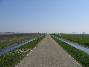
North Holland
Province of the Netherlands
Distance: Approx. 2586 meters
Latitude and longitude: 52.66666667,4.83333333
North Holland (Dutch: Noord-Holland, pronounced [ˌnoːrt ˈɦɔlɑnt] ) is a province of the Netherlands in the northwestern part of the country. It is located on the North Sea, north of South Holland and Utrecht, and west of Friesland and Flevoland. As of January 2023, it had a population of about 2,952,000 and a total area of 4,092 km2 (1,580 sq mi), of which 1,429 km2 (552 sq mi) is water.

Heerhugowaard
City in North Holland, Netherlands
Distance: Approx. 2586 meters
Latitude and longitude: 52.66666667,4.83333333
Heerhugowaard (Dutch: [ˌɦeːrɦyɣoːˈʋaːrt] ; West Frisian Dutch: Heerhugoweard, Heregeweard or De Weard) is a city in the Netherlands, in the province of North Holland and the region of West Friesland. Heerhugowaard was previously a separate municipality, which merged with the former municipality of Langedijk into the new municipality of Dijk en Waard on 1 January 2022.
Schermer
Former municipality in North Holland, Netherlands
Distance: Approx. 3243 meters
Latitude and longitude: 52.61666667,4.81666667
Schermer (Dutch pronunciation: [ˈsxɛrmər] ) is a former municipality in the Netherlands, in the province of North Holland. The name comes from "skir mere", which means "bright lake". Since 2015 it has been a part of the municipality of Alkmaar.

Broek op Langedijk
Village in North Holland, Netherlands
Distance: Approx. 3063 meters
Latitude and longitude: 52.6725,4.80555556
Broek op Langedijk (West Frisian Dutch: Broek op Lengedìk) is a village in the municipality of Dijk en Waard in the province of North Holland, the Netherlands.
Butterhuizen
Distance: Approx. 468 meters
Latitude and longitude: 52.65,4.81666667
Butterhuizen (West Frisian: Butterhúze), part of the former municipality of Heerhugowaard, is a neighbourhood of Heerhugowaard and a former hamlet in the province of North Holland, the Netherlands. Since 2022 it has been part of the new municipality of Dijk en Waard. Butterhuizen lies to the south of Heerhugowaard.

Oterleek
Village in North Holland, Netherlands
Distance: Approx. 1794 meters
Latitude and longitude: 52.63333333,4.83333333
Oterleek is a village in the Dutch province of North Holland. It is a part of the municipality of Alkmaar, and lies about 4 km south of Heerhugowaard.
Stompetoren
Village in North Holland, Netherlands
Distance: Approx. 3243 meters
Latitude and longitude: 52.61666667,4.81666667
Stompetoren is a village in the Dutch province of North Holland. It is a part of the municipality of Alkmaar, and lies about 6 km southeast of the city of Alkmaar.

Oudorp
Neighbourhood and former village in Alkmaar, North Holland, Netherlands
Distance: Approx. 3226 meters
Latitude and longitude: 52.63305556,4.77361111
Oudorp (Dutch pronunciation: [ˈʌuˌdɔr(ə)p]) is a neighbourhood of Alkmaar and former village in the Dutch province of North Holland. It is located about 2 km (1 mi) east of the city centre. The village merged with Alkmaar in 1972.

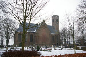
Sint Pancras
Village in North Holland, Netherlands
Distance: Approx. 2852 meters
Latitude and longitude: 52.66305556,4.78527778
Sint Pancras (West Frisian: Sundebankreas) is a town in the northwestern Netherlands. It is located in the municipality of Dijk en Waard, North Holland, about 5 km northeast of Alkmaar.

Stad van de Zon
Distance: Approx. 523 meters
Latitude and longitude: 52.64666667,4.80888889
Stad van de Zon (City of the Sun) is a housing and building project in Heerhugowaard, The Netherlands, based on a concept developed by Bert Smolders, then urban planner with Kuiper Compagnons, and further realized by the architect and urban planner Ashok Bhalotra. The goal was and is to build homes that are directed towards the sun, and that a big part of the energy used by those homes is provided by solar power. This way, the project is to become the first carbon neutral as well as the largest photovoltaic neighbourhood worldwide.
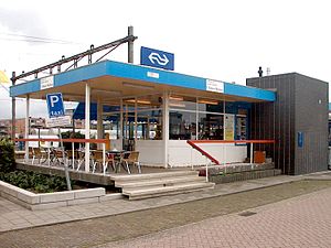
Heerhugowaard railway station
Railway station in the Netherlands
Distance: Approx. 2736 meters
Latitude and longitude: 52.67,4.82361111
Heerhugowaard railway station serves the towns of Heerhugowaard and Broek op Langedijk, Netherlands. The station opened on 20 December 1865 and is located on the Den Helder–Amsterdam railway and Heerhugowaard–Hoorn railway. The train services are operated by Nederlandse Spoorwegen.

Dijk en Waard
Municipality in North Holland, Netherlands
Distance: Approx. 2586 meters
Latitude and longitude: 52.66666667,4.83333333
Dijk en Waard (West Frisian Dutch: Doik en Weard/Weerd or Dìk en Weard/Weerd) is a municipality in the province of North Holland and the region of West-Frisia, the Netherlands. It was formed from the merger of Heerhugowaard and Langedijk on 1 January 2022.
Weather in this IP's area
clear sky
20 Celsius
20 Celsius
19 Celsius
21 Celsius
1024 hPa
75 %
1024 hPa
1024 hPa
10000 meters
1.34 m/s
4.02 m/s
8 degree
1 %
07:22:05
19:46:53