Country:
Region:
City:
Latitude and Longitude:
Time Zone:
Postal Code:
IP information under different IP Channel
ip-api
Country
Region
City
ASN
Time Zone
ISP
Blacklist
Proxy
Latitude
Longitude
Postal
Route
Luminati
Country
Region
nb
City
roosendaal
ASN
Time Zone
Europe/Amsterdam
ISP
Vodafone Libertel B.V.
Latitude
Longitude
Postal
IPinfo
Country
Region
City
ASN
Time Zone
ISP
Blacklist
Proxy
Latitude
Longitude
Postal
Route
db-ip
Country
Region
City
ASN
Time Zone
ISP
Blacklist
Proxy
Latitude
Longitude
Postal
Route
ipdata
Country
Region
City
ASN
Time Zone
ISP
Blacklist
Proxy
Latitude
Longitude
Postal
Route
Popular places and events near this IP address

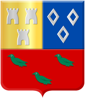
Roosendaal
Municipality in North Brabant, Netherlands
Distance: Approx. 1591 meters
Latitude and longitude: 51.53333333,4.45
Roosendaal (Dutch pronunciation: [ˈroːzə(n)ˌdaːl] ) is both a city and a municipality in the southern Netherlands, in the province of North Brabant.
RBC Stadion
Distance: Approx. 1185 meters
Latitude and longitude: 51.54055556,4.45416667
The RBC Stadion, former name among others Vast & Goed Stadion, Rosada Stadion and MariFlex Stadion, is a multi-use stadium in Roosendaal, Netherlands. It is used mostly for football matches. The stadium is able to hold 4,995 people and was built in 2000.

Streefkerk
Town in South Holland, Netherlands
Distance: Approx. 1465 meters
Latitude and longitude: 51.54,4.45
Streefkerk is a town in the Dutch province of South Holland. It is a part of the municipality of Molenlanden, and lies on the southside of the river Lek, about 20 kilometres east of Rotterdam. In 2004, the town of Streefkerk had 2600 inhabitants.
Kruisstraat, Roosendaal
Hamlet in Roosendaal
Distance: Approx. 3161 meters
Latitude and longitude: 51.51083333,4.46527778
Kruisstraat is a hamlet in the Dutch province of North Brabant. It is located in the municipality of Roosendaal, about 3 km (2 mi) southwest of the city centre.

Oud- en Nieuw-Gastel
Distance: Approx. 5050 meters
Latitude and longitude: 51.584217,4.465256
Oud- en Nieuw-Gastel was a municipality in the Dutch province of North Brabant. It covered the villages of Oud Gastel, located 7 km north of Roosendaal, and Stampersgat. The municipality existed until 1997, when it became part of the new municipality of Halderberge.
Roosendaal en Nispen
Distance: Approx. 3786 meters
Latitude and longitude: 51.50543,4.462337
Roosendaal en Nispen was a municipality in the Dutch province of North Brabant. It included the villages of Roosendaal and Nispen. In 1997, the municipality merged with Wouw.

Roosendaal railway station
Railway station in the Netherlands
Distance: Approx. 857 meters
Latitude and longitude: 51.54027778,4.45888889
Roosendaal is a railway station in the city of Roosendaal, Netherlands. The station opened on 3 July 1854 on the Antwerp–Lage Zwaluwe railway and is the beginning of the Roosendaal–Vlissingen railway. Roosendaal was the first station in North Brabant to be built.

De Donk
Hamlet in South Holland, Netherlands
Distance: Approx. 1005 meters
Latitude and longitude: 51.53,4.47
De Donk (other names: Braankse Donk, and Den Donk) is a hamlet in Molenlanden, which is a municipality in the Dutch province of South Holland. De Donk is 2 km northwestern of the village of Brandwijk and consists of some farms on a five-meter-high sandhill.
Kooiwijk
Hamlet in South Holland, Netherlands
Distance: Approx. 5323 meters
Latitude and longitude: 51.51,4.41
Kooiwijk is a hamlet in Molenlanden, which is a municipality in the Dutch province of South Holland.
Liesveld (hamlet)
Hamlet in South Holland, Netherlands
Distance: Approx. 1792 meters
Latitude and longitude: 51.55,4.49
Liesveld is a hamlet in Molenlanden, which is a municipality in the Dutch province of South Holland. Liesveld is on the southside of the Lek River, between Groot Ammers and Gelkenes.
Vuilendam
Hamlet in South Holland, Netherlands
Distance: Approx. 2238 meters
Latitude and longitude: 51.53,4.5
Vuilendam is a hamlet in Molenlanden, which is a municipality in the Dutch province of South Holland. Vuilendam lies between Molenaarsgraaf and Ottoland.
Oud Gastel
Village in North Brabant, Netherlands
Distance: Approx. 5355 meters
Latitude and longitude: 51.58638889,4.45777778
Oud Gastel is a village situated in the municipality of Halderberge, in the north-west of the North Brabant province in the Netherlands. The village was first mentioned in 1278 as Gestele, and means "guest house". Oud (old) has been added to distinguish from the former village Nieuw Gastel.
Weather in this IP's area
mist
8 Celsius
8 Celsius
7 Celsius
9 Celsius
1025 hPa
98 %
1025 hPa
1024 hPa
3100 meters
1.03 m/s
100 %
07:50:24
17:01:37
