Country:
Region:
City:
Latitude and Longitude:
Time Zone:
Postal Code:
IP information under different IP Channel
ip-api
Country
Region
City
ASN
Time Zone
ISP
Blacklist
Proxy
Latitude
Longitude
Postal
Route
Luminati
Country
Region
be
City
berlin
ASN
Time Zone
Europe/Berlin
ISP
Interhyp AG
Latitude
Longitude
Postal
IPinfo
Country
Region
City
ASN
Time Zone
ISP
Blacklist
Proxy
Latitude
Longitude
Postal
Route
db-ip
Country
Region
City
ASN
Time Zone
ISP
Blacklist
Proxy
Latitude
Longitude
Postal
Route
ipdata
Country
Region
City
ASN
Time Zone
ISP
Blacklist
Proxy
Latitude
Longitude
Postal
Route
Popular places and events near this IP address

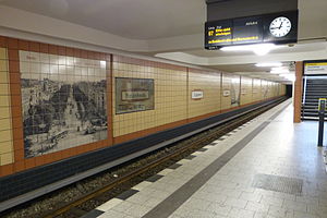
Gneisenaustraße (Berlin U-Bahn)
Station of the Berlin U-Bahn
Distance: Approx. 481 meters
Latitude and longitude: 52.49138889,13.39611111
Gneisenaustraße is a station on the U7 in Berlin, Germany.

Platz der Luftbrücke (Berlin U-Bahn)
Station of the Berlin U-Bahn
Distance: Approx. 932 meters
Latitude and longitude: 52.48555556,13.38583333
Platz der Luftbrücke is a Berlin U-Bahn station located on the U6. It is located under Platz der Luftbrücke and the south end of Mehringdamm on the border between Kreuzberg and Tempelhof, near the former Tempelhof International Airport, and is now named for the square there with its memorial to the victims of the Berlin Airlift.
Südstern (Berlin U-Bahn)
Station of the Berlin U-Bahn
Distance: Approx. 620 meters
Latitude and longitude: 52.48944444,13.40777778
Südstern is a circus of Kreuzberg district, Berlin, as well as a Berlin U-Bahn station of same denominator located on the U7.
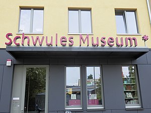
Schwules Museum
Museum of LGBT+ history in Berlin
Distance: Approx. 859 meters
Latitude and longitude: 52.49083333,13.38777778
The Schwules Museum (English: Gay Museum) in Berlin, Germany, is a museum and research centre with collections focusing on LGBTQ+ history and culture. It opened in 1985 and it was the first museum in the world dedicated to gay history. The museum archive holds periodicals dating from 1896 and a collection of photographs, videos, films, sound recordings, autographs, art works, and ephemera.

Military Ordinariate of Germany
Catholic ecclesiastical jurisdiction in Germany
Distance: Approx. 637 meters
Latitude and longitude: 52.4875,13.4086
The Military Ordinariate of Germany (German: Katholische Militärseelsorge; Deutsches Militärordinariat) is a military ordinariate of the Roman Catholic Church. Immediately subject to the Holy See, it provides pastoral care to Roman Catholics serving in the German Armed Forces and their families. Franz-Josef Overbeck, who was appointed Bishop of the Roman Catholic Diocese of Essen by Pope Benedict XVI in 2009, was also appointed Military Ordinary for Germany on 24 February 2011.

Platz der Luftbrücke
Public square in Berlin, Germany
Distance: Approx. 876 meters
Latitude and longitude: 52.48416667,13.3875
Platz der Luftbrücke is a landmarked square and transport node in Berlin, Germany, on the border between the localities of Tempelhof and Kreuzberg. The entrance to the former Tempelhof International Airport is on the square. The buildings around the square are now mostly government agencies, in particular police headquarters.

Columbia concentration camp
Concentration camp in Nazi Germany
Distance: Approx. 433 meters
Latitude and longitude: 52.48361111,13.39916667
Columbia concentration camp (also known as Columbia-Haus) was a Nazi concentration camp situated in the Tempelhof area of Berlin. It was one of the first such institutions established by the regime.

Mehringdamm
Street in southern Kreuzberg, Berlin
Distance: Approx. 938 meters
Latitude and longitude: 52.4917,13.3872
The Mehringdamm is a street in southern Kreuzberg, Berlin. In the north it starts at Mehringbrücke and ends - with its southernmost houses already belonging to Tempelhof locality - on Platz der Luftbrücke. It is the historical southbound Berlin-Halle highway, now forming the federal route 96.

Basilica of St. John the Baptist, Berlin
Church in Berlin, Germany
Distance: Approx. 658 meters
Latitude and longitude: 52.4876,13.4089
The Basilica of St. John the Baptist (German: Basilika St. Johannes der Täufer Patron von Breslau) also called Basilica of St.
Setanta Berlin GAA
GAA club in Berlin
Distance: Approx. 279 meters
Latitude and longitude: 52.49,13.3989
Setanta Berlin GAA is a GAA club in Berlin, Germany which caters for both youths and adults. The club plays hurling and camogie at BSC Eintracht / Südring, Clubheim Willi Boos in Kreuzberg. The club, which was founded in 2015, competes in Gaelic games in the European Championship.

Mehringhof
German building complex for alternative activities
Distance: Approx. 907 meters
Latitude and longitude: 52.49238889,13.3885
Mehringhof is a socialized building complex in Kreuzberg, Berlin, designed as a center for alternative activities. As of 1991, it hosted 38 projects, including a theater, an electronics collective (Wuseltronick), a printing collective, and a school for adults.

Columbiahalle
Concert venue in Berlin, Germany
Distance: Approx. 570 meters
Latitude and longitude: 52.48465,13.39221
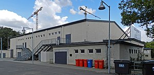
Columbiahalle is a concert venue in the Tempelhof district of Berlin. Built in 1951 as a sports hall for US soldiers, it opened as a venue in 1998. It should not be confused with Columbia Theater, a former cinema on the same site, also opened in 1951 for US soldiers, which is also now a music venue.
Weather in this IP's area
broken clouds
2 Celsius
-2 Celsius
2 Celsius
4 Celsius
996 hPa
86 %
996 hPa
991 hPa
10000 meters
5.36 m/s
8.49 m/s
255 degree
75 %
07:37:28
16:07:04

