Country:
Region:
City:
Latitude and Longitude:
Time Zone:
Postal Code:
IP information under different IP Channel
ip-api
Country
Region
City
ASN
Time Zone
ISP
Blacklist
Proxy
Latitude
Longitude
Postal
Route
Luminati
Country
Region
by
City
munich
ASN
Time Zone
Europe/Berlin
ISP
M-net Telekommunikations GmbH
Latitude
Longitude
Postal
IPinfo
Country
Region
City
ASN
Time Zone
ISP
Blacklist
Proxy
Latitude
Longitude
Postal
Route
db-ip
Country
Region
City
ASN
Time Zone
ISP
Blacklist
Proxy
Latitude
Longitude
Postal
Route
ipdata
Country
Region
City
ASN
Time Zone
ISP
Blacklist
Proxy
Latitude
Longitude
Postal
Route
Popular places and events near this IP address

Landtag of Bavaria
Legislature of the state of Bavaria, Germany
Distance: Approx. 267 meters
Latitude and longitude: 48.13638889,11.59444444
The Landtag of Bavaria, officially known in English as the Bavarian State Parliament, is the unicameral legislature of the German state of Bavaria. The parliament meets in the Maximilianeum in Munich. Elections to the Landtag are held every five years and have to be conducted on a Sunday or public holiday.
Hofbräukeller
Restaurant in Munich, Germany
Distance: Approx. 326 meters
Latitude and longitude: 48.13416667,11.595
The Hofbräukeller is a restaurant in Haidhausen, Munich, Germany owned by Hofbräuhaus brewery. This restaurant serves the traditional Bavarian cuisine and is less touristy than Hofbräuhaus am Platzl and more popular with the locals. It is a part of the Wiener Platz, home to the Wiener Markt.
Wilhelmsgymnasium (Munich)
State gymnasium school in Munich, Bavaria, Germany
Distance: Approx. 339 meters
Latitude and longitude: 48.13805556,11.58861111
The Wilhelmsgymnasium is a gymnasium (selective school) in Munich, Germany. Founded in 1559 to educate local boys, it is now coeducational. Wilhelmsgymnasium is one of the few remaining gymnasiums in Bavaria to be a "pure Humanistisches Gymnasium" (humanities gymnasium), meaning that it traditionally focuses on the Classics: all students are required to study Latin, English, and Ancient Greek, in addition to mainstream school subjects.

Gasteig
Cultural centre in Munich, Germany
Distance: Approx. 458 meters
Latitude and longitude: 48.13138889,11.59138889
The Gasteig is a cultural center in Munich, opened in 1985, which hosts the Munich Philharmonic Orchestra. The Richard Strauss Conservatory, the Volkshochschule, and the municipal library are all located in the Gasteig. Most of the events of the Filmfest München, and many of the events of the Munich Biennale take place here.
Wiener Markt
Haidhausen food market
Distance: Approx. 382 meters
Latitude and longitude: 48.13416667,11.59583333
The Wiener Markt is a daily food market in Haidhausen, a district of Munich. The market at Wiener Platz forms the centre of the district of Haidhausen.

Au-Haidhausen
Borough of Munich, Germany
Distance: Approx. 429 meters
Latitude and longitude: 48.13194444,11.58888889
Au-Haidhausen (Central Bavarian: Au-Haidhausn) is the 5th borough of the German city of Munich, Bavaria. It is formed by the Au and Haidhausen districts.

Maximilianeum
Building housing the Bavarian Parliament in Munich, Germany
Distance: Approx. 223 meters
Latitude and longitude: 48.136,11.594
The Maximilianeum, a palatial building in Munich, was built as the home of a gifted students' foundation but since 1949 has housed the Bavarian State Parliament.

St. Luke's Church, Munich
Church in Munich, Germany
Distance: Approx. 293 meters
Latitude and longitude: 48.135,11.58722222
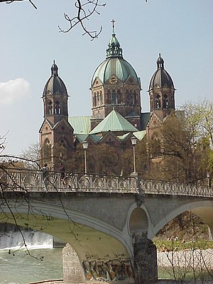
St. Luke's Church (German: St. Lukas or Lukaskirche) is the largest Protestant church in Munich, southern Germany.

Prater Island
Distance: Approx. 107 meters
Latitude and longitude: 48.13638889,11.59055556
Prater Island (Praterinsel) is one of the two islands in the Isar in Munich. The other is Museum Island.

Auer Mühlbach
River in Germany
Distance: Approx. 87 meters
Latitude and longitude: 48.136,11.592
Auer Mühlbach is a river in Bavaria, Germany. It is a branch of the Isar in the southern part of Munich.

Große Isar (Munich)
River in Germany
Distance: Approx. 354 meters
Latitude and longitude: 48.1385,11.5927
Große Isar is a branch of the river Isar in Munich, Bavaria, Germany.

Kleine Isar (Munich)
River in Germany
Distance: Approx. 354 meters
Latitude and longitude: 48.1385,11.5927
Kleine Isar is a river of Bavaria, Germany. It is a branch of the Isar in Munich.
Weather in this IP's area
scattered clouds
5 Celsius
5 Celsius
3 Celsius
6 Celsius
1026 hPa
93 %
1026 hPa
964 hPa
10000 meters
1.35 m/s
1.47 m/s
101 degree
49 %
07:11:39
16:43:24


