Country:
Region:
City:
Latitude and Longitude:
Time Zone:
Postal Code:
IP information under different IP Channel
ip-api
Country
Region
City
ASN
Time Zone
ISP
Blacklist
Proxy
Latitude
Longitude
Postal
Route
Luminati
Country
Region
by
City
munich
ASN
Time Zone
Europe/Berlin
ISP
M-net Telekommunikations GmbH
Latitude
Longitude
Postal
IPinfo
Country
Region
City
ASN
Time Zone
ISP
Blacklist
Proxy
Latitude
Longitude
Postal
Route
db-ip
Country
Region
City
ASN
Time Zone
ISP
Blacklist
Proxy
Latitude
Longitude
Postal
Route
ipdata
Country
Region
City
ASN
Time Zone
ISP
Blacklist
Proxy
Latitude
Longitude
Postal
Route
Popular places and events near this IP address

Staatliches Hofbräuhaus in München
German brewery
Distance: Approx. 3210 meters
Latitude and longitude: 48.14347222,11.69825
The Staatliches Hofbräuhaus in München (State Brewery in Munich, also Hofbräu München) is a brewery in Munich, Germany, owned by the Bavarian state government. The Hof (court) comes from the brewery's history as a royal brewery in the Kingdom of Bavaria. The brewery owns the Hofbräuhaus am Platzl, the Hofbräukeller and one of the largest tents at the Oktoberfest (Hofbräu-Festzelt).

Kirchheim bei München
Municipality in Bavaria, Germany
Distance: Approx. 3299 meters
Latitude and longitude: 48.18333333,11.75
Kirchheim bei München is a municipality in the district of Munich, in Bavaria, Germany. It is located 14 km east of Munich (centre). As of 2023 it has a population of 14,030.
Messestadt Ost station
Station of the Munich U-Bahn
Distance: Approx. 3498 meters
Latitude and longitude: 48.13333333,11.70361111
Messestadt Ost is a Munich U-Bahn station on line U2.

Feldkirchen, Upper Bavaria
Municipality in Munich, Germany
Distance: Approx. 637 meters
Latitude and longitude: 48.15,11.73333333
Feldkirchen is a municipality in the district of Munich, Bavaria, Germany. It is located 10 km east of Munich and has 5,987 inhabitants. Feldkirchen was first mentioned in a document dated 853.

Aschheim
Municipality in Bavaria, Germany
Distance: Approx. 2552 meters
Latitude and longitude: 48.17333333,11.71777778
Aschheim is a small town and municipality in the district of Munich in Bavaria in Germany. It lies beyond the northeastern outskirts of Munich. Aschheim is the location of BMW's test track opened by the manufacturer in 1972, and also has a golf club, established in 1990.

Sportpark Aschheim
Football stadium in Germany
Distance: Approx. 1332 meters
Latitude and longitude: 48.16194444,11.72361111
Sportpark Aschheim is a football (soccer) stadium in Aschheim near Munich, Germany. It is the home stadium of FC Bayern Munich (women) and FC Aschheim 1956. The stadium has a capacity of 3,000 seats.

Messestadt Riem
Distance: Approx. 3591 meters
Latitude and longitude: 48.1361,11.6986
Messestadt Riem (literally: Convention City Riem; Central Bavarian: Messestod Ream) is an urban district in the east of Munich. It is part of the municipality 15 Trudering-Riem, and located entirely on the grounds of Munich-Riem airport which closed in 1992 and now comprises a residential area, the Neue Messe München trade fair center and the Riem Arcaden shopping mall.

Neue Messe München
Exhibition center in Munich
Distance: Approx. 3626 meters
Latitude and longitude: 48.13555556,11.69861111
Neue Messe München is an exhibition center in the Messestadt Riem area in the eastern district of Munich Trudering-Riem built from 1994 to 1998. It is operated by Messe München.
1970 Munich bus attack
Terrorist incident at a German airport
Distance: Approx. 2566 meters
Latitude and longitude: 48.136,11.718
On 10 February 1970, a bus carrying passengers to an El Al airplane at the Munich-Riem Airport, West Germany was attacked by terrorists. One person was killed and 23 were wounded in the attack.

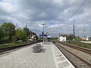
Feldkirchen (b München) station
Railway station in Bavaria, Germany
Distance: Approx. 631 meters
Latitude and longitude: 48.1514,11.7312
Feldkirchen (b München) station (German: Bahnhof Feldkirchen (b München)) is a railway station in the municipality of Feldkirchen, located in the Munich district in Bavaria, Germany.

Heimstetten station
Munich S-Bahn station
Distance: Approx. 1728 meters
Latitude and longitude: 48.159,11.7604
Heimstetten station (German: Haltepunkt Heimstetten) is a railway station in Heimstetten in the municipality of Kirchheim bei München, located in the Munich district in Bavaria, Germany.

Grub (Oberbay) station
Railway station in Bavaria
Distance: Approx. 3466 meters
Latitude and longitude: 48.1644,11.7824
Grub (Oberbay) station (German: Haltepunkt Grub (Oberbay)) is a railway station in Grub in the municipality of Poing, located in the Ebersberg district in Bavaria, Germany.
Weather in this IP's area
scattered clouds
5 Celsius
5 Celsius
4 Celsius
6 Celsius
1026 hPa
95 %
1026 hPa
963 hPa
10000 meters
0.45 m/s
1.79 m/s
184 degree
29 %
07:11:07
16:42:46
