212.113.218.132 - IP Lookup: Free IP Address Lookup, Postal Code Lookup, IP Location Lookup, IP ASN, Public IP
Country:
Region:
City:
Location:
Time Zone:
Postal Code:
IP information under different IP Channel
ip-api
Country
Region
City
ASN
Time Zone
ISP
Blacklist
Proxy
Latitude
Longitude
Postal
Route
Luminati
Country
ASN
Time Zone
Europe/London
ISP
JPC Infonet Ltd
Latitude
Longitude
Postal
IPinfo
Country
Region
City
ASN
Time Zone
ISP
Blacklist
Proxy
Latitude
Longitude
Postal
Route
IP2Location
212.113.218.132Country
Region
england
City
trowbridge
Time Zone
Europe/London
ISP
Language
User-Agent
Latitude
Longitude
Postal
db-ip
Country
Region
City
ASN
Time Zone
ISP
Blacklist
Proxy
Latitude
Longitude
Postal
Route
ipdata
Country
Region
City
ASN
Time Zone
ISP
Blacklist
Proxy
Latitude
Longitude
Postal
Route
Popular places and events near this IP address

Trowbridge
County town of Wiltshire, England
Distance: Approx. 129 meters
Latitude and longitude: 51.32,-2.208
Trowbridge ( TROH-brij) is the county town of Wiltshire, England; situated on the River Biss in the west of the county, close to the border with Somerset. The town lies 8 miles (13 km) south-east of Bath, 31 miles (50 km) south-west of Swindon and 20 miles (32 km) south-east of Bristol. The parish had a population of 37,169 in 2021.

Wiltshire Council
Unitary authority in South West England
Distance: Approx. 233 meters
Latitude and longitude: 51.317,-2.21
Wiltshire Council, known between 1889 and 2009 as Wiltshire County Council, is the local authority for the non-metropolitan county of Wiltshire in South West England. Since 2009 it has been a unitary authority, being a county council which also performs the functions of a district council. The non-metropolitan county is smaller than the ceremonial county, the latter additionally including Swindon.

The Shires Shopping Centre
Shopping centre in Trowbridge, England
Distance: Approx. 156 meters
Latitude and longitude: 51.32,-2.21
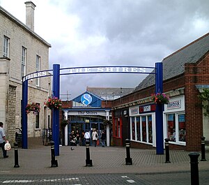
The Shires Shopping Centre is the central, covered shopping centre in Trowbridge, Wiltshire, England. The centre incorporates the county town's main museum and has a 1,000-space car park. As of 2009, approximately 120,000 shoppers visited the centre each week.
Wiltshire Library and Information Service
Distance: Approx. 280 meters
Latitude and longitude: 51.3165,-2.2098
Wiltshire Library and Information Service is a county-wide network of public libraries based in Trowbridge, Wiltshire, England. It is service of Wiltshire Council, with the strapline "Love Reading, Love Libraries". There are 31 public libraries and 5 mobile libraries, including one which specifically visits residential homes.

Holy Trinity Church, Trowbridge
Church
Distance: Approx. 408 meters
Latitude and longitude: 51.31861111,-2.21444444
Holy Trinity Church, Trowbridge is a Grade II* listed 19th-century Church of England church in Trowbridge, Wiltshire, England, which had parish church status until 2011. It is commonly known in Trowbridge as 'The Church on the Roundabout', as it is encircled by a one-way traffic system.

Ushers of Trowbridge
Former brewery in Wiltshire, England
Distance: Approx. 339 meters
Latitude and longitude: 51.3218,-2.21011
Ushers of Trowbridge was a brewery in Trowbridge, Wiltshire, England, between 1824 and 2000.

Trowbridge Museum
Textile industry museum in Trowbridge, England
Distance: Approx. 216 meters
Latitude and longitude: 51.3208,-2.2092
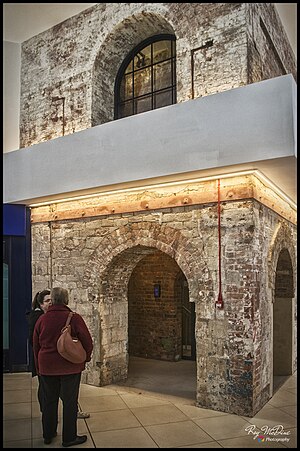
Trowbridge Museum, in the town of Trowbridge, Wiltshire, England, is a centre for the history of West of England cloth production.

St James's Church, Trowbridge
Church in Wiltshire, United Kingdom
Distance: Approx. 287 meters
Latitude and longitude: 51.3214,-2.2076
St James's Church is the main Church of England parish church for the town of Trowbridge, Wiltshire, England. The 15th-century Grade I listed building is the town's most prominent landmark. Those buried in the church include the poet George Crabbe, rector from 1814 to 1832, and in the churchyard the executed alleged-Luddite and Trade Union martyr Thomas Helliker.

County Hall, Trowbridge
County building in Trowbridge, Wiltshire, England
Distance: Approx. 244 meters
Latitude and longitude: 51.3171,-2.2106
County Hall is a municipal building in Bythesea Road, Trowbridge, Wiltshire, England, completed in 1940. It is the headquarters of Wiltshire Council.

Trowbridge Town Hall
Municipal building in Trowbridge, Wiltshire, England
Distance: Approx. 183 meters
Latitude and longitude: 51.3201,-2.2068
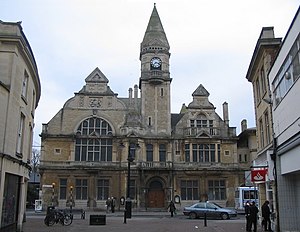
Trowbridge Town Hall is a municipal building in Market Street, Trowbridge, Wiltshire, England. The town hall, which was the headquarters of Trowbridge Urban District Council, is a Grade II listed building.

Parade House
Historic building in Wilrshire, England
Distance: Approx. 301 meters
Latitude and longitude: 51.32148,-2.2099
Parade House is a Grade I listed Georgian townhouse in central Trowbridge, Wiltshire, England. It is a centrepiece of what Pevsner's Guide to Wiltshire described in 1960 as "a stretch of palaces" along Fore Street. Built in around 1720 for the wealthy cloth merchant Robert Houlton, Parade House has an elegant and symmetrical façade typical of the Georgian period.
Castle Place Shopping Centre
Shopping mall in Wiltshire, England
Distance: Approx. 130 meters
Latitude and longitude: 51.3196,-2.2071
Castle Place Shopping Centre is a shopping centre in Trowbridge, England. The shopping centre was purchased by Legal & General Property in 2010. In 2011, it was refurbished.
Weather in this IP's area
broken clouds
3 Celsius
3 Celsius
2 Celsius
4 Celsius
1023 hPa
89 %
1023 hPa
1009 hPa
10000 meters
0.45 m/s
0.89 m/s
228 degree
82 %