Country:
Region:
City:
Latitude and Longitude:
Time Zone:
Postal Code:
IP information under different IP Channel
ip-api
Country
Region
City
ASN
Time Zone
ISP
Blacklist
Proxy
Latitude
Longitude
Postal
Route
Luminati
Country
Region
11
City
amadora
ASN
Time Zone
Europe/Lisbon
ISP
Nos Comunicacoes, S.A.
Latitude
Longitude
Postal
IPinfo
Country
Region
City
ASN
Time Zone
ISP
Blacklist
Proxy
Latitude
Longitude
Postal
Route
db-ip
Country
Region
City
ASN
Time Zone
ISP
Blacklist
Proxy
Latitude
Longitude
Postal
Route
ipdata
Country
Region
City
ASN
Time Zone
ISP
Blacklist
Proxy
Latitude
Longitude
Postal
Route
Popular places and events near this IP address

Santa Maria da Feira
Municipality in Norte, Portugal
Distance: Approx. 4058 meters
Latitude and longitude: 40.93333333,-8.53333333
Santa Maria da Feira (European Portuguese pronunciation: [ˈsɐ̃tɐ mɐˈɾi.ɐ ðɐ ˈfɐjɾɐ] ) is a city and a municipality in Aveiro District in Portugal, 23 km from central Porto. The population in 2011 was 139,309, in an area of 215.88 km².
São João de Ver
Civil parish in Norte, Portugal
Distance: Approx. 4206 meters
Latitude and longitude: 40.954,-8.551
São João de Ver is a Portuguese parish, located in the municipality of Santa Maria da Feira. The population in 2011 was 10,579, in an area of 15.37 km2.
Souto (Santa Maria da Feira)
Civil parish in Norte, Portugal
Distance: Approx. 4199 meters
Latitude and longitude: 40.888,-8.561
Souto is a former civil parish in the municipality of Santa Maria da Feira, Portugal. In 2013, the parish merged into the new parish São Miguel do Souto e Mosteirô. It has a population of 4,835 inhabitants and a total area of 9.40 km2.

Estádio Marcolino de Castro
Stadium in Santa Maria da Feira, Portugal
Distance: Approx. 2871 meters
Latitude and longitude: 40.92668889,-8.54581389
Estadio Marcolino de Castro is a multi-use stadium in Santa Maria da Feira, Portugal. It is currently used mostly for football matches and is the home of Segunda Liga club CD Feirense. The stadium is able to hold 5,401 people.
Fornos (Santa Maria da Feira)
Civil parish in Norte, Portugal
Distance: Approx. 4475 meters
Latitude and longitude: 40.917,-8.527
Fornos is a Portuguese parish, located in the municipality of Santa Maria da Feira. The population in 2011 was 3,397, in an area of 3.14 km2.
Espargo
Civil parish in Norte, Portugal
Distance: Approx. 303 meters
Latitude and longitude: 40.923,-8.576
Espargo is a former civil parish in the municipality of Santa Maria da Feira, Portugal. In 2013, the parish merged into the new parish Santa Maria da Feira, Travanca, Sanfins e Espargo. It has a population of 1,309 inhabitants and a total area of 5.70 km2.
Feira (Santa Maria da Feira)
Civil parish in Norte, Portugal
Distance: Approx. 2449 meters
Latitude and longitude: 40.93,-8.552
Feira is a former civil parish in the municipality of Santa Maria da Feira, Portugal. In 2013, the parish merged into the new parish Santa Maria da Feira, Travanca, Sanfins e Espargo. Covering the historic city centre, it is the seat of the Santa Maria da Feira Municipality.
Rio Meão
Civil parish in Norte, Portugal
Distance: Approx. 3898 meters
Latitude and longitude: 40.958,-8.581
Rio Meão is a Portuguese parish, located in the municipality of Santa Maria da Feira. The population in 2011 was 4,931, in an area of 6.68 km2.
Travanca (Santa Maria da Feira)
Civil parish in Norte, Portugal
Distance: Approx. 1416 meters
Latitude and longitude: 40.911,-8.574
Travanca is a former civil parish in the municipality of Santa Maria da Feira, Portugal. In 2013, the parish merged into the new parish Santa Maria da Feira, Travanca, Sanfins e Espargo. It has a population of 2,201 inhabitants and a total area of 5.72 km2.

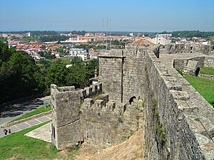
Castle of Santa Maria da Feira
Castle in Santa Maria da Feira, Aveiro, Portugal
Distance: Approx. 3106 meters
Latitude and longitude: 40.92100556,-8.54276389
The Castle of Santa Maria da Feira is a Portuguese castle in the municipality of Santa Maria da Feira, district of Aveiro. Emblematic of Portuguese medieval military architecture, the Castle of Santa Maria da Feira is one of the monuments that best reflects the diversity of defenses used during the Middle Ages, having been instrumental in the process of Reconquista and autonomy of the County of Portugal. It has been listed as a National monument since 1910.

Cortegaça, Ovar
Civil parish in Centro, Portugal
Distance: Approx. 4390 meters
Latitude and longitude: 40.946,-8.622
Cortegaça is a small village and a civil parish in the Ovar Municipality, Portugal. The population in 2011 was 3,837, in an area of 9.23 km2 (3.56 sq mi). It is a village dating back to the 9th and 10th centuries, associated with the repopulation of the lands of Santa Maria da Feira.
Santa Maria da Feira, Travanca, Sanfins e Espargo
Civil parish in Norte, Portugal
Distance: Approx. 3013 meters
Latitude and longitude: 40.926,-8.544
Santa Maria da Feira, Travanca, Sanfins e Espargo is a civil parish in the municipality of Santa Maria da Feira, Portugal. It was formed in 2013 by the merger of the former parishes Feira, Travanca, Sanfins and Espargo. The population in 2011 was 18,194, in an area of 23.36 km2.
Weather in this IP's area
scattered clouds
15 Celsius
15 Celsius
15 Celsius
16 Celsius
1019 hPa
82 %
1019 hPa
1007 hPa
10000 meters
0.6 m/s
0.66 m/s
103 degree
27 %
07:25:39
17:13:46