Country:
Region:
City:
Latitude and Longitude:
Time Zone:
Postal Code:
IP information under different IP Channel
ip-api
Country
Region
City
ASN
Time Zone
ISP
Blacklist
Proxy
Latitude
Longitude
Postal
Route
Luminati
Country
Region
14
City
kualalumpur
ASN
Time Zone
Asia/Kuala_Lumpur
ISP
TIME dotCom Berhad No. 14, Jalan Majistret U126 Hicom Glenmarie Industrial Park 40150 Shah Al
Latitude
Longitude
Postal
IPinfo
Country
Region
City
ASN
Time Zone
ISP
Blacklist
Proxy
Latitude
Longitude
Postal
Route
db-ip
Country
Region
City
ASN
Time Zone
ISP
Blacklist
Proxy
Latitude
Longitude
Postal
Route
ipdata
Country
Region
City
ASN
Time Zone
ISP
Blacklist
Proxy
Latitude
Longitude
Postal
Route
Popular places and events near this IP address

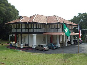
Tun Abdul Ghafar Baba Memorial
Museum in Malacca, Malaysia
Distance: Approx. 2662 meters
Latitude and longitude: 2.22325,102.25986111
Tun Abdul Ghafar Baba Memorial (Malay: Memorial Tun Abdul Ghafar Baba) is a museum in Peringgit, Malacca, Malaysia, which commemorates the life of Abdul Ghafar Baba, who was the Deputy Prime Minister of Malaysia from 1986 to 1993 under Prime Minister Mahathir Mohamad and the Chief Minister of Malacca from 1959 to 1967. Constructed in 1956 and served as Ghafar Baba's residence when he was the chief minister of the state, the building was converted into a memorial and was opened to the public on 28 February 2006. The memorial is divided into two exhibition halls.

Melaka Tengah District
Administrative district in Malacca, Malaysia
Distance: Approx. 2661 meters
Latitude and longitude: 2.25,102.25
Melaka Tengah District (translated as Central Malacca District) is one of the three administrative districts in Malacca, Malaysia. It borders Alor Gajah District to the north and Jasin District to the east. The capital of the state, Malacca City, is located in this district.

Batu Berendam
Town in Central Melaka, Melaka, Malaysia
Distance: Approx. 2661 meters
Latitude and longitude: 2.25,102.25
Batu Berendam is a small town in Melaka Tengah District, Malacca, Malaysia.

Melaka Sentral
Bus terminal in Malacca, Malaysia
Distance: Approx. 1727 meters
Latitude and longitude: 2.22166667,102.25
Melaka Sentral is the largest public transportation terminal in Malacca, Malaysia. It occupies 46.6 hectares of land and located between Lebuh AMJ (Jalan Tun Abdul Razak) and Jalan Panglima Awang and was opened on 14 May 2004. The construction of the bus terminal costed RM610,000 and begun in February 2003 and completed in the following year.
Taman Malim Jaya
Distance: Approx. 1358 meters
Latitude and longitude: 2.24166667,102.23333333
Taman Malim Jaya is a residential area and business district in Batu Berendam, Melaka Tengah District, Malacca, Malaysia.
Taman ASEAN
Distance: Approx. 2281 meters
Latitude and longitude: 2.23333333,102.21666667
Taman ASEAN is a township in Melaka, Malaysia. This township is located at Lebuh AMJ between Cheng, Pokok Mangga and Malim Jaya. It has 9 associations.
Macau Gallery Melaka
Gallery in Melaka Tengah, Malacca, Malaysia
Distance: Approx. 2287 meters
Latitude and longitude: 2.22136111,102.25555556
Macau Gallery Melaka (Malay: Galeri Macau Melaka; traditional Chinese: 馬六甲澳門展館; simplified Chinese: 马六甲澳门展馆; pinyin: Mǎliùjiǎ Àomén Zhǎnguǎn) was a gallery set up by the Government of Malacca in collaboration with the Government of Macau to promote and exhibit the culture and arts of Macau.
Casa Cuba
Gallery in Malacca, Malaysia
Distance: Approx. 2425 meters
Latitude and longitude: 2.22225,102.25727778
Casa Cuba was a gallery which displayed Cuban art in Bukit Peringgit, Malacca, Malaysia. The gallery was built in June 2007 in the former senior government officer's residence during British Malaya. An initiative of the Cuban embassy in Malacca, the gallery showcases various forms of art by Cuban artists, such as paintings, lithographs and ceramics.

Gallery of the Chief Minister of Malacca
Gallery in Malacca, Malaysia
Distance: Approx. 2357 meters
Latitude and longitude: 2.2205,102.25583333
Gallery of the Chief Minister of Malacca (Malay: Galeri Ketua Menteri Melaka), also known as the Chief Minister of Melaka's Gallery, Melaka Chief Minister Gallery or Melaka Chief Minister's Gallery, is a gallery which displays gifts, souvenirs, personal collections and biographies of the State's Chief Ministers in the Peringgit suburb. Its building was used as the official residence for the Chief Ministers from 1972 until 2006, when the new one at the Seri Negeri complex in Ayer Keroh was completed.
Peringgit
Mukim in Melaka Tengah, Malacca, Malaysia
Distance: Approx. 2265 meters
Latitude and longitude: 2.22141667,102.25536111
Peringgit is a suburb of Malacca City and a mukim of Melaka Tengah District in the Malaysian state of Malacca. It is home to several bungalows functioning as government offices and quarters or state galleries, which were built during British colonial era and located at the top of the Bukit Peringgit Hill.

Catholic High School, Melaka
National secondary school in Malacca City, Malacca, Malaysia
Distance: Approx. 2659 meters
Latitude and longitude: 2.20666,102.242
Catholic High School, Melaka (CHS Melaka) or Sekolah Menengah Jenis Kebangsaan Katholik, Melaka (Chinese: 马六甲公教国民型华文中学) is a state secondary boys' school in Malacca City, Malacca, Malaysia. The school is located at Gajah Berang Road with Notre Dame Convent and Gajah Berang Secondary School.

Catholic Elementary School, Melaka
National primary school in Malacca City, Malacca, Malaysia
Distance: Approx. 2664 meters
Latitude and longitude: 2.206713,102.242405
Sekolah Jenis Kebangsaan (Cina) Katholik (Chinese: 公教国民型华文小学), is a state primary school located at Gajah Berang Road in Malacca City. The school was initially established at Lorong Pandan (renamed Jalan Datuk Wira Poh Ah Tiam).
Weather in this IP's area
light rain
27 Celsius
31 Celsius
27 Celsius
28 Celsius
1010 hPa
84 %
1010 hPa
1010 hPa
10000 meters
1.54 m/s
30 degree
20 %
06:53:47
18:55:35


