210.87.127.42 - IP Lookup: Free IP Address Lookup, Postal Code Lookup, IP Location Lookup, IP ASN, Public IP
Country:
Region:
City:
Location:
Time Zone:
Postal Code:
ISP:
ASN:
language:
User-Agent:
Proxy IP:
Blacklist:
IP information under different IP Channel
ip-api
Country
Region
City
ASN
Time Zone
ISP
Blacklist
Proxy
Latitude
Longitude
Postal
Route
db-ip
Country
Region
City
ASN
Time Zone
ISP
Blacklist
Proxy
Latitude
Longitude
Postal
Route
IPinfo
Country
Region
City
ASN
Time Zone
ISP
Blacklist
Proxy
Latitude
Longitude
Postal
Route
IP2Location
210.87.127.42Country
Region
sagaing
City
monywa
Time Zone
Asia/Rangoon
ISP
Language
User-Agent
Latitude
Longitude
Postal
ipdata
Country
Region
City
ASN
Time Zone
ISP
Blacklist
Proxy
Latitude
Longitude
Postal
Route
Popular places and events near this IP address

Monywa
Capital Town in Sagaing Region, Myanmar
Distance: Approx. 1270 meters
Latitude and longitude: 22.10833333,95.14166667
Monywa (Burmese: မုံရွာမြို့; MLCTS: muṃ rwa mrui.; pronounced [mòʊɰ̃jwà mjo̰]) is the largest city in Sagaing Region, Myanmar, located 136 kilometres (85 mi) north-west of Mandalay on the eastern bank of the River Chindwin. Monywa is one of the largest economic cities in Myanmar. It is also known as 'Neem City' because many of the city's streets are lined with neem trees.
Monywa University of Economics
Distance: Approx. 5103 meters
Latitude and longitude: 22.1324353,95.1797753
The Monywa University of Economics (Burmese: မုံရွာ စီးပွားရေးတက္ကသိုလ် [mòʊɰ̃jwà síbwájé tɛʔkəθò]), located in Monywa, Sagaing Region, is one of four universities of economics and business in Myanmar. The university offers undergraduate and graduate degrees and diplomas, mostly in commerce, statistics and economics. It also has a small stable of graduate degree programs, including a full-time MBA program.
Monywa District
District in Sagaing Region, Burma
Distance: Approx. 5 meters
Latitude and longitude: 22.11666667,95.13333333
Monywa District (Burmese: မုံရွာခရိုင်) (formerly Lower Chindwin District) is an administrative district in southern Sagaing Division, Burma (Myanmar). Its administrative center is the city of Monywa.

Monywa Township
Township in Sagaing Region, Myanmar
Distance: Approx. 1859 meters
Latitude and longitude: 22.1,95.13333333
Monywa is a Capital City in the Sagaing Division of Myanmar.
Letpadaung Copper Mine
Distance: Approx. 9938 meters
Latitude and longitude: 22.119992,95.036995
The Letpadaung Copper Mine (Burmese: လက်ပံတောင်းတောင် ကြေးနီသတ္တုတွင်း) is a large surface mine in the Salingyi Township of Sagaing Region of Myanmar. Since Myanmar began liberalizing in 2011 the mine has been the site of contentious protest and come to symbolize the shortcomings of political reform. Villagers displaced by the Chinese-operated mine contend that they have not received fair compensation while the company claims that it has been socially responsible throughout the process.
Thambuddhe Pagoda
Distance: Approx. 2394 meters
Latitude and longitude: 22.11888889,95.15638889
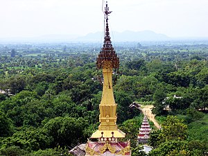
Thambuddhe Pagoda (Burmese: သမ္ဗုဒ္ဓေဘုုရား; Sambuddhe Pagoda) is one of the famous pagodas in Monywa of Sagaing Region.
Weather in this IP's area
clear sky
22 Celsius
22 Celsius
22 Celsius
22 Celsius
1011 hPa
53 %
1011 hPa
996 hPa
10000 meters
1.47 m/s
1.45 m/s
177 degree
