210.158.78.88 - IP Lookup: Free IP Address Lookup, Postal Code Lookup, IP Location Lookup, IP ASN, Public IP
Country:
Region:
City:
Location:
Time Zone:
Postal Code:
ISP:
ASN:
language:
User-Agent:
Proxy IP:
Blacklist:
IP information under different IP Channel
ip-api
Country
Region
City
ASN
Time Zone
ISP
Blacklist
Proxy
Latitude
Longitude
Postal
Route
db-ip
Country
Region
City
ASN
Time Zone
ISP
Blacklist
Proxy
Latitude
Longitude
Postal
Route
IPinfo
Country
Region
City
ASN
Time Zone
ISP
Blacklist
Proxy
Latitude
Longitude
Postal
Route
IP2Location
210.158.78.88Country
Region
yamanashi
City
shoji
Time Zone
Asia/Tokyo
ISP
Language
User-Agent
Latitude
Longitude
Postal
ipdata
Country
Region
City
ASN
Time Zone
ISP
Blacklist
Proxy
Latitude
Longitude
Postal
Route
Popular places and events near this IP address

Narusawa, Yamanashi
Village in Japan
Distance: Approx. 8758 meters
Latitude and longitude: 35.48136111,138.70644444
Narusawa (鳴沢村, Narusawa-mura) is a village located in Yamanashi Prefecture, Japan. As of 1 June 2019, the village had an estimated population of 3,152 in 1257 households, and a population density of 32.6 persons per km2. The total area of the village is 89.58 square kilometres (34.59 sq mi).

Saiko Lake
Lake in Fujikawaguchiko, Chūbu region, Japan
Distance: Approx. 6924 meters
Latitude and longitude: 35.49833333,138.68527778
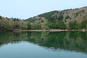
Western Lake (西湖, Saiko), sometimes Saiko, is one of the Fuji Five Lakes and located in the town of Fujikawaguchiko in southern Yamanashi Prefecture near Mount Fuji, Japan. It is the fourth of the Fuji Five Lakes in terms of surface area, and second deepest, with a maximum water depth of 71.1 metres (233 ft). Its surface elevation of 900 metres (3,000 ft) is the same as for Lake Motosu and Lake Shōji, confirming that these three lakes were originally a single lake, which was divided by an enormous lava flow from Mount Fuji during an eruption from 864 to 868 AD. The remnants of the lava flow are now under the Aokigahara Jukai Forest, and there is evidence to indicate that these three lakes remain connected by underground waterways.
Aokigahara
Forest in Yamanashi Prefecture, Japan
Distance: Approx. 2114 meters
Latitude and longitude: 35.47,138.61972222
Aokigahara (青木ヶ原, 'Blue Tree Meadow'), also known as the Sea of Trees (樹海, Jukai), is a forest on the northwestern flank of Mount Fuji on the island of Honshu in Japan, thriving on 30 square kilometres (12 sq mi) of hardened lava laid down by the last major eruption of Mount Fuji in 864 CE. The western edge of Aokigahara, where there are several caves that fill with ice in winter, is a popular destination for tourists and school trips. Parts of Aokigahara are very dense, and the porous lava rock absorbs sound, contributing to a sense of solitude that some visitors attribute to the forest. The forest has a historical reputation as a home to yūrei: ghosts of the dead in Japanese mythology.
Asagiri Plateau
Plateau in Fujinomiya, Shizuoka, Japan
Distance: Approx. 8412 meters
Latitude and longitude: 35.41333333,138.59111111
The Asagiri Plateau (朝霧高原, Asagiri Kōgen) is located at the southwest base of Mount Fuji in Fujinomiya, Shizuoka Prefecture, Japan. The Asagiri Plateau is richly utilized for its pastureland and many dairy farms are situated along it. The elevation of the plateau is generally around 800 m (2,625 ft) or 900 m (2,953 ft).
Shibireko Prefectural Natural Park
Distance: Approx. 9636 meters
Latitude and longitude: 35.52944444,138.51722222
Shibireko Prefectural Natural Park (県立四尾連湖自然公園, Kenritsu Shibireko shizen kōen) is a Prefectural Natural Park in Yamanashi Prefecture, Japan. Established in 1959, the park's central feature is Lake Shibire (四尾連湖). The park is wholly within the municipality of Ichikawamisato.

Lake Motosu
Lake in Fujikawaguchiko, Chūbu region, Japan
Distance: Approx. 3427 meters
Latitude and longitude: 35.46388889,138.58555556
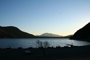
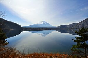
Lake Motosu (本栖湖, Motosu-ko) is the westernmost of the Fuji Five Lakes and located on the border of the towns of Fujikawaguchiko and Minobu in southern Yamanashi Prefecture near Mount Fuji, Japan. Lake Motosu is the third-largest of the Fuji Five Lakes in terms of surface area, and is the deepest, with a maximum water depth of 121.6 metres (399 feet), making it the ninth-deepest lake in Japan. Its surface elevation of 900 metres (3,000 feet) is the same as for Lake Shōji and Lake Sai, confirming that these three lakes were originally a single lake, which was divided by an enormous lava flow from Mount Fuji.

Lake Shōji
Distance: Approx. 180 meters
Latitude and longitude: 35.48888889,138.60972222
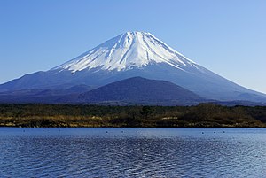
Lake Shōji (精進湖, Shōji-ko) is one of the Fuji Five Lakes and located in the town of Fujikawaguchiko in southern Yamanashi Prefecture near Mount Fuji, Japan. Lake Shōji is the smallest of the Fuji Five Lakes in terms of surface area, and third deepest, with a maximum water depth of 15.2 metres (50 ft). Its surface elevation of 900 metres (3,000 ft) is the same as for Lake Motosu and Lake Sai, confirming that these three lakes were originally a single lake, which was divided by an enormous lava flow from Mount Fuji during an eruption from 864-868 AD. The remnants of the lava flow are now under the Aokigahara Jukai Forest, and there is evidence to indicate that these three lakes remain connected by underground waterways.

Fugaku Wind Cave
Cave in Japan
Distance: Approx. 4433 meters
Latitude and longitude: 35.4775,138.6575
Fugaku Wind Cave (Japanese: 富岳風穴) is a lava tube at the northern foot of Mount Fuji, Japan. It is the largest of the several lava tubes that are found in the Aokigahara forest in Fujikawaguchiko Town, Yamanashi Prefecture.

Narusawa Ice Cave
Lava tube in Japan
Distance: Approx. 5291 meters
Latitude and longitude: 35.47472222,138.66638889
The Narusawa Ice Cave (Japanese: 鳴沢氷穴, Narusawa Hyōketsu) is a lava tube located in the Aokigahara forest, in the part that belongs to Narusawa Village, Yamanashi Prefecture, Japan. It is one of the three larger lava tubes at the northern foot of Mount Fuji, the other two caves being Fugaku Wind Cave and Lake Sai Bat Cave. All three were designated as Natural Monuments of Japan in 1929.

Mount Ōmuro (Mount Fuji)
Mountain in Japan
Distance: Approx. 6505 meters
Latitude and longitude: 35.44083333,138.65361111
Mount Ōmuro (大室山, Ōmuroyama) is a mountain located at the northwestern foot of Mount Fuji, in Fujikawaguchiko, Minamitsuru District, Yamanashi Prefecture. It is one of the many extinct volcanoes of Mount Fuji, and because it is located at the gentle foot of Mount Fuji, it looks like an independent peak. There is a crater depression at the top.
Weather in this IP's area
scattered clouds
6 Celsius
6 Celsius
6 Celsius
7 Celsius
1020 hPa
49 %
1020 hPa
933 hPa
10000 meters
1.22 m/s
2.6 m/s
213 degree
31 %


