Country:
Region:
City:
Latitude and Longitude:
Time Zone:
Postal Code:
IP information under different IP Channel
ip-api
Country
Region
City
ASN
Time Zone
ISP
Blacklist
Proxy
Latitude
Longitude
Postal
Route
Luminati
Country
Region
05
City
ashizaki
ASN
Time Zone
Asia/Tokyo
ISP
Cable Networks Akita Co.,ltd.
Latitude
Longitude
Postal
IPinfo
Country
Region
City
ASN
Time Zone
ISP
Blacklist
Proxy
Latitude
Longitude
Postal
Route
db-ip
Country
Region
City
ASN
Time Zone
ISP
Blacklist
Proxy
Latitude
Longitude
Postal
Route
ipdata
Country
Region
City
ASN
Time Zone
ISP
Blacklist
Proxy
Latitude
Longitude
Postal
Route
Popular places and events near this IP address

Kitaakita
City in Tōhoku, Japan
Distance: Approx. 2164 meters
Latitude and longitude: 40.22602778,140.37080556
Kitaakita (北秋田市, Kitaakita-shi) is a city located in Akita Prefecture, Japan. As of 28 February 2023, the city had an estimated population of 29,201, and a population density of 120 persons per km2. and a population density of 25 persons per km2.
Takanosu Station
Railway station in Kitaakita, Akita Prefecture, Japan
Distance: Approx. 1557 meters
Latitude and longitude: 40.23205278,140.36985833
Takanosu Station (鷹巣駅 or 鷹ノ巣駅, Takanosu-eki) is the name of two adjacent railway stations located in the city of Kitaakita, Akita Prefecture, Japan. One is operated by JR East and the other is operated by the third sector railway operator Akita Nairiku Jūkan Railway.

Hayaguchi Station
Railway station in Ōdate, Akita Prefecture, Japan
Distance: Approx. 6725 meters
Latitude and longitude: 40.27119722,140.44861111
Hayaguchi Station (早口駅, Hayaguchi-eki) is a railway station located in the city of Ōdate, Akita Prefecture, Japan, operated by the East Japan Railway Company (JR East).
Nukazawa Station
Railway station in Kitaakita, Akita Prefecture, Japan
Distance: Approx. 1871 meters
Latitude and longitude: 40.25109167,140.397825
Nukazawa Station (糠沢駅, Nukazawa-eki) is a JR East railway station located in the city of Kitaakita, Akita Prefecture, Japan.

Odate–Noshiro Airport
Airport in Akita, Japan
Distance: Approx. 5904 meters
Latitude and longitude: 40.19194444,140.37166667
Odate–Noshiro Airport (大館能代空港, Odate-Noshiro Kūkō) (IATA: ONJ, ICAO: RJSR) is an airport in Kitaakia, Akita Prefecture, Japan and is 15.4 km (9.6 mi) west of Ōdate, at 84 m (276 ft) above sea level. It is also informally known as Akita North Airport (あきた北空港 Akita Kita Kūkō).
Maeyama Station
Railway station in Kitaakita, Akita Prefecture, Japan
Distance: Approx. 6461 meters
Latitude and longitude: 40.21473611,140.31237778
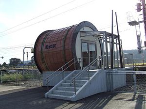
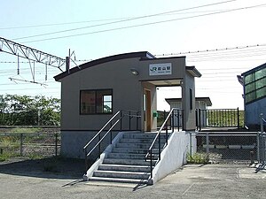
Maeyama Station (前山駅, Maeyama-eki) is a JR East railway station located in the city of Kitaakita, Akita Prefecture, Japan.

Ōnodai Station
Railway station in Kitaakita, Akita Prefecture, Japan
Distance: Approx. 7149 meters
Latitude and longitude: 40.18698889,140.34076944
Ōnodai Station (大野台駅, Ōnodai-eki) is a railway station located in the city of Kitaakita, Akita Prefecture, Japan, operated by the third sector railway operator Akita Nairiku Jūkan Railway.

Jōmon-Ogata Station
Railway station in Kitaakita, Akita Prefecture, Japan
Distance: Approx. 5040 meters
Latitude and longitude: 40.20497222,140.34920278
Jōmon-Ogata Station (縄文小ヶ田駅, Jōmon-Ogata-eki) is a railway station located in the city of Kitaakita, Akita Prefecture, Japan, operated by the third sector railway operator Akita Nairiku Jūkan Railway.

Nishi-Takanosu Station
Railway station in Kitaakita, Akita Prefecture, Japan
Distance: Approx. 2785 meters
Latitude and longitude: 40.22468333,140.35792222
Nishi-Takanosu Station (西鷹巣駅, Nishi-Takanosu-eki) is a railway station located in the city of Kitaakita, Akita Prefecture, Japan, operated by the third sector railway operator Akita Nairiku Jūkan Railway.
Isedōtai Ruins
Archeological site in Japan
Distance: Approx. 5466 meters
Latitude and longitude: 40.20111111,140.34805556
The Isedōtai Ruins (伊勢堂岱遺跡, Isedōtai iseki) are a late Jōmon period archaeological site in the city of Kitaakita, Akita Prefecture, in the Tōhoku region of northern Japan. Discovered during the construction of a highway to nearby Odate–Noshiro Airport, the remains were designated a National Historic Site of Japan in 2001 by the Japanese government. The site is located approximately five minutes on foot from Ogata on the Akita Nairiku Railway.
Weather in this IP's area
scattered clouds
16 Celsius
15 Celsius
16 Celsius
16 Celsius
1023 hPa
48 %
1023 hPa
1019 hPa
10000 meters
1.54 m/s
40 %
06:18:19
16:26:35


