Country:
Region:
City:
Latitude and Longitude:
Time Zone:
Postal Code:
IP information under different IP Channel
ip-api
Country
Region
City
ASN
Time Zone
ISP
Blacklist
Proxy
Latitude
Longitude
Postal
Route
IPinfo
Country
Region
City
ASN
Time Zone
ISP
Blacklist
Proxy
Latitude
Longitude
Postal
Route
MaxMind
Country
Region
City
ASN
Time Zone
ISP
Blacklist
Proxy
Latitude
Longitude
Postal
Route
Luminati
Country
Region
tx
City
austin
ASN
Time Zone
America/Chicago
ISP
TEXASNET-ASN
Latitude
Longitude
Postal
db-ip
Country
Region
City
ASN
Time Zone
ISP
Blacklist
Proxy
Latitude
Longitude
Postal
Route
ipdata
Country
Region
City
ASN
Time Zone
ISP
Blacklist
Proxy
Latitude
Longitude
Postal
Route
Popular places and events near this IP address

Herndon, Virginia
Town in Virginia, United States
Distance: Approx. 2574 meters
Latitude and longitude: 38.97138889,-77.38861111
Herndon is a town in Fairfax County, Virginia, United States, part of the Washington, D.C., metropolitan area. In 2020, the population at the census was 24,655, which makes it the largest of three incorporated towns in the county. The actual dimensions of the town of Herndon are fairly small.

Frying Pan Farm Park
Park Fairfax County, Virginia, U.S.
Distance: Approx. 2423 meters
Latitude and longitude: 38.93683333,-77.41058333
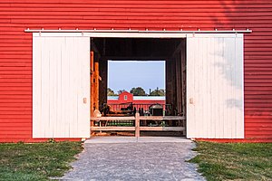
Frying Pan Farm Park is a park located in Fairfax County, Virginia. It has a variety of attractions of both a historic and recreational nature. The park contains the Frying Pan Meetinghouse, listed on the National Register of Historic Places and dating from the 18th century, and the Old Floris Schoolhouse, constructed in 1911.

Herndon station
Washington Metro station
Distance: Approx. 2514 meters
Latitude and longitude: 38.9528,-77.3852
Herndon station (preliminary names: Herndon–Monroe, Herndon–Reston West) is a Washington Metro station in Fairfax County, Virginia on the Silver Line that opened on November 15, 2022. The station is in the median strip of VA-267 adjacent to the current Herndon-Monroe Park and Ride parking garage and bus station, which is on the south side of the highway. It has two pedestrian bridges across SR 267 to reach entrances on either side of the highway.

Innovation Center station
Washington Metro station
Distance: Approx. 325 meters
Latitude and longitude: 38.96083333,-77.41555556
Innovation Center station (preliminary names Route 28, Herndon – Dulles East) is a Washington Metro station in Fairfax County, Virginia on the Silver Line. It is located adjacent to the Virginia Center for Innovative Technology at the intersection of the SR 267 and SR 28 in McNair, near the Fairfax / Loudoun county line. Originally planned to begin operation in 2016, the station opened on November 15, 2022.

Merrybrook
Historic house in Virginia, United States
Distance: Approx. 522 meters
Latitude and longitude: 38.95555556,-77.40861111
Merrybrook is the only known remaining home of American Civil War Confederate spy Laura Ratcliffe. The house is located south of Herndon, Virginia, in Fairfax County, Virginia. She lived here from the earliest days of the Civil War until her death in 1923.

Frying Pan Meetinghouse
Historic church in Virginia, United States
Distance: Approx. 2059 meters
Latitude and longitude: 38.94,-77.41333333
The Frying Pan Meetinghouse (also known as Frying Pan Old School Baptist Church (1832) or Frying Pan Spring Meeting House) is a historic church building within Frying Pan Farm Park in Floris, Virginia. It was built in 1791 as a church building. In 1984 the last remaining trustee deeded the building to the Fairfax County Park Authority to preserve and maintain the property.
Hattontown, Virginia
Unincorporated community in Virginia, United States
Distance: Approx. 2309 meters
Latitude and longitude: 38.945,-77.39305556
Hattontown is an unincorporated community in Fairfax County, Virginia, United States. It is on the CDP border of Reston. It was at one time a rural crossroads located at present-day State Routes 665 (Fox Mill Road) and 666 (Monroe Street) and was named for the Hattons, a family that resided in the area.

Floris, Virginia
Census-designated place in Virginia, United States
Distance: Approx. 2400 meters
Latitude and longitude: 38.93694444,-77.41305556
Floris is a census-designated place (CDP) located within the Oak Hill area of Fairfax County, Virginia, United States. The population at the 2020 census was 8,341.

McNair, Virginia
Census-designated place in Virginia, United States
Distance: Approx. 701 meters
Latitude and longitude: 38.95222222,-77.41388889
McNair is a census-designated place located in the Oak Hill section of Fairfax County, Virginia, United States. It is directly to the east of Washington Dulles International Airport. The population as of the 2020 census was 21,598.

Floris Historic District
Historic district in Virginia, United States
Distance: Approx. 2331 meters
Latitude and longitude: 38.93805556,-77.4075
Floris Historic District is a historic district that is listed on the U.S. National Register of Historic Places (NRHP). It's located in the vicinity of the town of Herndon, Virginia, and just about one mile east of Dulles International Airport. It includes the last remaining working farm in Fairfax County, Virginia, the Frying Pan Farm, which is now also a park.
Cortona Academy
Private school in Herndon, Virginia, United States
Distance: Approx. 668 meters
Latitude and longitude: 38.9525,-77.41305556
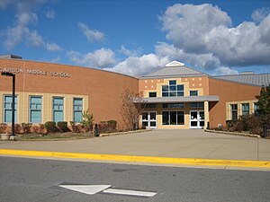
Cortona Academy, founded in 1992, is a private, co-educational, college preparatory academy in Herndon, Virginia, serving grades 7–12. It serves students from the greater Washington area. The campus is situated in Herndon and 100% of Cortona seniors are accepted to college.
Hutchison, Virginia
Census-designated place in Virginia
Distance: Approx. 815 meters
Latitude and longitude: 38.96472222,-77.40833333
Hutchison is a census designated place in Fairfax County, Virginia, United States. It is a residential development just north of Virginia State Route 267, located 23 miles west of Washington, D.C. The community is one of the census-designated places newly recognized for the 2020 United States census. As of the 2020 census, the population of Hutchison is 6,231.
Weather in this IP's area
scattered clouds
24 Celsius
24 Celsius
23 Celsius
26 Celsius
1020 hPa
51 %
1020 hPa
1007 hPa
10000 meters
4.12 m/s
10 degree
40 %
07:09:39
18:45:55