Country:
 USA
USARegion:
City:
Latitude and Longitude:
Time Zone:
Postal Code:
IP information under different IP Channel
ip-api
Country
Region
City
ASN
Time Zone
ISP
Blacklist
Proxy
Latitude
Longitude
Postal
Route
IPinfo
Country
Region
City
ASN
Time Zone
ISP
Blacklist
Proxy
Latitude
Longitude
Postal
Route
MaxMind
Country
Region
City
ASN
Time Zone
ISP
Blacklist
Proxy
Latitude
Longitude
Postal
Route
Luminati
Country
USASN
Time Zone
America/Chicago
ISP
TEXASNET-ASN
Latitude
Longitude
Postal
db-ip
Country
Region
City
ASN
Time Zone
ISP
Blacklist
Proxy
Latitude
Longitude
Postal
Route
ipdata
Country
Region
City
ASN
Time Zone
ISP
Blacklist
Proxy
Latitude
Longitude
Postal
Route
Popular places and events near this IP address

Warp Drive
Short street in Sterling, Virginia
Distance: Approx. 2409 meters
Latitude and longitude: 39.01379,-77.42991
Warp Drive is a short street in Sterling, Virginia, United States. Originally named Steeplechase Drive, it is located in an industrial park off Atlantic Boulevard, and primarily serves as the address for Northrop Grumman Innovation Systems, an aerospace company. The street ends at a circle where an off-ramp from Virginia State Highway 28 joins from the opposite direction.
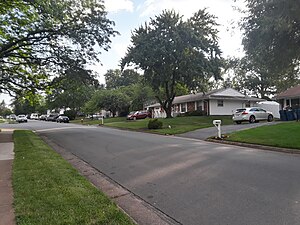
Sterling, Virginia
Census-designated place in Virginia
Distance: Approx. 2712 meters
Latitude and longitude: 39.00611111,-77.42861111
Sterling, Virginia, refers most specifically to a census-designated place (CDP) in Loudoun County, Virginia, United States. The population of the CDP as of the 2020 United States Census was 30,337 The CDP boundaries are confined to a relatively small area between Virginia State Route 28 on the west and Virginia State Route 7 on the northeast, excluding areas near SR 606 and the Dulles Town Center. A much wider region has a preferred mailing address of "Sterling, Virginia", per the United States Postal Service.
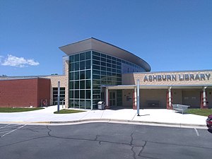
Ashburn, Virginia
Census-designated place in Virginia, United States
Distance: Approx. 2015 meters
Latitude and longitude: 39.03,-77.47111111
Ashburn is a rapidly growing census-designated place (CDP) in Loudoun County, Virginia, United States. At the 2010 United States census, its population was 43,511, up from 3,393 in 1990. It is 30 miles (48 km) northwest of Washington, D.C., and part of the Washington metropolitan area.

Loudoun Gateway station
Washington Metro station
Distance: Approx. 2520 meters
Latitude and longitude: 38.99277778,-77.46166667
Loudoun Gateway station is a Washington Metro station in Loudoun County, Virginia, on the Silver Line. It is located at SR 606 (Old Ox Road) and the ramps to SR 267. Originally planned to begin operations in 2016, the station opened on November 15, 2022.

Ashburn station (Washington Metro)
Washington Metro station
Distance: Approx. 3105 meters
Latitude and longitude: 39.0046,-77.4909
Ashburn station is a Washington Metro station in Loudoun County, Virginia, United States, that serves as the western terminus of the Silver Line. Originally planned to begin operation in 2016, the station opened on November 15, 2022. Ashburn station is located at the median of the Dulles Greenway (SR 267) east of Old Ryan Road (SR 772).
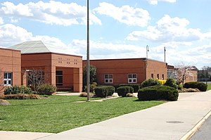
Broad Run High School
Public school in Ashburn, Loudoun County, Virginia
Distance: Approx. 3048 meters
Latitude and longitude: 39.0225,-77.49166667
Broad Run High School is a public secondary school in Ashburn, an unincorporated area in Loudoun County, Virginia, United States. Broad Run is part of the Loudoun County Public Schools system (LCPS). It was ranked as the #1 Best Public High School in Loudoun County and the #9 Best Public High School in Virginia by U.S. News in 2020.
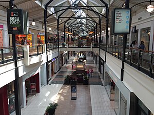
Dulles Town Center
Shopping mall in Dulles, Virginia
Distance: Approx. 3483 meters
Latitude and longitude: 39.03213889,-77.42383333
Dulles Town Center is a two-level enclosed shopping mall in Sterling in Loudoun County, Virginia. It is located five miles (8.0 km) north of Washington Dulles International Airport. It is part of the Dulles Town Center census-designated place for population statistical purposes.

Ryan, Virginia
Unincorporated community in Virginia, United States
Distance: Approx. 3058 meters
Latitude and longitude: 39.015,-77.49305556
Ryan is an unincorporated community in Loudoun County, Virginia, United States. The community was once at the corner of Shellhorn, Ryan, and Waxpool roads. It is now a part of the Ashburn communities.
Loudoun School for Advanced Studies
Private school in Ashburn, Virginia, United States
Distance: Approx. 321 meters
Latitude and longitude: 39.0174,-77.4553
Loudoun School for Advanced Studies (LSAS) is a private school in Ashburn, Virginia, United States and is designed to inspire and challenge advanced students in grades 6-12. Students from LSAS worked to rehabilitate the historic Ashburn Colored School, which is located on the same property where LSAS has built its new campus.

Ashburn Presbyterian Church
Presbyterian church in Virginia, USA
Distance: Approx. 3530 meters
Latitude and longitude: 39.03867,-77.48515
Ashburn Presbyterian Church is a historic Presbyterian church located in Ashburn, Loudoun County, Virginia. It was built in 1878, and is a one-story, rectangular wood-frame building in the Carpenter Gothic style. The church measures 33 feet wide by 50 feet long, and is topped by a steep gable roof.
Murder of Bethany Decker
American woman who went missing in 2011
Distance: Approx. 3392 meters
Latitude and longitude: 38.9934,-77.4851
On January 29, 2011, Bethany Anne Decker (née Littlejohn; born May 13, 1989) left her grandparents' home and returned to her apartment in Ashburn, Virginia. Her then-boyfriend, Ronald Roldan, claimed he saw her there later that day. She has not been seen since.
Kincora, Virginia
Census-designated place in Virginia, United States
Distance: Approx. 3553 meters
Latitude and longitude: 39.04222222,-77.43583333
Kincora is a census-designated place in Loudoun County, Virginia, United States. The CDP was first drawn prior to the 2020 census.
Weather in this IP's area
scattered clouds
24 Celsius
24 Celsius
23 Celsius
26 Celsius
1020 hPa
52 %
1020 hPa
1012 hPa
10000 meters
4.12 m/s
10 degree
40 %
07:09:51
18:46:04