209.87.60.59 - IP Lookup: Free IP Address Lookup, Postal Code Lookup, IP Location Lookup, IP ASN, Public IP
Country:
 Canada
Region:
City:
Location:
Time Zone:
Postal Code:
ISP:
ASN:
language:
User-Agent:
Proxy IP:
Blacklist:
IP information under different IP Channel
ip-api
Country
Region
City
ASN
Time Zone
ISP
Blacklist
Proxy
Latitude
Longitude
Postal
Route
db-ip
Country
Region
City
ASN
Time Zone
ISP
Blacklist
Proxy
Latitude
Longitude
Postal
Route
IPinfo
Country
Region
City
ASN
Time Zone
ISP
Blacklist
Proxy
Latitude
Longitude
Postal
Route
IP2Location
209.87.60.59Country
caRegion
british columbia
City
burnaby
Time Zone
America/Vancouver
ISP
Language
User-Agent
Latitude
Longitude
Postal
ipdata
Country
Region
City
ASN
Time Zone
ISP
Blacklist
Proxy
Latitude
Longitude
Postal
Route
Popular places and events near this IP address

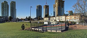
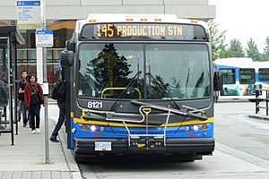
Production Way–University station
Metro Vancouver SkyTrain station
Distance: Approx. 2100 meters
Latitude and longitude: 49.25337,-122.91815
Production Way–University is an elevated station on the Expo and Millennium Lines of Metro Vancouver's SkyTrain rapid transit system. The station is located at the intersection of Lougheed Highway and Production Way in Burnaby, British Columbia, Canada. Initially a Millennium Line station, a reorganization of SkyTrain service patterns in 2016 made Production Way–University a terminus for a branch of the Expo Line.

Lake City Way station
Metro Vancouver SkyTrain station
Distance: Approx. 2555 meters
Latitude and longitude: 49.25458,-122.93903
Lake City Way is an elevated station on the Millennium Line of Metro Vancouver's SkyTrain rapid transit system, located at the intersection of Lougheed Highway and Lake City Way in Burnaby, British Columbia, Canada. It opened in November 2003, after the initial 2002 opening of the Millennium Line. The station serves a nearby business park and the television studios for CHAN-DT (Global Television Network) and Global News: BC 1, a terrestrial and cable television news channel, respectively.

Burnaby Mountain Secondary School
High school in Burnaby, British Columbia, Canada
Distance: Approx. 1950 meters
Latitude and longitude: 49.255,-122.91138889
Burnaby Mountain Secondary School is in Burnaby, British Columbia, Canada. It is three stories and located at 8800 Eastlake Drive, at the intersection with Beaverbrook Drive. It is named after nearby Burnaby Mountain, which is also home to Simon Fraser University.

CJSF-FM
Radio station at Simon Fraser University in Burnaby, British Columbia
Distance: Approx. 845 meters
Latitude and longitude: 49.279677,-122.918529
CJSF-FM is a college radio station from Simon Fraser University in Burnaby, British Columbia. The station features a wide range of genres, from spoken word politics to heavy metal music shows. Its transmitter is located atop Burnaby Mountain.

Burnaby Mountain
Mountain in Canada
Distance: Approx. 964 meters
Latitude and longitude: 49.27916667,-122.90861111
Burnaby Mountain, elev. 370 m (1,214 ft), is a low, forested mountain in the city of Burnaby, British Columbia, overlooking the upper arms of Burrard Inlet. It is the location of Simon Fraser University Burnaby Campus, the Discovery Park research community, and the System Control Tower of BC Hydro and a residential neighbourhood with retail shops development called UniverCity.

Burquitlam station
Metro Vancouver SkyTrain station
Distance: Approx. 2287 meters
Latitude and longitude: 49.26138889,-122.88972222
Burquitlam station is a rapid transit station on the Millennium Line, part of Metro Vancouver's SkyTrain system, and is located in Coquitlam, a suburb of Vancouver, British Columbia, Canada. It opened on December 2, 2016, with the rest of the Evergreen Extension and is named after the Burquitlam neighbourhood in which it is located. The station features a transit exchange (including a direct connection to Simon Fraser University), HandyDart area, night bus service to and from Downtown Vancouver, and bike lockers and racks.

Fraser International College
Distance: Approx. 346 meters
Latitude and longitude: 49.27388889,-122.9125
Fraser International College (FIC) is situated in Burnaby, British Columbia, Canada, and commenced its operations in September 2006. FIC functions as a private educational institution in partnership with Simon Fraser University. The courses offered at FIC are developed in collaboration with SFU's faculty and departments, ensuring a meticulous approach to course content and academic standards.
Barnet, British Columbia
Place in British Columbia, Canada
Distance: Approx. 1768 meters
Latitude and longitude: 49.288,-122.914
Barnet is a settlement in British Columbia. It is part of Port Moody, British Columbia.
Burquitlam, British Columbia
Neighbourhood of Coquitlam in Lower Mainland, British Columbia, Canada
Distance: Approx. 2355 meters
Latitude and longitude: 49.26111111,-122.88888889
Burquitlam is a neighbourhood and commercial district of the City of Coquitlam, British Columbia, Canada.

4D LABS
Canadian materials science research institute
Distance: Approx. 519 meters
Latitude and longitude: 49.27686,-122.91659
4D LABS is a materials science research institute at Simon Fraser University in British Columbia, Canada that focuses on the design, development, demonstration, and delivery of advanced functional materials and nanoscale devices. Its $41 million facility opened in Jan 2007 with funding from Canada Foundation for Innovation, the British Columbia Knowledge Development Fund, and Simon Fraser University. 4D LABS is located in the Technology and Science Complex 2 (TASC2) building on the Simon Fraser University campus in Burnaby.
Burnaby Velodrome
Distance: Approx. 2561 meters
Latitude and longitude: 49.28905,-122.94051
One of only three indoor bicycle racing tracks in Canada, the Burnaby Velodrome is located in Burnaby, British Columbia. It is operated by the non-profit Burnaby Velodrome Club (BVC), and is an affiliated member of Cycling British Columbia. The track is located inside the Harry Jerome Sports Centre, which is also used by Volleyball BC for game play and administration purposes.
SFU Exchange
Public transit exchange in Metro Vancouver, Canada
Distance: Approx. 763 meters
Latitude and longitude: 49.27861111,-122.91277778
SFU Exchange is a bus terminus for TransLink located on the campus of Simon Fraser University in Burnaby, British Columbia. It opened on September 3, 1965, and consists of 2 exchanges: the main exchange located at University Drive at East Campus Road at the eastern part of the campus and the secondary, and original, exchange located at the Transportation Centre. The exchanges primarily serve students, staff, and faculty of Simon Fraser University, as well as residents of UniverCity.
Weather in this IP's area
clear sky
-6 Celsius
-9 Celsius
-8 Celsius
-4 Celsius
1015 hPa
90 %
1015 hPa
996 hPa
10000 meters
1.69 m/s
1.33 m/s
13 degree
9 %