209.87.235.93 - IP Lookup: Free IP Address Lookup, Postal Code Lookup, IP Location Lookup, IP ASN, Public IP
Country:
Region:
City:
Location:
Time Zone:
Postal Code:
IP information under different IP Channel
ip-api
Country
Region
City
ASN
Time Zone
ISP
Blacklist
Proxy
Latitude
Longitude
Postal
Route
Luminati
Country
Region
on
City
ottawa
ASN
Time Zone
America/Toronto
ISP
S-I-S
Latitude
Longitude
Postal
IPinfo
Country
Region
City
ASN
Time Zone
ISP
Blacklist
Proxy
Latitude
Longitude
Postal
Route
IP2Location
209.87.235.93Country
Region
ontario
City
ottawa
Time Zone
America/Toronto
ISP
Language
User-Agent
Latitude
Longitude
Postal
db-ip
Country
Region
City
ASN
Time Zone
ISP
Blacklist
Proxy
Latitude
Longitude
Postal
Route
ipdata
Country
Region
City
ASN
Time Zone
ISP
Blacklist
Proxy
Latitude
Longitude
Postal
Route
Popular places and events near this IP address

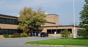
Nepean High School (Ottawa)
High school in Ottawa, Ontario, Canada
Distance: Approx. 1622 meters
Latitude and longitude: 45.383833,-75.759058
Nepean High School (often abbreviated to NHS) is a high school in Ottawa, Ontario, Canada. It is located in the Westboro neighbourhood, at 574 Broadview Avenue. There were 1160 students enrolled for 2011–2012.
Laurentian High School
School in Ottawa, Ontario, Canada
Distance: Approx. 1248 meters
Latitude and longitude: 45.3632,-75.7379
Laurentian High School was a high school in the Central Park neighbourhood of Ottawa, Ontario, Canada. The school opened in 1958 and provided education to grade 9 through 12 (and 13 from 1961 to 2003) through an unsemestered curriculum as established by the Ontario Ministry of Education.

Glabar Park
Neighbourhood in Ottawa, Ontario, Canada
Distance: Approx. 1220 meters
Latitude and longitude: 45.36726,-75.76422
Glabar Park is a neighbourhood in Bay Ward, in the west end of Ottawa, Ontario, Canada. It is bounded on the west by Woodroffe Avenue north by Carling Avenue, south by The Queensway and on the east by Maitland Avenue. The population at the 2011 census was about 2,806.
Notre Dame High School (Ottawa)
Ottawa catholic high school in Ottawa, Ontario, Canada
Distance: Approx. 1010 meters
Latitude and longitude: 45.378642,-75.756236
Notre Dame High School is a Catholic intermediate school and high school in Ottawa's west operated by the Ottawa Catholic School Board. The school is one of the first in the area to use a uniform. The school is mainly two storeys throughout, except for the northeast corner where it features a basement in which the classrooms are almost exclusively for mathematics.
Carlingwood Mall
Shopping mall in Ontario, Canada
Distance: Approx. 1608 meters
Latitude and longitude: 45.372,-75.77
Carlingwood Shopping Centre is shopping mall located in the Carlingwood neighbourhood of Ottawa, Ontario, Canada. The mall opened in 1956 and was one of the city's first major shopping centres. Since May 2024, it has been operated by Anthem Properties Group.

Carlington
Neighbourhood in Ottawa, Ontario, Canada
Distance: Approx. 1478 meters
Latitude and longitude: 45.37777778,-75.73333333
Carlington is a neighbourhood located in River Ward in the west-end of Ottawa, Ontario, Canada. The community association boundaries are Clyde Avenue to the west, Carling Avenue and the Queensway to the north, Fisher Avenue to the east and the Central Experimental Farm Pathway to the south. According to the Canada 2016 Census, the total population for this area was 11,363.

Central Park, Ottawa
Neighbourhood in Ottawa, Ontario, Canada
Distance: Approx. 990 meters
Latitude and longitude: 45.36805556,-75.7375
Central Park (French: Parc Central) is a neighbourhood in River Ward in the west end of Ottawa, Ontario, Canada. It is bounded on the east by Merivale Road, on the south by Baseline Road, on the west by Clyde Avenue and on the north by the Carlington neighbourhood. The population of the neighbourhood in 2016 was 3,888 in an area of 0.91 km2.

Fairlawn Centre
Distance: Approx. 1532 meters
Latitude and longitude: 45.36962,-75.769
The Fairlawn Centre (formerly Fairlawn Plaza) is a strip mall along Carling Avenue in Ottawa, Ontario, Canada. The mall opened in 1961 when the plaza's original tenants were Steinberg's grocery store and J. Pascal Hardware. Miracle Mart was also one of the early tenants.
Ottawa Jewish Community School
Independent jewish day school in Ottawa, Ontario, Canada
Distance: Approx. 588 meters
Latitude and longitude: 45.37591667,-75.75183333
The Ottawa Jewish Community School (or OJCS) is a pluralistic Jewish day school in Ottawa, Ontario. The school was founded as Hillel Academy in 1949, and amalgamated with Yitzhak Rabin High School in 2006. OJCS teaches Hebrew, English and French as part of its curriculum, and runs a Judaics program focusing on Jewish religion, culture and values.
Adath Shalom (Ottawa)
Religious group in Ottawa, Canada
Distance: Approx. 523 meters
Latitude and longitude: 45.3751,-75.7525
Adath Shalom, officially Adath Shalom Congregation of Ottawa (Hebrew: שלום עדת קהילת), is a Conservative synagogue located in Ottawa, Ontario, Canada. It has been egalitarian and lay-led since 1978. It is affiliated with the United Synagogue of Conservative Judaism.
Ottawa Torah Institute
School in Ottawa, Ontario, Canada
Distance: Approx. 1638 meters
Latitude and longitude: 45.35997222,-75.76352778
Ottawa Torah Institute was a yeshiva high school located in Ottawa providing secular and Judaic education. Founded in 1982 as a boys' school, it is Ottawa's first and only full-time Jewish high school. In 1990 the high school expanded to include a girls' division, known as Machon Sarah.

Carlington Park
Park in Ottawa, Canada
Distance: Approx. 570 meters
Latitude and longitude: 45.3736,-75.7433
Carlington Park is a large park in Ottawa, Ontario, Canada. It contains one of Ottawa's largest hills. It is a City of Ottawa owned and operated park.
Weather in this IP's area
broken clouds
-11 Celsius
-11 Celsius
-13 Celsius
-10 Celsius
1032 hPa
33 %
1032 hPa
1020 hPa
8890 meters
0.25 m/s
0.86 m/s
130 degree
59 %
