209.87.234.219 - IP Lookup: Free IP Address Lookup, Postal Code Lookup, IP Location Lookup, IP ASN, Public IP
Country:
Region:
City:
Location:
Time Zone:
Postal Code:
IP information under different IP Channel
ip-api
Country
Region
City
ASN
Time Zone
ISP
Blacklist
Proxy
Latitude
Longitude
Postal
Route
Luminati
Country
Region
on
City
ottawa
ASN
Time Zone
America/Toronto
ISP
S-I-S
Latitude
Longitude
Postal
IPinfo
Country
Region
City
ASN
Time Zone
ISP
Blacklist
Proxy
Latitude
Longitude
Postal
Route
IP2Location
209.87.234.219Country
Region
ontario
City
ottawa
Time Zone
America/Toronto
ISP
Language
User-Agent
Latitude
Longitude
Postal
db-ip
Country
Region
City
ASN
Time Zone
ISP
Blacklist
Proxy
Latitude
Longitude
Postal
Route
ipdata
Country
Region
City
ASN
Time Zone
ISP
Blacklist
Proxy
Latitude
Longitude
Postal
Route
Popular places and events near this IP address
Riverview, Ottawa
Neighbourhood in Ottawa, Ontario, Canada
Distance: Approx. 548 meters
Latitude and longitude: 45.40833333,-75.65
Riverview (also known as Riverview Park) is a neighbourhood in Ottawa, Ontario, Canada. It is southeast of the downtown adjacent to the Rideau River, its location on which is its namesake. The 2021 Census population of Riverview is 13,113.

Children's Hospital of Eastern Ontario
Hospital in Ontario, Canada
Distance: Approx. 1259 meters
Latitude and longitude: 45.40111111,-75.65138889
The Children's Hospital of Eastern Ontario — Ottawa Children's Treatment Centre, commonly known by its acronym CHEO ( CHEE-oh), is a children's hospital and tertiary trauma centre for children and youth located in Ottawa, Ontario, Canada. CHEO serves patients from eastern Ontario, northern Ontario, Nunavut, and the Outaouais region of Quebec. CHEO first opened its doors on May 17, 1974 at 401 Smyth Road in Ottawa.
Ottawa General Hospital
Hospital in Ottawa, Ontario
Distance: Approx. 1124 meters
Latitude and longitude: 45.4014,-75.6472
The Ottawa Hospital's General Campus is one of three main campuses of The Ottawa Hospital in Ottawa, Ontario, Canada. With 569 beds, the General Campus includes The Ottawa Hospital Rehabilitation Centre and the Cancer Centre. The Ottawa General Hospital opened in 1845 at the current site of the Élisabeth Bruyère Hospital in the ByWard Market area of Ottawa.

Ottawa Stadium
Baseball Stadium in Ottawa, Ontario
Distance: Approx. 1217 meters
Latitude and longitude: 45.42014167,-75.65356944
Ottawa Stadium is a baseball stadium in Ottawa, Ontario, Canada, with a seating capacity of 10,332. The stadium is located in the city's east end near the interchange of Queensway and Vanier Parkway. It has been used for minor-league professional baseball and music concerts since 1993.

Ottawa station
Inter-city train station in Ontario, Canada
Distance: Approx. 802 meters
Latitude and longitude: 45.41638889,-75.65166667
Ottawa station (French: Gare d'Ottawa, IATA: XDS), or Ottawa Train Station, is the main inter-city train station in Ottawa, Ontario, Canada. It is located 4 kilometres (2.5 mi) east of downtown Ottawa, adjacent to Tremblay O-Train station in the neighbourhood of Eastway Gardens. The station is operated by Via Rail and serves inter-city trains connecting to Toronto, Kingston, Montreal and Quebec City on Via Rail's Corridor Route.

Tremblay station
Railway station in Ottawa, Ontario, Canada
Distance: Approx. 919 meters
Latitude and longitude: 45.41666667,-75.65333333
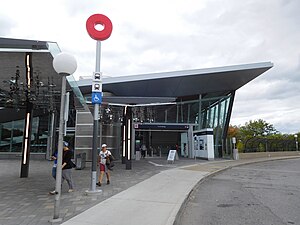
Tremblay is an O-Train station on the Confederation Line in Ottawa, Ontario which serves the Ottawa train station, connecting to Via Rail Corridor inter-city rail services and a daily Ontario Northland bus service to Sudbury and Sault Ste. Marie. The station opened on September 14, 2019 to replace the former Transitway bus rapid transit station known as Train Station (which closed on June 28, 2015).

St-Laurent station
Transit station in Ottawa, Canada
Distance: Approx. 1143 meters
Latitude and longitude: 45.42055556,-75.63805556
St-Laurent is a station on the Confederation Line of Ottawa's O-Train, and on the system's bus network and is located at St. Laurent Boulevard and the Queensway.

University of Ottawa Faculty of Medicine
Distance: Approx. 1140 meters
Latitude and longitude: 45.4012,-75.6468
The Faculty of Medicine (French: Faculté de médecine) at the University of Ottawa is a bilingual medical school in Ottawa, Ontario, Canada founded in 1945. It is located at a campus centred on Roger-Guindon Hall in the east end of Ottawa and is attached to the Ottawa Hospital's General Campus. The Health Sciences Complex is separate from the downtown University of Ottawa campus.
École secondaire catholique Franco-Cité
School in Ottawa, Ontario, Canada
Distance: Approx. 1218 meters
Latitude and longitude: 45.400523,-75.641685
École secondaire catholique Franco-Cité is a French Catholic school located in the Riverview neighbourhood of Ottawa, Ontario. It operates under the Conseil des écoles catholiques du Centre-Est (CECCE) school board and is renowned for its numerous sports programs, most notably the flagship "Sport-Études" program.
St. Laurent Centre
Shopping mall
Distance: Approx. 1264 meters
Latitude and longitude: 45.422,-75.639
St. Laurent Centre (French: Centre St-Laurent) is a shopping mall located in Ottawa, Ontario, Canada. It is owned and operated by Morguard REIT. The shopping mall is located just north of Highway 417 at the corner of St.

Eastway Gardens
Neighbourhood in Ottawa, Ontario, Canada
Distance: Approx. 665 meters
Latitude and longitude: 45.41722222,-75.64333333
Eastway Gardens is a small neighbourhood in Alta Vista Ward in the east end of Ottawa, Ontario, Canada. It consists of a series of dead end streets coming off of Tremblay Road between Riverside Drive and St. Laurent Boulevard.

Belfast Yard
O-Train rail yard
Distance: Approx. 542 meters
Latitude and longitude: 45.41502778,-75.63994444
Belfast Yard is the maintenance, storage and administrative facility for LRT fleet for the Confederation Line of Ottawa's O-Train light rail system. The yard was opened in 2016 and assembled 34 Alstom Citadis Spirit LRT vehicles. The facility was expanded to accommodate 38 additional LRT vehicles as part of the Stage 2 Confederation Line expansion.
Weather in this IP's area
light snow
-6 Celsius
-11 Celsius
-7 Celsius
-5 Celsius
1025 hPa
89 %
1025 hPa
1017 hPa
10000 meters
2.57 m/s
350 degree
100 %


