209.62.241.117 - IP Lookup: Free IP Address Lookup, Postal Code Lookup, IP Location Lookup, IP ASN, Public IP
Country:
 USA
USARegion:
City:
Location:
Time Zone:
Postal Code:
ISP:
ASN:
language:
User-Agent:
Proxy IP:
Blacklist:
IP information under different IP Channel
ip-api
Country
Region
City
ASN
Time Zone
ISP
Blacklist
Proxy
Latitude
Longitude
Postal
Route
db-ip
Country
Region
City
ASN
Time Zone
ISP
Blacklist
Proxy
Latitude
Longitude
Postal
Route
IPinfo
Country
Region
City
ASN
Time Zone
ISP
Blacklist
Proxy
Latitude
Longitude
Postal
Route
IP2Location
209.62.241.117Country
usRegion
south dakota
City
rapid city
Time Zone
America/Denver
ISP
Language
User-Agent
Latitude
Longitude
Postal
ipdata
Country
Region
City
ASN
Time Zone
ISP
Blacklist
Proxy
Latitude
Longitude
Postal
Route
Popular places and events near this IP address

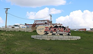
Rapid City, South Dakota
City in South Dakota, United States
Distance: Approx. 3977 meters
Latitude and longitude: 44.07138889,-103.22083333
Rapid City is a city in South Dakota, United States, and the county seat of Pennington County. It is the second most populous city in the state, after Sioux Falls. It is located on the eastern slope of the Black Hills in western South Dakota and was named after Rapid Creek, where the settlement developed.
Rapid Valley, South Dakota
CDP in South Dakota, United States
Distance: Approx. 4319 meters
Latitude and longitude: 44.0675,-103.12222222
Rapid Valley is a census-designated place (CDP) and unincorporated community in Pennington County, South Dakota, United States, and a suburb of Rapid City. The population was 8,098 at the 2020 census. Rapid Valley has been a retreat for people living in Rapid City due to its low crime, cheap land, and views of the Black Hills.

South Dakota School of Mines and Technology
Public university in Rapid City, South Dakota, U.S.
Distance: Approx. 2768 meters
Latitude and longitude: 44.07388889,-103.20611111
The South Dakota School of Mines & Technology (South Dakota Mines, SD Mines, or SDSM&T) is a public university in Rapid City, South Dakota. It is governed by the South Dakota Board of Regents and was founded in 1885. South Dakota Mines offers bachelor’s, master’s, and doctoral degrees.

The Monument (Rapid City, South Dakota)
Arenas in Rapid City, South Dakota, U.S.
Distance: Approx. 4316 meters
Latitude and longitude: 44.08854,-103.225816
The Monument, formerly known as Rushmore Plaza Civic Center and Rushmore Plaza, is a 500,000-square-foot (46,000 m2) exhibition center, in Rapid City, South Dakota. The Monument is the main event center for the Black Hills Region, serving Western South Dakota, South West North Dakota, North West Nebraska, and Eastern Wyoming. It is home to many large annual events, including the Black Hills Stock Show and Rodeo & Rodeo Rapid City, Lakota Nation Invitational, the Black Hills Homebuilders Expo, South Dakota High School Activities Association Tournaments, the Rapid City Rush ice hockey team of the ECHL, and the Rapid City Marshals of Champions Indoor Football, who in 2024, folded.
Rapid City, South Dakota metropolitan area
Metropolitan Statistical Area in South Dakota, United States
Distance: Approx. 3977 meters
Latitude and longitude: 44.07138889,-103.22083333
The Rapid City, SD metropolitan area, as defined by the United States Census Bureau. Anchored by the city of Rapid City, the area corresponds to the entirety of Pennington and Meade counties in the state of South Dakota, though the Rapid City market area extends well beyond those counties and into Nebraska, Montana, Wyoming, and North Dakota. The population was 139,074 at the 2020 census.

Western Dakota Technical College
Community college in Rapid City, South Dakota, U.S.
Distance: Approx. 704 meters
Latitude and longitude: 44.07666667,-103.17944444
Western Dakota Technical Institute is a public community college in Rapid City, South Dakota. It has an enrollment of 1,324 and offers 26 associate degree programs.

SoDak Con
Annual three-day anime convention in South Dakota
Distance: Approx. 4316 meters
Latitude and longitude: 44.08853889,-103.22581667
SoDak Con formerly called SoDak Anime Convention, was an annual three-day anime convention held during May/June at the Rushmore Plaza Civic Center in Rapid City, South Dakota. The name of the convention comes from the state that the convention is located in, South Dakota.

Church of the Immaculate Conception (Rapid City, South Dakota)
Historic church in South Dakota, United States
Distance: Approx. 4226 meters
Latitude and longitude: 44.07583333,-103.22527778
The Church of the Immaculate Conception (also Old Cathedral of the Immaculate Conception) is a historic building located in Rapid City, South Dakota, United States. Built as a parish church, it became the cathedral of the Diocese of Rapid City when the seat of the diocese was moved to Rapid City. It is now known as the Chapel of the Immaculate Conception.

Hotel Alex Johnson
Hotel in Rapid City, South Dakota
Distance: Approx. 4369 meters
Latitude and longitude: 44.080393,-103.227527
The Hotel Alex Johnson is a historic hotel in Rapid City, South Dakota. It was opened in 1928 by its namesake, Alex Carlton Johnson. From 1956 to 1968, it was operated by Sheraton Hotels and Resorts and was known as the Sheraton-Johnson Hotel.

Pennington County Courthouse
United States historic place
Distance: Approx. 3973 meters
Latitude and longitude: 44.07888889,-103.2225
The Pennington County Courthouse, located at 315 St. Joseph Street in Rapid City, is the county courthouse serving Pennington County, South Dakota. The courthouse has functioned as the seat of Pennington County government since it was built in 1922.

O'Harra Stadium
Stadium located in South Dakota, U.S.A.
Distance: Approx. 2555 meters
Latitude and longitude: 44.07277778,-103.20277778
Dunham Field at O'Harra Memorial Stadium is a multi-purpose college football stadium in the United States, located on the campus of the South Dakota School of Mines & Technology (SDSM&T) in Rapid City, South Dakota. It is the home of the South Dakota Mines Hardrockers of the Rocky Mountain Athletic Conference in NCAA Division II, as well as Rapid City's two public high schools (Central and Stevens). The stadium is named after SDSM&T's eighth president, Dr.
Quarter Pounder statue
Sculpture in Rapid City, South Dakota
Distance: Approx. 2446 meters
Latitude and longitude: 44.09569444,-103.15027778
A statue of a Quarter Pounder stands outside a McDonald's restaurant in Rapid City, South Dakota, United States. The statue was erected in 2020.
Weather in this IP's area
few clouds
3 Celsius
-2 Celsius
2 Celsius
4 Celsius
1012 hPa
70 %
1012 hPa
890 hPa
10000 meters
8.23 m/s
340 degree
20 %