Country:
Region:
City:
Latitude and Longitude:
Time Zone:
Postal Code:
IP information under different IP Channel
ip-api
Country
Region
City
ASN
Time Zone
ISP
Blacklist
Proxy
Latitude
Longitude
Postal
Route
Luminati
Country
Region
qc
City
matane
ASN
Time Zone
America/Toronto
ISP
CC-3272
Latitude
Longitude
Postal
IPinfo
Country
Region
City
ASN
Time Zone
ISP
Blacklist
Proxy
Latitude
Longitude
Postal
Route
db-ip
Country
Region
City
ASN
Time Zone
ISP
Blacklist
Proxy
Latitude
Longitude
Postal
Route
ipdata
Country
Region
City
ASN
Time Zone
ISP
Blacklist
Proxy
Latitude
Longitude
Postal
Route
Popular places and events near this IP address

Matane River
River in Quebec, Canada
Distance: Approx. 3029 meters
Latitude and longitude: 48.85305556,-67.53361111
The Matane River is a river flowing in La Matanie Regional County Municipality, in administrative region of Bas-Saint-Laurent, on the Gaspé Peninsula, in the province of Quebec, Canada, which empties into the Saint Lawrence River at the city of Matane. The river successively crosses the cantons: Le Clercq and Cuoq (in unorganized territory of Rivière-Bonjour), Tessier (in Saint-René-de-Matane), Matapédia (in Saint-Alexis-de-Matapédia), and Matane (in Saint-Léandre and the city of Matane).
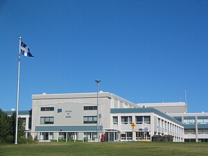
Cégep de Matane
Public college in Matane, Quebec
Distance: Approx. 2359 meters
Latitude and longitude: 48.8409,-67.4974
Cégep de Matane is a francophone CEGEP pre-university and technical college located at 616 Saint-Rédempteur in Matane, Quebec, Canada.
Matane/Russell-Burnett Airport
Airport in Matane, Quebec
Distance: Approx. 6051 meters
Latitude and longitude: 48.85638889,-67.45222222
Matane/Russell-Burnett Airport (IATA: YME, ICAO: CYME) is a registered aerodrome located 2.5 nautical miles (4.6 km; 2.9 mi) east of Matane, Quebec, Canada.

Jardin d'Eole Wind Farm
Distance: Approx. 6479 meters
Latitude and longitude: 48.8,-67.6
The Jardin d'Eole Wind Farm is a 127.5 megawatt (MW) wind farm, located in Saint-Ulric, near Matane, Quebec. It is owned and operated by Northland Power. The wind farm began commercial operations in December 2009.

Matane
Town in Quebec, Canada
Distance: Approx. 2698 meters
Latitude and longitude: 48.85,-67.53333333
Matane is a town on the Gaspé Peninsula in Quebec, Canada, on the south shore of the Saint Lawrence River at the mouth of the Matane River. The town is the seat for the La Matanie Regional County Municipality. In addition to Matane itself, the town's territory also includes the communities of Petit-Matane and Saint-Luc-de-Matane.
Weather in this IP's area
clear sky
2 Celsius
-3 Celsius
2 Celsius
2 Celsius
1027 hPa
50 %
1027 hPa
1018 hPa
10000 meters
5.65 m/s
6.94 m/s
298 degree
9 %
06:20:48
16:06:26
