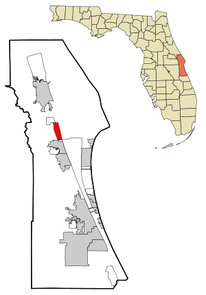
Country:
Region:
City:
Latitude and Longitude:
Time Zone:
Postal Code:
IP information under different IP Channel
ip-api
Country
Region
City
ASN
Time Zone
ISP
Blacklist
Proxy
Latitude
Longitude
Postal
Route
IPinfo
Country
Region
City
ASN
Time Zone
ISP
Blacklist
Proxy
Latitude
Longitude
Postal
Route
MaxMind
Country
Region
City
ASN
Time Zone
ISP
Blacklist
Proxy
Latitude
Longitude
Postal
Route
Luminati
Country
Region
fl
City
palmbay
ASN
Time Zone
America/New_York
ISP
BLUE-01
Latitude
Longitude
Postal
db-ip
Country
Region
City
ASN
Time Zone
ISP
Blacklist
Proxy
Latitude
Longitude
Postal
Route
ipdata
Country
Region
City
ASN
Time Zone
ISP
Blacklist
Proxy
Latitude
Longitude
Postal
Route
Popular places and events near this IP address

Port St. John, Florida
Census-designated place in Florida
Distance: Approx. 2437 meters
Latitude and longitude: 28.47694444,-80.78861111
Port St. John is a census-designated place located between Titusville and Cocoa in Brevard County, Florida. The population was 23,474 at the 2020 United States Census, up from 12,267 at the 2010 United States Census.

Sharpes, Florida
Census-designated place in Florida
Distance: Approx. 3970 meters
Latitude and longitude: 28.44138889,-80.76111111
Sharpes is a census-designated place (CDP) in Brevard County, Florida. The population was 3,115 at the 2020 United States census, down from 3,411 at the 2010 United States Census. It is part of the Palm Bay–Melbourne–Titusville, Florida Metropolitan Statistical Area.
NASA Causeway
Bridge in Florida, United States of America
Distance: Approx. 8328 meters
Latitude and longitude: 28.5275764,-80.7709017
The NASA Causeway, is an east–west expressway in Brevard County, Florida, containing two causeways. The first causeway connects the Florida mainland to Merritt Island and later, over the private second causeway, connects Merritt Island to Cape Canaveral. As such, the NASA Causeway is the main route connecting points of interest in Titusville, Florida to the Kennedy Space Center on Merritt Island.
Courtenay, Florida
Unincorporated community in Florida, US
Distance: Approx. 8620 meters
Latitude and longitude: 28.45667,-80.70972
Courtenay ( ; KORT-nee) is an unincorporated community on Merritt Island in Brevard County, Florida, United States. It is part of the Palm Bay–Melbourne–Titusville Metropolitan Statistical Area. Courtenay was settled in the 1870s and 1880s by people from Charleston, South Carolina, and was named for William Ashmead Courtenay, a native of Charleston, Confederate veteran and Charleston businessman who later served two terms as Mayor of Charleston.

City Point Community Church
United States historic place
Distance: Approx. 5756 meters
Latitude and longitude: 28.42305556,-80.75305556
The City Point Community Church (also known as the Brevard County Environmental Field Station) is a historic church in Cocoa, Florida, United States. It is located at 3783 North Indian River Drive. It was originally constructed as a public hall, school, and non-denominational church for both black and white residents.

St. Luke's Episcopal Church and Cemetery (Courtenay, Florida)
Historic church in Florida, United States
Distance: Approx. 7859 meters
Latitude and longitude: 28.45722222,-80.7175
St. Luke's Episcopal Church and Cemetery is an historic Carpenter Gothic style Episcopal church building built in 1888 and its adjacent cemetery located at 5555 North Tropical Trail, in Courtenay, on Merritt Island, Brevard County, Florida, in the United States. On June 15, 1990, St.
Space Coast Junior/Senior High School
School in Brevard County, Florida, United States
Distance: Approx. 3663 meters
Latitude and longitude: 28.47678,-80.82736
Space Coast Junior/Senior High School is located in Brevard County, Florida, in the community of Port St. John, Florida, United States. It is part of the Brevard County School District.
Valiant Air Command Warbird Museum
Aviation museum in Titusville, Florida
Distance: Approx. 6956 meters
Latitude and longitude: 28.519,-80.794
The Valiant Air Command, Inc. Warbird Museum (VAC) is located at the Space Coast Regional Airport in Brevard County, just south of Titusville, Florida. The VAC contains vintage aircraft and a 30,000-square-foot (2,800 m2) hangar with a restoration area.

Astronaut Memorial Planetarium and Observatory
Observatory
Distance: Approx. 8698 meters
Latitude and longitude: 28.38513889,-80.76186111
The Astronaut Memorial Planetarium and Observatory, or AMPO, also known as the Eastern Florida State College Planetarium and Observatory, was an astronomical observatory and planetarium at Eastern Florida State College in Cocoa, Florida. The facility consisted of a planetarium, public observatory, large-screen movie theater, exhibit halls, multi-media classroom and an art gallery. In September 2017 Hurricane Irma caused minor damage to the building.
North Merritt Island, Florida
Census-designated place in Florida, United States
Distance: Approx. 8647 meters
Latitude and longitude: 28.45666667,-80.70944444
North Merritt Island is a census-designated place (CDP) in Brevard County, Florida, United States. It occupies a portion of the physical Merritt Island, north of the CDP of Merritt Island and south of Merritt Island National Wildlife Refuge. Florida State Road 3 is the main highway through the community, leading north to Florida State Road 405 and south to Florida State Road 528.
West Canaveral Groves, Florida
Census-designated place in Florida, United States
Distance: Approx. 8505 meters
Latitude and longitude: 28.39277778,-80.84555556
West Canaveral Groves is a census-designated place (CDP) in Brevard County, Florida, United States. It is in western Brevard County, south of Florida State Route 528, north of Florida State Road 520, and 7 miles (11 km) west of Cocoa. The community was first listed as a CDP prior to the 2020 census.
Cocoa station
Planned Brightline train station
Distance: Approx. 7971 meters
Latitude and longitude: 28.39739,-80.75202
Cocoa station is a future Brightline inter-city rail infill station in Cocoa, Florida, United States. The station would be located just south of the Cocoa Curve, where Brightline's Orlando Line along State Road 528 merges with the Florida East Coast Railway main line. The station will be located on property already owned by Brightline, on the south side of the interchange between U.S. Route 1 and State Road 528.
Weather in this IP's area
clear sky
25 Celsius
25 Celsius
24 Celsius
27 Celsius
1025 hPa
58 %
1025 hPa
1024 hPa
10000 meters
4.02 m/s
7.6 m/s
64 degree
10 %
07:25:50
18:50:19
