Country:
 USA
USARegion:
City:
Latitude and Longitude:
Time Zone:
Postal Code:
IP information under different IP Channel
ip-api
Country
Region
City
ASN
Time Zone
ISP
Blacklist
Proxy
Latitude
Longitude
Postal
Route
IPinfo
Country
Region
City
ASN
Time Zone
ISP
Blacklist
Proxy
Latitude
Longitude
Postal
Route
MaxMind
Country
Region
City
ASN
Time Zone
ISP
Blacklist
Proxy
Latitude
Longitude
Postal
Route
Luminati
Country
USRegion
tx
City
conroe
ASN
Time Zone
America/Chicago
ISP
CCI-TEXAS
Latitude
Longitude
Postal
db-ip
Country
Region
City
ASN
Time Zone
ISP
Blacklist
Proxy
Latitude
Longitude
Postal
Route
ipdata
Country
Region
City
ASN
Time Zone
ISP
Blacklist
Proxy
Latitude
Longitude
Postal
Route
Popular places and events near this IP address

Montgomery County, Texas
County in Texas, United States
Distance: Approx. 4344 meters
Latitude and longitude: 30.3,-95.5
Montgomery County is a county in the U.S. state of Texas. As of the 2020 U.S. census, the county had a population of 620,443. The county seat is Conroe.
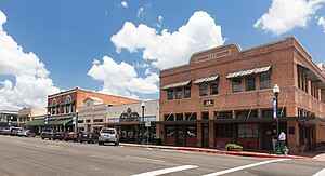
Conroe, Texas
City in Texas, United States
Distance: Approx. 1265 meters
Latitude and longitude: 30.31611111,-95.45888889
Conroe is a city in and the county seat of Montgomery County, Texas, United States, about 40 miles (64 km) north of Houston. It is a principal city in the Houston–The Woodlands–Sugar Land metropolitan area. As of 2023, the population was 103,035.
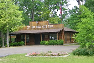
Cut and Shoot, Texas
City in Texas, United States
Distance: Approx. 9735 meters
Latitude and longitude: 30.33305556,-95.35916667
Cut and Shoot is a city in eastern Montgomery County, Texas, United States, about 6 mi (9.7 km) east of Conroe and 40 mi (64 km) north of Houston. Until 2006, Cut and Shoot was considered and called a town. Then, the town council elected for it to be considered and referred to as a city.

Panorama Village, Texas
City in Texas, United States
Distance: Approx. 9080 meters
Latitude and longitude: 30.37861111,-95.49638889
Panorama Village is a city in Montgomery County, Texas, United States. Residents have Conroe addresses and Willis phone exchanges. The small city is home to a 27-hole municipal golf course and country club.
Lone Star Expo Center
Distance: Approx. 5583 meters
Latitude and longitude: 30.350361,-95.429928
The Lone Star Expo Center is a 5,000-seat multi-purpose arena in Conroe, Texas, USA. It hosts local sporting events, concerts, and other events. It was opened in 2002. In 2007, it became home to the now-defunct Conroe Storm indoor football team.

Southern Star Brewing Company
Distance: Approx. 5070 meters
Latitude and longitude: 30.3464,-95.4327
Southern Star Brewing Company is a brewery in Conroe, Texas, USA. Southern Star's president is Dave Fougeron, former head brewer of Houston-based Saint Arnold Brewing Company. The brewery distributes in Texas, Alabama, Indiana, Kentucky, Ohio and South Carolina. Southern Star's flagship beer is its Pine Belt Pale Ale, an American-style pale ale that is roughly 6.5 percent alcohol by volume.
Excel Academy (Conroe, Texas)
Distance: Approx. 8903 meters
Latitude and longitude: 30.32833333,-95.54388889
Excel Academy was a coeducational boarding school located in Conroe, Texas, established circa 1998 and operated by the Aspen Education Group beginning in 2001. Excel Academy was accredited by the Southern Association of Colleges and Schools. The school enrolled adolescents with behavioral issues and provided a college preparatory high school curriculum and treatment based on the 12-step philosophy.

Conroe-North Houston Regional Airport
Airport in Texas, United States
Distance: Approx. 6562 meters
Latitude and longitude: 30.3525,-95.41444444
Conroe-North Houston Regional Airport (IATA: CXO, ICAO: KCXO, FAA LID: CXO) (formerly known as Lone Star Executive Airport and Montgomery County Airport) is a public-use airport in Conroe, Texas, United States, 37 miles (60 km) north of the central business district of Houston. It is publicly owned by Montgomery County.
Covenant Christian School (Conroe, Texas)
Private school in Conroe, Texas, United States
Distance: Approx. 8437 meters
Latitude and longitude: 30.375461,-95.488123
Covenant Christian School is a private Christian school in Conroe, Texas, United States. CCS was formed in 1982 under the original name of Conroe Bible Christian School. The name was changed to Covenant Christian School in 1983 in an effort to appeal to a broader segment of the Christian community.
Willis High School
Public school in Willis, Texas, United States
Distance: Approx. 9930 meters
Latitude and longitude: 30.3923,-95.4775
Willis High School is a public high school in Montgomery County, Texas. It is a part of the Willis Independent School District. In 2022, the school received a C grade from the Texas Education Agency.
Sam Houston State University College of Osteopathic Medicine
School of Sam Houston State University
Distance: Approx. 4268 meters
Latitude and longitude: 30.267,-95.459
Sam Houston State University College of Osteopathic Medicine (SHSU-COM) is the medical school of Sam Houston State University in Conroe, Texas. Founded in 2019, the college confers the Doctor of Osteopathic Medicine (D.O.) degree. The campus consists of a five-story, 107,000 square-foot building on 7.3 acres.
Conroe Normal and Industrial College
Private school
Distance: Approx. 1717 meters
Latitude and longitude: 30.318311,-95.445788
Conroe Normal and Industrial College (1903–1981) was a private co-educational vocational school and normal school for African American students, founded in 1903 in Conroe, Texas, United States. The school also went by the names Conroe Baptist Theological Institute, and Conroe College.
Weather in this IP's area
scattered clouds
24 Celsius
25 Celsius
22 Celsius
25 Celsius
1013 hPa
90 %
1013 hPa
1006 hPa
10000 meters
1.95 m/s
4.55 m/s
52 degree
28 %
07:19:00
18:59:41