209.25.181.9 - IP Lookup: Free IP Address Lookup, Postal Code Lookup, IP Location Lookup, IP ASN, Public IP
Country:
Region:
City:
Location:
Time Zone:
Postal Code:
IP information under different IP Channel
ip-api
Country
Region
City
ASN
Time Zone
ISP
Blacklist
Proxy
Latitude
Longitude
Postal
Route
Luminati
Country
ASN
Time Zone
America/Toronto
ISP
COGECO-PEER1
Latitude
Longitude
Postal
IPinfo
Country
Region
City
ASN
Time Zone
ISP
Blacklist
Proxy
Latitude
Longitude
Postal
Route
IP2Location
209.25.181.9Country
Region
california
City
sacramento
Time Zone
America/Los_Angeles
ISP
Language
User-Agent
Latitude
Longitude
Postal
db-ip
Country
Region
City
ASN
Time Zone
ISP
Blacklist
Proxy
Latitude
Longitude
Postal
Route
ipdata
Country
Region
City
ASN
Time Zone
ISP
Blacklist
Proxy
Latitude
Longitude
Postal
Route
Popular places and events near this IP address

Foothill Farms, California
Census-designated place in California, United States
Distance: Approx. 973 meters
Latitude and longitude: 38.68166667,-121.34833333
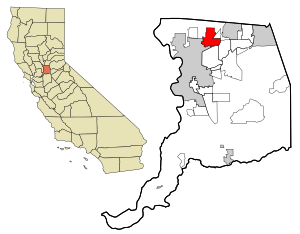
Foothill Farms is a census-designated place (CDP) and unincorporated community in Sacramento County, California, USA. It is part of the Sacramento–Arden-Arcade–Roseville Metropolitan Statistical Area. The population was 33,121 at the 2010 census, up from 17,426 at the 2000 census. Foothill Farms is part of the greater North Highlands-Foothill Farms community, and comprises the zip codes 95841 and 95842.

North Highlands, California
Census-designated place in California, United States
Distance: Approx. 3043 meters
Latitude and longitude: 38.67305556,-121.37277778
North Highlands is a census-designated place (CDP) in Sacramento County, California, United States. It is part of the Sacramento–Arden-Arcade–Roseville Metropolitan Statistical Area. The population was 42,694 at the 2010 census, down from 44,187 at the 2000 census.

Antelope, California
Census-designated place in California, United States
Distance: Approx. 3107 meters
Latitude and longitude: 38.71527778,-121.36083333
Antelope is a census-designated place in Sacramento County, California, United States located approximately 15 miles (24 km) northeast of downtown Sacramento and 5 miles (8 km) southwest of Roseville. The population was 45,770 at the 2020 census.

Mercy San Juan Medical Center
Hospital in California, United States
Distance: Approx. 3710 meters
Latitude and longitude: 38.668212,-121.313213
Mercy San Juan Medical Center is a not-for-profit hospital located in Carmichael, California serving the areas of north Sacramento County and south Placer County. It is home to Sacramento's first Comprehensive Stroke Center.
Foothill High School (Sacramento, California)
Public school in the United States
Distance: Approx. 1187 meters
Latitude and longitude: 38.6797,-121.3484
Foothill High School is a four-year high school located in Foothill Farms, California, a middle-class suburb of Sacramento, California. It is part of the Twin Rivers Unified School District.
Twin Rivers Adult School
California adult school in McClellan, CA
Distance: Approx. 4071 meters
Latitude and longitude: 38.67055556,-121.385
Twin Rivers Adult School is a California Adult School part of the Twin Rivers Unified School District. It primarily serves the North Highlands, Del Paso Heights and North Sacramento regions. Twin Rivers Adult School was formerly named Grant Adult Education when it was part of the Grant Joint Union High School District.

Campus (college)
Private community college in Sacramento, California
Distance: Approx. 3272 meters
Latitude and longitude: 38.6608,-121.3424
Campus, formerly MTI College, is a private junior college in Sacramento, California. Founded in 1965, it focuses on education in the fields of information technology, law, business, health care, and cosmetology. The college has been accredited by the Accrediting Commission for Community and Junior Colleges of the Western Association of Schools and Colleges since 1999.
Antelope High School
Public secondary school in Antelope, California, United States
Distance: Approx. 2462 meters
Latitude and longitude: 38.7105,-121.35634
Antelope High School is one of the five high schools in the Roseville Joint Union High School District. The school is located at 7801 Titan Drive, in Antelope, California, United States. Antelope High School opened up for 9th and 10th grade students at the beginning of the 2008–2009 school year.
The Salt Box
Historic site
Distance: Approx. 4025 meters
Latitude and longitude: 38.6572,-121.3646
The Salt Box was a house built in the early 1880s in the Bunker Hill section of Los Angeles, California. Designed in the saltbox style that was popularized in New England, it was originally located at 339 South Bunker Hill Avenue (231 South Bunker Hill prior to a renumbering in the early 1890s). It was the home of physician Dr.
Pacific High School (North Highlands, California)
School in North Highlands, California, United States
Distance: Approx. 2437 meters
Latitude and longitude: 38.68444444,-121.3725
Pacific Career Technology High School (PCTHS) (also known as Pacific High School) is a high school in the Twin Rivers Unified School District located in North Highlands, California.

Camp Kohler
Distance: Approx. 2560 meters
Latitude and longitude: 38.674042,-121.366481
Camp Kohler was located in the northeast corner of unincorporated Sacramento County, California, United States, until it was destroyed by a fire in 1947. Initially a camp for migrant farm workers, it became the Sacramento Assembly Center a temporary detention center for interned Japanese Americans in 1942. The site is one of 12 California assembly centers that share designation as California Historical Landmark No.
Community Outreach Academy Elementary
Charter school in California, United States
Distance: Approx. 4179 meters
Latitude and longitude: 38.67083333,-121.38666667
Community Outreach Academy Elementary is a Charter Elementary School located in McClellan Park, California, United States. Community Outreach Academy was founded in 2004 with one class per grade level. There were over 1200 students enrolled in the 2014–2015 school year.
Weather in this IP's area
clear sky
10 Celsius
9 Celsius
9 Celsius
12 Celsius
1024 hPa
54 %
1024 hPa
1020 hPa
10000 meters
8.75 m/s
11.83 m/s
330 degree

