Country:
 USA
USARegion:
City:
Latitude and Longitude:
Time Zone:
Postal Code:
IP information under different IP Channel
ip-api
Country
Region
City
ASN
Time Zone
ISP
Blacklist
Proxy
Latitude
Longitude
Postal
Route
IPinfo
Country
Region
City
ASN
Time Zone
ISP
Blacklist
Proxy
Latitude
Longitude
Postal
Route
MaxMind
Country
Region
City
ASN
Time Zone
ISP
Blacklist
Proxy
Latitude
Longitude
Postal
Route
Luminati
Country
USRegion
ca
City
vallejo
ASN
Time Zone
America/Los_Angeles
ISP
SOLANOCOUNTY
Latitude
Longitude
Postal
db-ip
Country
Region
City
ASN
Time Zone
ISP
Blacklist
Proxy
Latitude
Longitude
Postal
Route
ipdata
Country
Region
City
ASN
Time Zone
ISP
Blacklist
Proxy
Latitude
Longitude
Postal
Route
Popular places and events near this IP address

Fairfield, California
City in California, United States
Distance: Approx. 1364 meters
Latitude and longitude: 38.25777778,-122.05416667
Fairfield is a city in and the county seat of Solano County, California, United States, in the North Bay sub-region of the San Francisco Bay Area. The city has a diversified economy, with government, manufacturing, healthcare, retail, professional and commercial construction sectors. Fairfield was founded in 1856 by clipper ship captain Robert H. Waterman, and named after his former hometown of Fairfield, Connecticut.
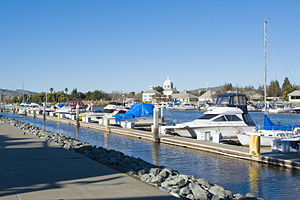
Suisun City, California
City in California, United States
Distance: Approx. 2213 meters
Latitude and longitude: 38.245,-122.01694444
Suisun City ( sə-SOON; Wintun for "where the west wind blows") is a city in Solano County, California, United States. The population was 29,518 at the 2020 census.

Armijo High School
Public school in the United States
Distance: Approx. 263 meters
Latitude and longitude: 38.251,-122.038
Armijo High School is a public secondary school located in Fairfield, California, United States. It is the oldest of the three high schools in the Fairfield-Suisun Unified School District, the other two being Fairfield High School and Angelo Rodriguez High School. It is named after the Armijo family, who purchased one of the original six land grants in Solano County awarded to General Mariano Vallejo.

Solano County Library
Distance: Approx. 532 meters
Latitude and longitude: 38.252,-122.047
Solano County Library is the public library for Solano County, California, United States, including the cities of Dixon, Fairfield, Rio Vista, Suisun City, Vacaville, and Vallejo. The library consists of nine branch locations, the Solano County Law Library, and the Solano County Library Adult Literacy Program. The city of Benicia operates its own independent public library.

Solano Town Center
Shopping mall in Fairfield, California, U.S.
Distance: Approx. 1740 meters
Latitude and longitude: 38.2629,-122.0542
Solano Town Center, formerly Westfield Solano and Solano Mall, and colloquially known as the Fairfield Mall, is a shopping mall in Fairfield, California, United States, with over 125 stores, multiple restaurants and dining options. The mall is located on Travis Boulevard, one block east of I-80 off the Travis Boulevard exit. Solano Town Center is owned by Starwood Retail Partners and is leased and managed by Spinoso Real Estate Group.

Suisun–Fairfield station
Train station in Suisun City, California, United States
Distance: Approx. 881 meters
Latitude and longitude: 38.243287,-122.041272
Suisun–Fairfield station is an Amtrak station in Suisun City, California. It serves both Suisun City and nearby Fairfield. It is served by the Amtrak Capitol Corridor commuter rail line between Auburn and San Jose through Oakland.

Fairfield and Suisun Transit
Californian public bus service operator
Distance: Approx. 2435 meters
Latitude and longitude: 38.24833333,-122.06861111
Fairfield Transit (FAST) provides general public fixed route bus service through eight local routes. All FAST buses are wheelchair accessible and most are equipped with bike racks. In 2023, the system had a ridership of 233,800, or about 700 per weekday as of the second quarter of 2024.
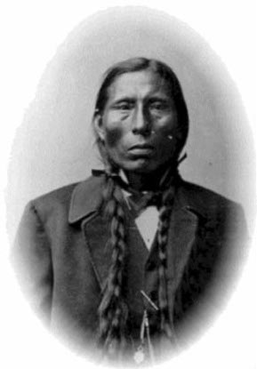
Rancho Suisun
Mexican land grant in California
Distance: Approx. 2095 meters
Latitude and longitude: 38.27,-122.04
Rancho Suisun was a 18,237-acre (73.80 km2) Mexican land grant in present-day Solano County, California given in 1842 by Governor Juan Alvarado to Francisco Solano Indian chief and Captain in the Mexican Army. The rancho lands include the present-day city of Fairfield, California.
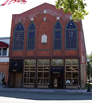
Suisun Masonic Lodge No. 55
United States historic place
Distance: Approx. 1470 meters
Latitude and longitude: 38.23805556,-122.03944444
The Stanley Y. Beverley Lodge #108' building (also known as Stanley Y. Beverley Lodge), is a historic building located in Suisun City, California, built in 1855. It was designed by Hiram Rush. The building served as a Prince Hall Masonic Lodge and as a business.
Fairfield High School (California)
Public school in the United States
Distance: Approx. 2871 meters
Latitude and longitude: 38.2758575,-122.0313673
Fairfield High School is a public secondary school located in Fairfield, California. It is one of the three high schools in the Fairfield-Suisun Unified School District, the other two being Armijo High School and Angelo Rodriguez High School. The school has about 1,610 students in grades 9 to 12 in north-central Fairfield.

Fairfield Transportation Center
Distance: Approx. 2414 meters
Latitude and longitude: 38.24882,-122.06845
The Fairfield Transportation Center or FTC is a bus station in Fairfield, California, United States. The facility serves as a bus hub for transportation on local, commuter, and long-distance bus services. There are plans to expand the center.
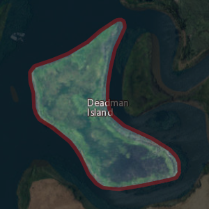
Deadman Island (Solano County)
Island in California
Distance: Approx. 3594 meters
Latitude and longitude: 38.22055556,-122.02805556
Deadman Island is an island near Suisun Bay. It is part of Solano County, California, and not managed by any reclamation district. Its coordinates are 38°13′14″N 122°01′41″W, and the United States Geological Survey measured its elevation as 7 ft (2.1 m) in 1981.
Weather in this IP's area
clear sky
27 Celsius
27 Celsius
21 Celsius
30 Celsius
1009 hPa
46 %
1009 hPa
1009 hPa
10000 meters
7.2 m/s
220 degree
06:53:49
19:09:45