Country:
Region:
City:
Latitude and Longitude:
Time Zone:
Postal Code:
IP information under different IP Channel
ip-api
Country
Region
City
ASN
Time Zone
ISP
Blacklist
Proxy
Latitude
Longitude
Postal
Route
Luminati
Country
Region
ga
City
alma
ASN
Time Zone
America/New_York
ISP
ATC-BROADBAND
Latitude
Longitude
Postal
IPinfo
Country
Region
City
ASN
Time Zone
ISP
Blacklist
Proxy
Latitude
Longitude
Postal
Route
db-ip
Country
Region
City
ASN
Time Zone
ISP
Blacklist
Proxy
Latitude
Longitude
Postal
Route
ipdata
Country
Region
City
ASN
Time Zone
ISP
Blacklist
Proxy
Latitude
Longitude
Postal
Route
Popular places and events near this IP address

Bacon County, Georgia
County in Georgia, United States
Distance: Approx. 1012 meters
Latitude and longitude: 31.56,-82.45
Bacon County is a county located in the southeastern part of the U.S. state of Georgia. As of the 2020 census, the population was 11,140. The county seat is Alma.
Alma, Georgia
City in Georgia, United States
Distance: Approx. 1675 meters
Latitude and longitude: 31.54166667,-82.46666667
Alma is a city in Bacon County, Georgia, United States, and the county seat. As of the 2020 census, the city had a population of 3,433. Alma is known as Georgia's blueberry capital, and hosts a Blueberry Festival each June.
Bacon County High School
American school in Georgia, USA.
Distance: Approx. 990 meters
Latitude and longitude: 31.55005,-82.46343
Bacon County High School is located in the town of Alma in Bacon County, Georgia, United States. It is part of the Bacon County School District.
Rockingham, Georgia
Place in Georgia, United States
Distance: Approx. 3501 meters
Latitude and longitude: 31.54805556,-82.41638889
Rockingham (also Sallie) is an unincorporated community and census-designated place (CDP) in central Bacon County, Georgia, United States. It lies along State Route 32 to the east of the city of Alma, the county seat of Bacon County. Its elevation is 194 feet (59 m).
Bacon County School District
School district in Georgia (U.S. state)
Distance: Approx. 937 meters
Latitude and longitude: 31.547185,-82.461714
The Bacon County School District is a public school district in Bacon County, Georgia, United States, based in Alma. It serves the communities of Alma and Rockingham.

Alma Depot
United States historic place
Distance: Approx. 1775 meters
Latitude and longitude: 31.54296,-82.46905
Alma Depot is a historic site in Alma, Georgia. It is a one-story frame building and was constructed in 1906 in a style similar to many of the era. It is located on Dixon Street and 11th Street.

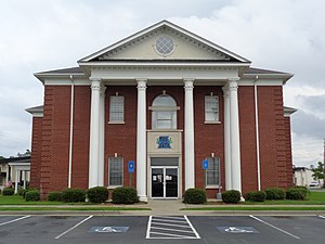
Bacon County Courthouse
United States historic place
Distance: Approx. 1459 meters
Latitude and longitude: 31.54111111,-82.46277778
The Bacon County Courthouse is a historic county courthouse on Main Street in Alma, Bacon County, Georgia. It was designed by architect J. J. Baldwin and completed in 1920. It was added to the National Register of Historic Places on September 18, 1980.

Bacon County Elementary School
United States historic place
Distance: Approx. 1134 meters
Latitude and longitude: 31.545,-82.4625
The Bacon County Elementary School, also referred to as Bacon County School, is a historic school in Alma, Georgia, located at 504 North Pierce Street (US Highway 1). It was built by Alexander Douglas and was constructed in 1933-1934. It is in the Colonial Revival style.

Rabinowitz Building
United States historic place
Distance: Approx. 1599 meters
Latitude and longitude: 31.54306,-82.4669
The Rabinowitz Building is a historic building in Alma, Georgia. It was built in 1915 and is located at 203-205 West Eleventh Street. It is a good example of a commercial, multi-use building in a small town.
Weather in this IP's area
overcast clouds
27 Celsius
29 Celsius
27 Celsius
28 Celsius
1016 hPa
74 %
1016 hPa
1011 hPa
10000 meters
1.54 m/s
150 degree
100 %
06:52:07
17:35:09


