Country:
 USA
USARegion:
City:
Latitude and Longitude:
Time Zone:
Postal Code:
IP information under different IP Channel
ip-api
Country
Region
City
ASN
Time Zone
ISP
Blacklist
Proxy
Latitude
Longitude
Postal
Route
IPinfo
Country
Region
City
ASN
Time Zone
ISP
Blacklist
Proxy
Latitude
Longitude
Postal
Route
MaxMind
Country
Region
City
ASN
Time Zone
ISP
Blacklist
Proxy
Latitude
Longitude
Postal
Route
Luminati
Country
USRegion
ca
City
sunnyvale
ASN
Time Zone
America/Los_Angeles
ISP
T2EE-AS1
Latitude
Longitude
Postal
db-ip
Country
Region
City
ASN
Time Zone
ISP
Blacklist
Proxy
Latitude
Longitude
Postal
Route
ipdata
Country
Region
City
ASN
Time Zone
ISP
Blacklist
Proxy
Latitude
Longitude
Postal
Route
Popular places and events near this IP address
Sunnyvale ESL shooting
Mass shooting in Sunnyvale, California, United States
Distance: Approx. 1856 meters
Latitude and longitude: 37.4114,-122.0124
On February 16, 1988, a mass shooting occurred at the headquarters of ESL Incorporated in Sunnyvale, California, United States. 39-year-old Richard Farley shot and killed seven people and wounded four others. A former employee of the company, he stalked his co-worker Laura Black for four years beginning in 1984.

Mission College (California)
Distance: Approx. 1813 meters
Latitude and longitude: 37.3911,-121.9821
Mission College (Mission or MC) is a public community college in Santa Clara, California. It is part of the West Valley–Mission Community College District. The land the college is on was bought between 1966 and 1967.
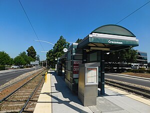
Crossman station
VTA light rail station in Sunnyvale, California
Distance: Approx. 1600 meters
Latitude and longitude: 37.40916667,-122.01138889
Crossman station is a light rail station operated by Santa Clara Valley Transportation Authority (VTA), located in Sunnyvale, California. This station is served by the Orange Line of the VTA light rail system. It is located in an industrial area; nearby buildings include the headquarters of NetApp.

Fair Oaks station
VTA light rail station in Sunnyvale, California
Distance: Approx. 938 meters
Latitude and longitude: 37.40277778,-122.00916667
Fair Oaks station is a light rail station operated by Santa Clara Valley Transportation Authority (VTA), located in Sunnyvale, California. This station is served by the Orange Line of the VTA light rail system.
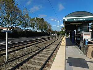
Reamwood station
VTA light rail station in Sunnyvale, California
Distance: Approx. 1600 meters
Latitude and longitude: 37.40916667,-122.01138889
Reamwood station is a light rail station operated by Santa Clara Valley Transportation Authority (VTA), located in Sunnyvale, California. This station is served by the Orange Line of the VTA light rail system.
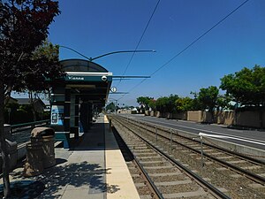
Vienna station (VTA)
VTA light rail station in Sunnyvale, California
Distance: Approx. 1600 meters
Latitude and longitude: 37.40916667,-122.01138889
Vienna station is a light rail station operated by Santa Clara Valley Transportation Authority (VTA) in Sunnyvale, California. This station is served by the Orange Line of the VTA light rail system. No bus connections are available at this location.

John W. Christian Greenbelt
Distance: Approx. 1866 meters
Latitude and longitude: 37.399,-122.022
The John W. Christian Greenbelt is a stretch of green land in northern Sunnyvale, California.

HyAxiom
Distance: Approx. 1837 meters
Latitude and longitude: 37.38201,-122.00848
ClearEdge Power, Inc. was a fuel cell manufacturer focusing on the stationary fuel cell. It was headquartered in South Windsor, Connecticut, U.S. The company employed 225 people as of August 2011.

Herguan University
University in California, US
Distance: Approx. 1268 meters
Latitude and longitude: 37.38648,-121.99691
Herguan University was a private, unaccredited, university and alleged visa mill in Sunnyvale, California operated by Ying Qiu Wang. As of 2019, its domain names herguanuniversity.edu and herguanuniversity.org appear to be abandoned. Ying Qiu Wang also founded the University of East-West Medicine (UEWM), which according to its website was founded in 1997 and operates where Herguan University was located.

The King's Academy (California)
School in Sunnyvale, California
Distance: Approx. 1550 meters
Latitude and longitude: 37.386534,-122.011959
The King's Academy is a private, Christian junior and senior high school in Sunnyvale, California, US. It is a member of the Association of Christian Schools International and the Western Association of Schools and Colleges. It was founded in 1991 and is housed on the former campus of Sunnyvale High School.
BioCurious
Nonprofit biotechnology community laboratory
Distance: Approx. 1541 meters
Latitude and longitude: 37.39563433,-121.98371237
BioCurious is a community biology laboratory and nonprofit organization located in Sunnyvale, California, co-founded by Eri Gentry, Kristina Hathaway, Josh Perfetto, Raymond McCauley, Joseph Jackson, and Tito Jankowski. With the help of Kickstarter and 239 backers they raised $35,319. BioCurious is a complete working laboratory and technical library for entrepreneurs to access equipment, materials, and co-working space, and a meeting place for citizen scientists, hobbyists, activists, and students.
Mission Early College High School (California)
School
Distance: Approx. 1645 meters
Latitude and longitude: 37.3924,-121.9835
Mission Early College High School (MECHS) is a public secondary education and college immersion program in Santa Clara, California, United States that serves students in grades nine through twelve. MECHS is a dual enrollment partnership between the Santa Clara Unified School District (SCUSD) and the West Valley–Mission Community College District (WVM). It is accredited by the Western Association of Schools and Colleges (WASC).
Weather in this IP's area
clear sky
22 Celsius
21 Celsius
20 Celsius
24 Celsius
1018 hPa
26 %
1018 hPa
1017 hPa
10000 meters
3.13 m/s
4.02 m/s
315 degree
07:20:12
18:25:10