209.203.213.122 - IP Lookup: Free IP Address Lookup, Postal Code Lookup, IP Location Lookup, IP ASN, Public IP
Country:
Region:
City:
Location:
Time Zone:
Postal Code:
ISP:
ASN:
language:
User-Agent:
Proxy IP:
Blacklist:
IP information under different IP Channel
ip-api
Country
Region
City
ASN
Time Zone
ISP
Blacklist
Proxy
Latitude
Longitude
Postal
Route
db-ip
Country
Region
City
ASN
Time Zone
ISP
Blacklist
Proxy
Latitude
Longitude
Postal
Route
IPinfo
Country
Region
City
ASN
Time Zone
ISP
Blacklist
Proxy
Latitude
Longitude
Postal
Route
IP2Location
209.203.213.122Country
Region
pennsylvania
City
duncansville
Time Zone
America/New_York
ISP
Language
User-Agent
Latitude
Longitude
Postal
ipdata
Country
Region
City
ASN
Time Zone
ISP
Blacklist
Proxy
Latitude
Longitude
Postal
Route
Popular places and events near this IP address

Duncansville, Pennsylvania
Borough in Pennsylvania, United States
Distance: Approx. 41 meters
Latitude and longitude: 40.425,-78.4325
Duncansville is a borough in Blair County, Pennsylvania, United States. It is part of the Altoona, Pennsylvania metropolitan statistical area. The population was 1,258 at the 2020 census.

Hollidaysburg, Pennsylvania
Place in Pennsylvania, United States
Distance: Approx. 3521 meters
Latitude and longitude: 40.43166667,-78.39222222
Hollidaysburg is a borough in and the county seat of Blair County in the U.S. Commonwealth of Pennsylvania. It is located on the Juniata River, 5 miles (8 km) south of Altoona and is part of the Altoona, Pennsylvania, metropolitan statistical area. In 1900, 2,998 people lived in the borough, in 1910, 3,734 lived there, and in 1940, 5,910 residents were counted.

Newry, Pennsylvania
Borough in Pennsylvania, United States
Distance: Approx. 3556 meters
Latitude and longitude: 40.39333333,-78.43583333
Newry is a borough in Blair County, Pennsylvania, United States. The population was 231 at the 2020 census. It is part of the Altoona, PA Metropolitan Statistical Area and one of the communities comprising the Altoona Urban Area.
Hollidaysburg Area High School
Public school in Hollidaysburg, Blair County, Pennsylvania , United States
Distance: Approx. 3373 meters
Latitude and longitude: 40.4418,-78.3996
Hollidaysburg Area Senior High School is the midsized, suburban public high school for the Hollidaysburg Area School District. The Senior High School is located at 1510 North Montgomery Street in Hollidaysburg, Blair County. The high school serves the populations living in Hollidaysburg, Duncansville, Newry, and a small portion of Altoona (Eldorado).
Highland Hall (Hollidaysburg, Pennsylvania)
United States historic place
Distance: Approx. 3528 meters
Latitude and longitude: 40.43194444,-78.39222222
Highland Hall, also known as the Courthouse Annex, was a Presbyterian seminary, an historic school building for females, a radio school during World War II, and a county office building before it became a retirement home in 2016. It is located in Hollidaysburg, Blair County, Pennsylvania. Highland Hall was added to the National Register of Historic Places in 1978.
Blair County Courthouse
United States historic place
Distance: Approx. 3470 meters
Latitude and longitude: 40.43027778,-78.3925
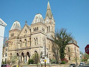
Blair County Courthouse is a historic courthouse building located at Hollidaysburg, Blair County, Pennsylvania. It was built in 1875–1876, and is a T-shaped stone building in the Gothic Revival style. The entrance is flanked by two square, three-story towers with truncated pyramidal roofs.
Foot of Ten, Pennsylvania
Census-designated place in Pennsylvania, United States
Distance: Approx. 2564 meters
Latitude and longitude: 40.41805556,-78.46166667
Foot of Ten is a census-designated place in Allegheny and Juniata Townships in Blair County, Pennsylvania, United States. It is located approximately one mile west of the small borough Duncansville on Foot of Ten Road, and about 2.5 miles (4 km) north of the even smaller borough Newry. It is often considered a region of Duncansville, despite lying outside the borough limits.
Carson Valley, Pennsylvania
Census-designated place in Pennsylvania, United States
Distance: Approx. 2982 meters
Latitude and longitude: 40.44916667,-78.44861111
Carson Valley is an unincorporated community and census-designated place (CDP) in Blair County, Pennsylvania, United States. It was first listed as a CDP prior to the 2020 census. The CDP is in western Blair County, in the eastern part of Allegheny Township.
Cross Keys, Blair County, Pennsylvania
Census-designated place in Pennsylvania, United States
Distance: Approx. 2315 meters
Latitude and longitude: 40.44583333,-78.42944444
Cross Keys is an unincorporated community and census-designated place (CDP) in Blair County, Pennsylvania, United States. It was first listed as a CDP prior to the 2020 census.
Fort Fetter, Pennsylvania
Census-designated place in Pennsylvania, United States
Distance: Approx. 2493 meters
Latitude and longitude: 40.43,-78.40416667
Fort Fetters is a neighborhood and census-designated place (CDP) in Blair County, Pennsylvania, United States. It was first listed as a CDP prior to the 2020 census.
Penn Farms, Pennsylvania
Census-designated place in Pennsylvania, United States
Distance: Approx. 1943 meters
Latitude and longitude: 40.41611111,-78.41333333
Penn Farms is an unincorporated community and census-designated place (CDP) in Blair County, Pennsylvania, United States. It was first listed as a CDP prior to the 2020 census. The CDP is in south-central Blair County, in the northern part of Blair Township.
Sunbrook, Pennsylvania
Census-designated place in Pennsylvania, United States
Distance: Approx. 968 meters
Latitude and longitude: 40.43388889,-78.4325
Sunbrook is an unincorporated community and census-designated place (CDP) in Blair County, Pennsylvania, United States. It was first listed as a CDP prior to the 2020 census. The CDP is southwest of the center of Blair County, in the east part of Allegheny Township.
Weather in this IP's area
overcast clouds
-6 Celsius
-12 Celsius
-6 Celsius
-5 Celsius
1028 hPa
65 %
1028 hPa
961 hPa
10000 meters
5.66 m/s
10.29 m/s
310 degree
100 %

