209.203.162.15 - IP Lookup: Free IP Address Lookup, Postal Code Lookup, IP Location Lookup, IP ASN, Public IP
Country:
Region:
City:
Location:
Time Zone:
Postal Code:
ISP:
ASN:
language:
User-Agent:
Proxy IP:
Blacklist:
IP information under different IP Channel
ip-api
Country
Region
City
ASN
Time Zone
ISP
Blacklist
Proxy
Latitude
Longitude
Postal
Route
db-ip
Country
Region
City
ASN
Time Zone
ISP
Blacklist
Proxy
Latitude
Longitude
Postal
Route
IPinfo
Country
Region
City
ASN
Time Zone
ISP
Blacklist
Proxy
Latitude
Longitude
Postal
Route
IP2Location
209.203.162.15Country
Region
kansas
City
protection
Time Zone
America/Chicago
ISP
Language
User-Agent
Latitude
Longitude
Postal
ipdata
Country
Region
City
ASN
Time Zone
ISP
Blacklist
Proxy
Latitude
Longitude
Postal
Route
Popular places and events near this IP address

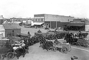
Protection, Kansas
City in Comanche County, Kansas
Distance: Approx. 160 meters
Latitude and longitude: 37.20027778,-99.48083333
Protection is a city in Comanche County, Kansas, United States. As of the 2020 census, the population of the city was 498.

Protection Township, Comanche County, Kansas
Township in Kansas, United States
Distance: Approx. 1670 meters
Latitude and longitude: 37.20833333,-99.46694444
Protection Township is a township in Comanche County, Kansas, United States. As of the 2000 census, its population was 734.

Protection High School
United States historic place
Distance: Approx. 289 meters
Latitude and longitude: 37.1979576,-99.4805815
The Protection High School, located at 210 S. Jefferson in Protection, Kansas, was built in 1930. It was designed by architects Routledge & Hertz in Late Gothic Revival style. An extension to add a grade school in 1950 was designed by Hibbs & Robinson.
Kiowa Creek (Kansas)
River in the United States
Distance: Approx. 2644 meters
Latitude and longitude: 37.17912,-99.46838
Kiowa Creek is a stream in Comanche County, Kansas. Its watershed includes multiple other streams. West Kiowa Creek forms in northeast Clark County, Kansas, and flows generally southeast, passing through the southwestern corner of Kiowa County, Kansas, where it is joined by Turkey Creek and Little Turkey Creek.
Weather in this IP's area
clear sky
2 Celsius
-1 Celsius
2 Celsius
2 Celsius
1027 hPa
59 %
1027 hPa
956 hPa
10000 meters
3.54 m/s
5.87 m/s
346 degree