209.174.66.137 - IP Lookup: Free IP Address Lookup, Postal Code Lookup, IP Location Lookup, IP ASN, Public IP
Country:
Region:
City:
Location:
Time Zone:
Postal Code:
IP information under different IP Channel
ip-api
Country
Region
City
ASN
Time Zone
ISP
Blacklist
Proxy
Latitude
Longitude
Postal
Route
Luminati
Country
Region
il
City
byron
ASN
Time Zone
America/Chicago
ISP
ILLINOIS-CENTURY
Latitude
Longitude
Postal
IPinfo
Country
Region
City
ASN
Time Zone
ISP
Blacklist
Proxy
Latitude
Longitude
Postal
Route
IP2Location
209.174.66.137Country
Region
illinois
City
savanna
Time Zone
America/Chicago
ISP
Language
User-Agent
Latitude
Longitude
Postal
db-ip
Country
Region
City
ASN
Time Zone
ISP
Blacklist
Proxy
Latitude
Longitude
Postal
Route
ipdata
Country
Region
City
ASN
Time Zone
ISP
Blacklist
Proxy
Latitude
Longitude
Postal
Route
Popular places and events near this IP address

Savanna, Illinois
City in Carroll County, Illinois, US
Distance: Approx. 1475 meters
Latitude and longitude: 42.09,-90.14
Savanna is a city in Carroll County, Illinois, United States. The population was 2,783 at the 2020 census. Savanna is located along the Mississippi River at the mouth of the Plum River.

Sabula, Iowa
City in Iowa, United States
Distance: Approx. 3303 meters
Latitude and longitude: 42.06777778,-90.17416667
Sabula is a city in Jackson County, Iowa, United States. The population was 506 at the 2020 census. Sabula is the site of Iowa's only island city.

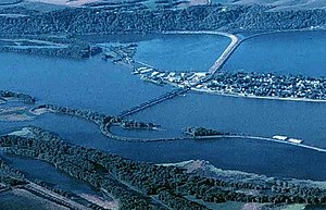
Savanna–Sabula Bridge
Bridge in Iowa, River Mile
Distance: Approx. 1150 meters
Latitude and longitude: 42.10444444,-90.16055556
The Savanna–Sabula Bridge was a truss bridge and causeway crossing the Mississippi River that connected the city of Savanna, Illinois, with the island city of Sabula, Iowa. The bridge was put out of service on November 17, 2017, when its replacement, which lies a few dozen feet downstream, opened as the Dale Gardner Veterans Memorial Bridge. The bridge carried U.S. Route 52 over the river.
Plum River
River
Distance: Approx. 839 meters
Latitude and longitude: 42.0872222,-90.1541667
The Plum River is a tributary of the Mississippi River, about 46.6 miles (75.0 km) long, in northwestern Illinois in the United States. It rises in Jo Daviess County and flows generally south-southwestwardly into Carroll County, where it joins the Mississippi at Savanna. Among its several short tributaries are: The East Plum River, which rises in Stephenson County and flows southwestwardly into Carroll County, joining the Plum at 42°10′16″N 90°01′20″W The Muddy Plum River, which flows for its entire length in Jo Daviess County.

Sabula Rail Bridge
Bridge in United States of America
Distance: Approx. 3463 meters
Latitude and longitude: 42.06416667,-90.16611111
The Sabula Rail Bridge is a swing bridge that carries a single rail line across the Mississippi River between the island town of Sabula, Iowa and Savanna, Illinois. Originally built for the Milwaukee Road, and subsequently owned by the Iowa, Chicago and Eastern Railroad, the bridge is operational and is currently owned by Canadian Pacific Railway.

Savanna Township, Illinois
Township in Illinois, United States
Distance: Approx. 3740 meters
Latitude and longitude: 42.06888889,-90.1275
Savanna Township is one of twelve townships in Carroll County, Illinois, USA. As of the 2020 census, its population was 3,432 and it contained 1,919 housing units.
Plum River raid
Attack by Native Americans
Distance: Approx. 50 meters
Latitude and longitude: 42.09416667,-90.15638889
The Plum River raid was a bloodless skirmish that occurred at present-day Savanna, Illinois, on May 21, 1832, as part of the Black Hawk War. Most of the settlement's inhabitants, except for a few defenders, had fled for Galena, Illinois, before the raid happened. A small band of Native Americans, either Sauk or Fox, attacked the settlement while only three of the six defenders were present.
West Carroll High School
Comprehensive public high school in Savanna, Carroll County, Illinois, United States
Distance: Approx. 1939 meters
Latitude and longitude: 42.0959,-90.1334
West Carroll High School, or WCHS, is a public four-year high school in Savanna, Carroll County, Illinois. WCHS serves Savanna, Mt. Carroll, Thomson and the surrounding area.
Union Township, Jackson County, Iowa
Township in Jackson County, Iowa, U.S.
Distance: Approx. 3241 meters
Latitude and longitude: 42.0783,-90.1894
Union Township is a township in Jackson County, Iowa, United States.

John S. Dominy House
Historic house in Iowa, United States
Distance: Approx. 3001 meters
Latitude and longitude: 42.07,-90.17194444
The John S. Dominy House is a historic house located at 605 Pearl Street in Sabula, Iowa.

Jeremiah Wood House
Historic house in Iowa, United States
Distance: Approx. 3156 meters
Latitude and longitude: 42.06805556,-90.17055556
The Jeremiah Wood House is a historic residence located in Sabula, Iowa, United States. The house is associated with the settlement of Sabula, and the occupation of steamboat pilot. Dr.

Dale Gardner Veterans Memorial Bridge
Bridge in Iowa, River Mile
Distance: Approx. 1150 meters
Latitude and longitude: 42.10444444,-90.16055556
The Dale Gardner Veterans Memorial Bridge, often referred to as the New Savanna-Sabula Bridge, or by the same name as its predecessor, the Savanna-Sabula Bridge, is a steel tied-arch that carries U.S. Route 52 (US 52) across the Mississippi River. It connects the city of Savanna, Illinois, with the island city of Sabula, Iowa. Construction on the span began in 2016 and it opened on November 17, 2017.
Weather in this IP's area
light snow
-3 Celsius
-6 Celsius
-3 Celsius
-3 Celsius
1025 hPa
77 %
1025 hPa
1002 hPa
10000 meters
2.05 m/s
4.15 m/s
296 degree
100 %