209.165.245.94 - IP Lookup: Free IP Address Lookup, Postal Code Lookup, IP Location Lookup, IP ASN, Public IP
Country:
Region:
City:
Location:
Time Zone:
Postal Code:
IP information under different IP Channel
ip-api
Country
Region
City
ASN
Time Zone
ISP
Blacklist
Proxy
Latitude
Longitude
Postal
Route
Luminati
Country
Region
mi
City
richmond
ASN
Time Zone
America/Detroit
ISP
GREAT-LAKES-COMNET
Latitude
Longitude
Postal
IPinfo
Country
Region
City
ASN
Time Zone
ISP
Blacklist
Proxy
Latitude
Longitude
Postal
Route
IP2Location
209.165.245.94Country
Region
ohio
City
cleveland
Time Zone
America/New_York
ISP
Language
User-Agent
Latitude
Longitude
Postal
db-ip
Country
Region
City
ASN
Time Zone
ISP
Blacklist
Proxy
Latitude
Longitude
Postal
Route
ipdata
Country
Region
City
ASN
Time Zone
ISP
Blacklist
Proxy
Latitude
Longitude
Postal
Route
Popular places and events near this IP address

Broadview Heights, Ohio
City in Ohio, United States
Distance: Approx. 5818 meters
Latitude and longitude: 41.32194444,-81.67666667
Broadview Heights is a city in southern Cuyahoga County, Ohio, United States. The city's population was 19,936 at the 2020 census. A suburb of Cleveland, it is part of the Cleveland metropolitan area.

North Royalton, Ohio
City in Ohio, United States
Distance: Approx. 941 meters
Latitude and longitude: 41.32222222,-81.74638889
North Royalton is a city in Cuyahoga County, Ohio, United States. It is a suburb of Cleveland. The population was 31,322 as of the 2020 census.

WKNR
Sports radio station in Cleveland, Ohio
Distance: Approx. 1272 meters
Latitude and longitude: 41.31671944,-81.73068611
WKNR (850 AM) – branded as 850 ESPN Cleveland – is a commercial sports radio station licensed to Cleveland, Ohio, serving Greater Cleveland. Owned by Good Karma Brands, WKNR is the Cleveland affiliate for ESPN Radio and the AM flagship station for the Cleveland Browns Radio Network; the Cleveland affiliate for the Ohio State Sports Network, and the radio home of Je'Rod Cherry and Tony Grossi. The WKNR studios are currently located in the East Bank of The Flats in Downtown Cleveland, while the station transmitter resides in the Cleveland suburb of North Royalton, And due to the 4-tower array at the site, WKNR’s daytime signal can be heard as far as Mansfield, and even as far as Newark and Zanesville.
WCCD
Radio station in Parma, Ohio, serving Cleveland
Distance: Approx. 2040 meters
Latitude and longitude: 41.319775,-81.76846389
WCCD (1000 AM) is a commercial daytime-only radio station licensed to Parma, Ohio, with a religious format known as "Radio 1000". Owned by New Spirit Revival Center Ministries, Inc., co-founded by the Rev. Darrell C. Scott, WCCD serves Greater Cleveland and parts of surrounding Northeast Ohio.

North Royalton High School
Public school in North Royalton, Ohio, United States
Distance: Approx. 1143 meters
Latitude and longitude: 41.309028,-81.733292
North Royalton High School is a public high school located in North Royalton, Ohio, United States, a suburban community in Greater Cleveland. Over 1,000 students attend the school. North Royalton is a member of the National Division of the Suburban League.

Valley Forge High School
Public, coeducational high school in Parma Heights, Ohio, US
Distance: Approx. 6531 meters
Latitude and longitude: 41.37194444,-81.75583333
Valley Forge High School is located in Parma Heights, Ohio, a suburb of Cleveland. It is one of two high schools in the Parma City School District, which is one of the largest school districts in the state of Ohio, serving the cities of Parma, Parma Heights, and Seven Hills. The school's colors are navy blue, white, and red; its sports teams are known as the Patriots.

Normandy High School (Ohio)
Public, coeducational high school in Parma, Ohio, United States
Distance: Approx. 6632 meters
Latitude and longitude: 41.36222222,-81.69916667
Normandy High School (commonly Normandy or NHS) is a public high school in Parma, Ohio, United States, serving students in grades 9–12. The school is part of the Parma City School District, with admission based primarily on the locations of students' homes. Established in 1968, Normandy is located approximately three miles west of Interstate 77 on West Pleasant Valley Road.
Broadview Developmental Center
Former Psychiatric Hospital
Distance: Approx. 5477 meters
Latitude and longitude: 41.305811,-81.680766
The Broadview Developmental Center was a psychiatric hospital built in 1939 near Broadview Heights, Ohio, United States. Constructed under the Works Progress Administration as part of President Franklin Roosevelt's New Deal, it functioned as a Veterans Administration Hospital until 1966 when it was sold to the state of Ohio. The Broadview Developmental Center was then converted into a psychiatric hospital, and remained open until 1993 when the prevailing opinion on mental health shifted from institutional care to community-based care, and the hospital lost its funding.

SouthPark Mall (Ohio)
Shopping mall in Strongsville, Ohio, U.S.
Distance: Approx. 6291 meters
Latitude and longitude: 41.308333,-81.820278
SouthPark Mall is an enclosed shopping mall located in Strongsville, Ohio, United States, a Greater Cleveland suburb. Its anchor stores are Dick's Sporting Goods, Dillard's, JCPenney, Macy's, and a 14-screen Cinemark movie theater. Kohl's is also an anchor, though located on the outskirts of the plaza.

John M. Annis House
Historic house in Ohio, United States
Distance: Approx. 3614 meters
Latitude and longitude: 41.34208333,-81.72416667
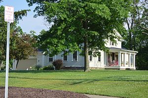
The John M. Annis House is an American registered historic building, located in North Royalton, Ohio. It was listed in the U.S. National Register of Historic Places on March 19, 1992. John McClintock Annis was born on February 26, 1804, in Phelps, New York, the son of Stephen and Christin Annis.
Bennetts Corners, Ohio
Unincorporated community in Ohio, U.S.
Distance: Approx. 5321 meters
Latitude and longitude: 41.27638889,-81.785
Bennetts Corners is an unincorporated community in Medina County, in the U.S. state of Ohio.
Shiva Vishnu Hindu Temple of Greater Cleveland
Hindu temple in Cleveland Metropolitan Area US
Distance: Approx. 4785 meters
Latitude and longitude: 41.355853,-81.733529
The Shiva Vishnu Hindu Temple of Greater Cleveland is a Hindu Temple in Parma, Ohio and serves the Hindu population of the Greater Cleveland Area. The central deities at the temple are Shiva and Vishnu.
Weather in this IP's area
overcast clouds
-7 Celsius
-7 Celsius
-9 Celsius
-6 Celsius
1033 hPa
77 %
1033 hPa
995 hPa
10000 meters
0.89 m/s
0.89 m/s
112 degree
100 %
