209.159.204.92 - IP Lookup: Free IP Address Lookup, Postal Code Lookup, IP Location Lookup, IP ASN, Public IP
Country:
Region:
City:
Location:
Time Zone:
Postal Code:
IP information under different IP Channel
ip-api
Country
Region
City
ASN
Time Zone
ISP
Blacklist
Proxy
Latitude
Longitude
Postal
Route
Luminati
Country
Region
sd
City
boxelder
ASN
Time Zone
America/Denver
ISP
CLARITY-TELECOM
Latitude
Longitude
Postal
IPinfo
Country
Region
City
ASN
Time Zone
ISP
Blacklist
Proxy
Latitude
Longitude
Postal
Route
IP2Location
209.159.204.92Country
Region
colorado
City
denver
Time Zone
America/Denver
ISP
Language
User-Agent
Latitude
Longitude
Postal
db-ip
Country
Region
City
ASN
Time Zone
ISP
Blacklist
Proxy
Latitude
Longitude
Postal
Route
ipdata
Country
Region
City
ASN
Time Zone
ISP
Blacklist
Proxy
Latitude
Longitude
Postal
Route
Popular places and events near this IP address

Greenwood Village, Colorado
City in Colorado, United States
Distance: Approx. 3225 meters
Latitude and longitude: 39.61583333,-104.91138889
The City of Greenwood Village is a home rule municipality located in Arapahoe County, Colorado, United States. The city population was 15,691 at the 2020 United States Census. Greenwood Village is a part of the Denver–Aurora–Lakewood, CO Metropolitan Statistical Area and the Front Range Urban Corridor.
Cherry Creek High School
Public high school in Greenwood Village, Colorado, United States
Distance: Approx. 2448 meters
Latitude and longitude: 39.63055556,-104.88
Cherry Creek High School (commonly Cherry Creek, Creek, or CCHS) is the oldest of seven high schools in the Cherry Creek School District in the Denver metropolitan area. It is located in Greenwood Village, Colorado, and is the largest high school in the Denver metro area, with an 80-acre (320,000 m2) campus and approximately 3,800 students. Cherry Creek High School is ranked 16th in Colorado and 716th nationally, and ranked 2nd in Colorado for public schools behind Stargate Charter School.
Denver Technological Center
Distance: Approx. 2317 meters
Latitude and longitude: 39.6241,-104.89468
Denver Technological Center, better known as The Denver Tech Center or DTC, is a business and economic trading center located in Colorado in the southeastern portion of the Denver Metropolitan Area, within portions of the cities of Denver and Greenwood Village. The DTC roughly corresponds to the area surrounding the I-25 corridor between I-225 and SH 88 (Arapahoe Road) and has a similar business community reputation to Irvine, California. The DTC was founded in 1962 on 40 acres.

Thomas Jefferson High School (Denver)
Public secondary school in Denver, Colorado, United States
Distance: Approx. 1670 meters
Latitude and longitude: 39.64668,-104.92177
Thomas Jefferson High School is a secondary school located in the Southmoor Park neighborhood, on the southeast side of Denver, Colorado, United States. It is operated under the Denver Public Schools. The school teams are the Spartans.
Southmoor station
Light rail station in Denver, Colorado
Distance: Approx. 1290 meters
Latitude and longitude: 39.6488,-104.9163
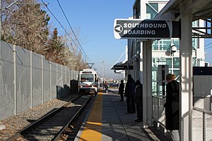
Southmoor station is a light rail station in Denver, Colorado, United States. It is served by the E and H Lines, operated by the Regional Transportation District (RTD), and was opened on November 17, 2006. It is the southernmost station before the Interstate 225 branch splits from the Southeast Corridor and serves as a transfer station for each line.
Belleview station
Light rail station in Denver, Colorado
Distance: Approx. 1800 meters
Latitude and longitude: 39.6279,-104.9046
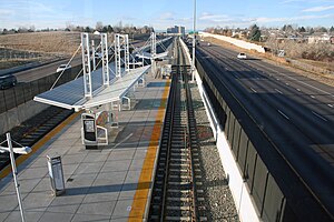
Belleview station is a light rail station in Denver, Colorado, United States. It is served by the E and R Lines, operated by the Regional Transportation District (RTD), and was opened on November 17, 2006. This is the primary station serving the Denver Technological Center.
Dayton station
Light rail station in Aurora, Colorado
Distance: Approx. 2104 meters
Latitude and longitude: 39.6428,-104.8781
Dayton station is an island platformed RTD light rail station in Aurora, Colorado, United States. Operating as part of the H and R lines, the station was opened on November 17, 2006, and is operated by the Regional Transportation District.
Temple Sinai (Denver)
Reform synagogue in Denver, Colorado, US
Distance: Approx. 2270 meters
Latitude and longitude: 39.65246111,-104.92669167
Temple Sinai is a Reform Jewish congregation and synagogue located at 3509 South Glencoe in Denver, Colorado, in the United States.
Hampden South, Denver
Neighborhood in Denver, CO
Distance: Approx. 244 meters
Latitude and longitude: 39.64461,-104.89987
Hampden South is a neighborhood in Denver, Colorado, United States.
Holly Hills, Colorado
Census Designated Place in Colorado, United States
Distance: Approx. 3104 meters
Latitude and longitude: 39.6677274,-104.9216215
Holly Hills is an unincorporated community and a census-designated place (CDP) located in and governed by Arapahoe County, Colorado, United States. Holly Hills is an enclave of the City and County of Denver. The CDP is a part of the Denver–Aurora–Lakewood, CO Metropolitan Statistical Area.
Hopkins Farm (Cherry Hills Village, Colorado)
United States historic place
Distance: Approx. 3124 meters
Latitude and longitude: 39.6375,-104.93805556
The Hopkins Farm is a home located at 4400 East Quincy Avenue in Cherry Hills Village, Colorado. The home is a 1+1⁄2-story house that is surrounded by a 1930s agricultural area and additional buildings. The farm was one of many dairy operations in the area.
Arrest of Robert Seacat
Destructive standoff and arrest in June 2015
Distance: Approx. 1885 meters
Latitude and longitude: 39.64066,-104.881046
The arrest of Robert Jonathan Seacat was the culmination of a destructive 19.48-hour standoff with American police in June 2015. After being chased by police for stealing clothing from a Walmart, Seacat barricaded himself in a house at 4219 South Alton Street in Greenwood Village, Colorado. By the time Seacat was finally extracted from the premises, the house had been destroyed by law enforcement in their efforts to flush him out.
Weather in this IP's area
broken clouds
5 Celsius
4 Celsius
3 Celsius
7 Celsius
1006 hPa
64 %
1006 hPa
820 hPa
10000 meters
1.54 m/s
20 degree
75 %


