209.15.59.165 - IP Lookup: Free IP Address Lookup, Postal Code Lookup, IP Location Lookup, IP ASN, Public IP
Country:
Region:
City:
Location:
Time Zone:
Postal Code:
IP information under different IP Channel
ip-api
Country
Region
City
ASN
Time Zone
ISP
Blacklist
Proxy
Latitude
Longitude
Postal
Route
Luminati
Country
Region
on
City
toronto
ASN
Time Zone
America/Toronto
ISP
COGECO-PEER1
Latitude
Longitude
Postal
IPinfo
Country
Region
City
ASN
Time Zone
ISP
Blacklist
Proxy
Latitude
Longitude
Postal
Route
IP2Location
209.15.59.165Country
Region
missouri
City
kansas city
Time Zone
America/Chicago
ISP
Language
User-Agent
Latitude
Longitude
Postal
db-ip
Country
Region
City
ASN
Time Zone
ISP
Blacklist
Proxy
Latitude
Longitude
Postal
Route
ipdata
Country
Region
City
ASN
Time Zone
ISP
Blacklist
Proxy
Latitude
Longitude
Postal
Route
Popular places and events near this IP address
Hyatt Regency walkway collapse
1981 structural collapse in Kansas City, Missouri
Distance: Approx. 380 meters
Latitude and longitude: 39.085,-94.58
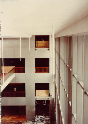
Two overhead walkways in the Hyatt Regency Hotel in Kansas City, Missouri, collapsed on July 17, 1981, killing 114 people and injuring 216. Loaded with partygoers, the concrete and glass platforms crashed onto a tea dance in the lobby. Kansas City society was affected for years, with the collapse resulting in billions of dollars of insurance claims, legal investigations, and city government reforms.

Kansas City massacre
June 1933 shootout in Kansas City, Missouri, United States
Distance: Approx. 108 meters
Latitude and longitude: 39.08481,-94.58537
The Kansas City massacre was the shootout and murder of four law enforcement officers and a criminal fugitive at the Union Station railroad depot in Kansas City, Missouri, on the morning of June 17, 1933. It occurred as part of the attempt by a gang led by Vernon C. "Verne" Miller to free Frank "Jelly" Nash, a federal prisoner. At the time, Nash was in the custody of several law enforcement officers who were returning him to the U.S. Penitentiary at Leavenworth, Kansas, from which he had escaped three years earlier.
Kansas City Irish Center
Non-profit organization in Missouri, USA
Distance: Approx. 139 meters
Latitude and longitude: 39.08509,-94.58554
The Kansas City Irish Center, formerly known as the Irish Center of Kansas City, is a non-profit organization in Kansas City, Missouri. The Center opened in Union Station on March 17, 2007 (Saint Patrick's Day). The Center's mission encourages knowledge and appreciation of the Irish and Irish-American community, culture, history, and heritage in the greater Kansas City area and region.
Kansas City Irish Fest
Festival celebrating Celtic pride in Kansas City
Distance: Approx. 312 meters
Latitude and longitude: 39.08276,-94.58129
Kansas City Irish Fest celebrates Celtic pride in Kansas City dedicated to promoting the culture, music, character and history of Ireland and of the Irish people who call Kansas City home. It was voted by visitors as the "Best Ethnic Festival" in Kansas City in 2011, 2010 and 2009, and the "Best Festival" in Kansas City in 2008 and 2007. Founded in 2003 and located in the heart of Kansas City at Crown Center Square, Kansas City Irish Fest hosts more than 90,000 people each Labor Day weekend.

2345 Grand
High-rise office building or skyscraper located in Kansas City, Missouri
Distance: Approx. 278 meters
Latitude and longitude: 39.085015,-94.581216
2345 Grand (formerly the IBM Plaza, IBM Building and Mutual Benefit Life Insurance Company Building) is a high-rise office building located in Kansas City, Missouri. It is listed on many sites as being the work of Mies van der Rohe; however, he died in 1969 before the building could be opened in 1977. The work was done by Fujikawa Conterato Lohan & Associates.

Pencoyd Railroad Bridge
Bridge
Distance: Approx. 287 meters
Latitude and longitude: 39.08634,-94.58633
The Pencoyd Railroad Bridge is a former railroad bridge in Kansas City, Missouri, that was converted into the Freight House Pedestrian Bridge and moved to its new location where it connects Union Station and the Crossroads Arts District.

Science City at Union Station
Distance: Approx. 113 meters
Latitude and longitude: 39.0847,-94.5855
Science City at Union Station is a family-friendly interactive science center that features traveling exhibitions, The Arvin Gottlieb Planetarium, City Extreme Screen theatre, and more than 120 hands-on displays. It is located inside Union Station at 30 West Pershing Road in Kansas City, Missouri. It was the main feature in the bi-state renovation vote of 1997.

Freight House (Kansas City, Missouri)
Distance: Approx. 367 meters
Latitude and longitude: 39.0875,-94.5853
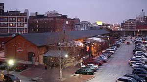
The Freight House is a historic railroad building just north of Union Station in the Crossroads Arts District of Kansas City, Missouri. The renovated Freight House is now home to three award-winning restaurants: Fiorella's Jack Stack Barbecue, Grunauer (German and Austrian food) and Lidia's. The building is located immediately east of the Stuart Hall Building, and it is connected via pedestrian bridge to Union Station.

Kansas City Union Station
Historic train station in Kansas City
Distance: Approx. 103 meters
Latitude and longitude: 39.0848,-94.5853
Kansas City Union Station (station code: KCY) is a union station that opened in 1914, serving Kansas City, Missouri, and the surrounding metropolitan area. It replaced a small Union Depot built in 1878. Union Station served a peak annual traffic of more than 670,000 passengers in 1945 at the end of World War II, but traffic quickly declined in the 1950s, and the station was closed in 1985.

Sweeney School
United States historic place
Distance: Approx. 258 meters
Latitude and longitude: 39.083222,-94.586942
The Sweeney School was a trade school in Kansas City, Missouri, founded by Emory J. Sweeney in 1908 to use the "Sweeney System" (hands on training) and eventually taught more than a dozen trades, e.g., "Autos, Tractors, and Aviation": Sweeney Automobile School and Sweeney School of Aviation c. 1921. It was added to the National Register of Historic Places in 2014.
Sea Life Kansas City
Zoo in Kansas City
Distance: Approx. 363 meters
Latitude and longitude: 39.0821,-94.5812
Sea Life Kansas City is an interactive aquarium located at the Crown Center in Kansas City, Missouri. The aquarium contains thousands of aquatic creatures, plus interactive touch pools and a 360° ocean tunnel. Sea Life Kansas City is owned and operated by Merlin Entertainments.
2024 Kansas City parade shooting
Super Bowl LVIII parade shooting
Distance: Approx. 183 meters
Latitude and longitude: 39.08355,-94.58618
On February 14, 2024, 33 people were wounded in a mass shooting at the west side of Union Station in Kansas City, Missouri, United States. One person was killed and twenty-two others were wounded by gunshots, including eleven children. The shooting followed a Super Bowl LVIII victory parade for the Kansas City Chiefs.
Weather in this IP's area
clear sky
12 Celsius
10 Celsius
10 Celsius
13 Celsius
1019 hPa
35 %
1019 hPa
986 hPa
10000 meters
3.09 m/s
250 degree


