209.15.34.109 - IP Lookup: Free IP Address Lookup, Postal Code Lookup, IP Location Lookup, IP ASN, Public IP
Country:
Region:
City:
Location:
Time Zone:
Postal Code:
IP information under different IP Channel
ip-api
Country
Region
City
ASN
Time Zone
ISP
Blacklist
Proxy
Latitude
Longitude
Postal
Route
Luminati
Country
Region
ca
City
losangeles
ASN
Time Zone
America/Los_Angeles
ISP
COGECO-PEER1
Latitude
Longitude
Postal
IPinfo
Country
Region
City
ASN
Time Zone
ISP
Blacklist
Proxy
Latitude
Longitude
Postal
Route
IP2Location
209.15.34.109Country
Region
california
City
sacramento
Time Zone
America/Los_Angeles
ISP
Language
User-Agent
Latitude
Longitude
Postal
db-ip
Country
Region
City
ASN
Time Zone
ISP
Blacklist
Proxy
Latitude
Longitude
Postal
Route
ipdata
Country
Region
City
ASN
Time Zone
ISP
Blacklist
Proxy
Latitude
Longitude
Postal
Route
Popular places and events near this IP address

Arden-Arcade, California
Census-designated place in California, United States
Distance: Approx. 2422 meters
Latitude and longitude: 38.60527778,-121.37972222
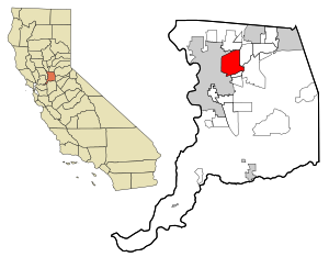
Arden-Arcade is a census-designated place (CDP) in Sacramento County, California, United States. The population was 94,659 at the 2020 census, making it the second most populous census-designated place in California. It is east of the city of Sacramento and west of the community of Carmichael.
Los Rios Community College District
Special-purpose district in California, U.S
Distance: Approx. 1953 meters
Latitude and longitude: 38.57944444,-121.41694444
The Los Rios Community College District is a special-purpose district providing administrative services and governance for the community colleges serving the greater Sacramento area and points east all the way to Lake Tahoe. The Los Rios Community College district is run by CEO/chancellor (Daniel) Brian King of Folsom, California. King's previous occupation was the president of the Cabrillo Community College in Aptos, California.

Arden Fair
Mall in Sacramento, California
Distance: Approx. 2308 meters
Latitude and longitude: 38.60137,-121.42697
Arden Fair is a two-level regional shopping mall located on Arden Way in Sacramento, California, United States. It consists of over 150 tenants, encompassing over 1,100,000 square feet (100,000 m2) of retail space. The mall features the traditional retailers Macy's and JCPenney as anchor stores.
Arden Way (Sacramento, California)
Street in California, United States
Distance: Approx. 778 meters
Latitude and longitude: 38.59611,-121.41071
Arden Way is a major east-west arterial in Sacramento County, California, United States. It is approximately 8 miles (13 km) long and runs through Sacramento and the unincorporated suburbs of Arden-Arcade and Carmichael.
Encina High School
US public high school in Sacramento, California
Distance: Approx. 559 meters
Latitude and longitude: 38.592,-121.409
Encina High School is an American 9-12 public school located in Arden-Arcade, California. It is a member of the San Juan Unified School District. While the school thrived during its early years of existence and into the 1980s, it has since suffered from low enrollment and been suggested for closure several times in its recent history.
Swanston Estates
Human settlement in California, United States of America
Distance: Approx. 2612 meters
Latitude and longitude: 38.6079,-121.4259
Swanston Estates is a neighborhood situated in North Sacramento, California. It is bordered by Arden Way on the south, Ethan Way on the East, Business 80 on the west, and El Camino Avenue on the north. This area lies behind the Arden Fair Mall.

California State Fair
Annual state fair in Sacramento, California
Distance: Approx. 2786 meters
Latitude and longitude: 38.59333333,-121.43472222
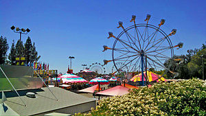
The California State Fair (CSF) is the annual state fair for the state of California. The fair is held at Cal Expo in Sacramento, California. The Fair is a 17-day event showcasing California's industries, agriculture, and diversity of people.

California Exposition
Independent state agency in California
Distance: Approx. 2790 meters
Latitude and longitude: 38.59337,-121.434765
The California Exposition and State Fair (Cal Expo) is an independent state agency established by law in the California Food and Agriculture codes. Cal Expo is governed by an appointed 11-member Board of Directors and daily operations are managed by the chief executive officer (selected by the Board). During the annual California State Fair more than 2,000 seasonal temporary employees are hired.
McClellan AFB Annex
Distance: Approx. 2370 meters
Latitude and longitude: 38.605201,-121.425018
McClellan Air Force Base Annex #1 ("McClellan Anx #1") was a military installation near McClellan Air Force Base in Sacramento County, California, that was active from 28 November 1951 to 2 July 1956. Strategic Air Command operated an automatic tracking radar station (call sign "Sacramento Bomb Plot") just outside the base at Whitney and Eastern Avenues.
Bushy Lake
Lake in Sacramento, California, United States
Distance: Approx. 2804 meters
Latitude and longitude: 38.5889,-121.4345
Bushy Lake is a small lake located in Sacramento, California along the American River Parkway. The area is part of an ongoing restoration project, it also provides habitat to wildlife and offers nearby recreation opportunities. The area is prone to drought, erosion, species invasion, fire, and groups of transient populations.
Town & Country Village (Sacramento)
Shopping mall in California, United States
Distance: Approx. 2894 meters
Latitude and longitude: 38.618924,-121.400174
Town & Country Village is a shopping center in Arden-Arcade, California, United States (with a Sacramento address), in the Sacramento area. It is located at the northeast corner of Marconi and Fulton Avenues. Town & Country Village was the first suburban, auto-oriented shopping center in the Sacramento metropolitan area and one of the first in the United States, opening in 1946 with 65 shops.
Country Club Centre
Shopping mall in California, United States
Distance: Approx. 2358 meters
Latitude and longitude: 38.608806,-121.384661
Country Club Centre is a shopping center in Arden-Arcade, California, United States (with a Sacramento address), in unincorporated Sacramento County of the Sacramento area. It is located at the southwest corner of El Camino and Watt Avenues, diagonally across from what was the first stand-alone store of the now defunct Tower Records chain. It originally opened as a small strip shopping center in 1952 that was later expanded into a regional mall and then later converted into a mixed use of office and retail.
Weather in this IP's area
mist
9 Celsius
7 Celsius
8 Celsius
9 Celsius
1020 hPa
89 %
1020 hPa
1018 hPa
8047 meters
3.6 m/s
10 degree
100 %
