209.145.100.104 - IP Lookup: Free IP Address Lookup, Postal Code Lookup, IP Location Lookup, IP ASN, Public IP
Country:
Region:
City:
Location:
Time Zone:
Postal Code:
ISP:
ASN:
language:
User-Agent:
Proxy IP:
Blacklist:
IP information under different IP Channel
ip-api
Country
Region
City
ASN
Time Zone
ISP
Blacklist
Proxy
Latitude
Longitude
Postal
Route
db-ip
Country
Region
City
ASN
Time Zone
ISP
Blacklist
Proxy
Latitude
Longitude
Postal
Route
IPinfo
Country
Region
City
ASN
Time Zone
ISP
Blacklist
Proxy
Latitude
Longitude
Postal
Route
IP2Location
209.145.100.104Country
Region
british columbia
City
prince rupert
Time Zone
America/Vancouver
ISP
Language
User-Agent
Latitude
Longitude
Postal
ipdata
Country
Region
City
ASN
Time Zone
ISP
Blacklist
Proxy
Latitude
Longitude
Postal
Route
Popular places and events near this IP address

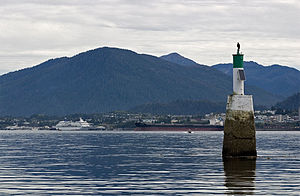
Prince Rupert, British Columbia
City in British Columbia, Canada
Distance: Approx. 201 meters
Latitude and longitude: 54.31277778,-130.32527778
Prince Rupert is a port city in the province of British Columbia, Canada. Its location is on Kaien Island near the Alaskan panhandle. It is the land, air, and water transportation hub of British Columbia's North Coast, and has a population of 12,300 people as of 2021.
Charles Hays Secondary School
High school in Prince Rupert, British Columbia, Canada
Distance: Approx. 1279 meters
Latitude and longitude: 54.31125,-130.30388
Charles Hays Secondary School (CHSS) is a public secondary school located in Prince Rupert, British Columbia, Canada. The school serves a student population of approximately 700 students in grades 9 to 12. Besides scholastic programs, CHSS offers extracurricular sports and opportunities for students to become involved with their community.

Port of Prince Rupert
Port in British Columbia, Canada
Distance: Approx. 3583 meters
Latitude and longitude: 54.2883,-130.3562
The Port of Prince Rupert is a seaport managed by the Prince Rupert Port Authority that occupies 667,731 hectares (1,650,000 acres) of land and water along 20 kilometres (12 miles) of waterfront. The port is located in Prince Rupert Harbour in the North Coast Regional District of British Columbia. The Port of Prince Rupert is the third busiest seaport in Canada by container volume and cargo tonnage after the Port of Vancouver and Port of Montreal.

Prince Rupert/Seal Cove Water Aerodrome
Airport in Prince Rupert, British Columbia
Distance: Approx. 3356 meters
Latitude and longitude: 54.33333333,-130.28333333
Prince Rupert/Seal Cove Water Aerodrome (IATA: ZSW, ICAO: CZSW) is located adjacent to Prince Rupert, British Columbia, Canada. Inland Air, Ocean Pacific Air, Helijet and Lakelse Air (Universal Helicopters) are users of this aerodrome. It is classified as an aerodrome and as an airport of entry by Nav Canada, and is staffed by the Canada Border Services Agency (CBSA).
Prince Rupert Secondary School
Distance: Approx. 706 meters
Latitude and longitude: 54.3085,-130.3176
Prince Rupert Secondary was a public high school in Prince Rupert, British Columbia. Prince Rupert Secondary was a part of School District 52 Prince Rupert.
CHTK-FM
Radio station in Prince Rupert, British Columbia
Distance: Approx. 3331 meters
Latitude and longitude: 54.28444444,-130.315
CHTK-FM is a Canadian radio station that broadcasts an adult hits format at 99.1 FM in Prince Rupert, British Columbia. The station is branded as Bounce 99.1. CHTK is owned by Bell Media.
CIAJ-FM
Christian radio station in Prince Rupert, British Columbia
Distance: Approx. 446 meters
Latitude and longitude: 54.31,-130.32333333
CIAJ-FM was a Christian radio station that broadcast at 100.7 FM in Prince Rupert, British Columbia. Owned by the Aboriginal Christian Voice Network, the station was given approval by the CRTC on October 18, 1999. It continues broadcasting today (October 2024) perhaps without a license or on low power.

Prince Rupert station
Railway station in British Columbia, Canada
Distance: Approx. 2761 meters
Latitude and longitude: 54.29583333,-130.35194444
The Prince Rupert station is on the Canadian National Railway mainline in Prince Rupert, British Columbia. The station is the western terminus for the Via Rail's Jasper–Prince Rupert train. The station building was designed by the CNR Architectural Division in Winnipeg and constructed between 1921 and 1922 in a Modern Classical style adjacent to the waterfront.

Prince Rupert City Hall
Distance: Approx. 215 meters
Latitude and longitude: 54.31268,-130.32541
The art deco Prince Rupert City Hall, in Prince Rupert, British Columbia, was originally constructed as the Federal Building in 1938. The architect was Max B. Downing who persuaded the Department of Public Works to use "monolithic concrete" on the edifice instead of brick. It was built in the fashionable art deco streamlined style; many years later decorative native motifs were incorporated into the front wall.
Fairview Point
Distance: Approx. 3560 meters
Latitude and longitude: 54.28888889,-130.35694444
Fairview Point is a point or headland on the west side of Kaien Island on the North Coast of British Columbia, Canada.
Museum of Northern British Columbia
Distance: Approx. 263 meters
Latitude and longitude: 54.3163,-130.3239
The Museum of Northern British Columbia is a museum in Prince Rupert, British Columbia, Canada. The museum is housed in a large cedar wood longhouse where it collects and exhibits the culture and history of the indigenous peoples of the Pacific Northwest Coast. It was founded in 1924 and now houses thousands of artifacts, maps, photographs and other material.

Château Prince Rupert
Building
Distance: Approx. 339 meters
Latitude and longitude: 54.312766,-130.327778
The Château Prince Rupert was an unexecuted hotel to be built in Prince Rupert, British Columbia. The hotel was planned by the Grand Trunk Pacific Railway and was designed by Francis Rattenbury. The architect's first sketches were made in September 1911, and he completed the final plans in June 1913.
Weather in this IP's area
overcast clouds
3 Celsius
-2 Celsius
2 Celsius
3 Celsius
1031 hPa
88 %
1031 hPa
1025 hPa
10000 meters
6.69 m/s
330 degree
100 %
