209.128.215.144 - IP Lookup: Free IP Address Lookup, Postal Code Lookup, IP Location Lookup, IP ASN, Public IP
Country:
Region:
City:
Location:
Time Zone:
Postal Code:
ISP:
ASN:
language:
User-Agent:
Proxy IP:
Blacklist:
IP information under different IP Channel
ip-api
Country
Region
City
ASN
Time Zone
ISP
Blacklist
Proxy
Latitude
Longitude
Postal
Route
db-ip
Country
Region
City
ASN
Time Zone
ISP
Blacklist
Proxy
Latitude
Longitude
Postal
Route
IPinfo
Country
Region
City
ASN
Time Zone
ISP
Blacklist
Proxy
Latitude
Longitude
Postal
Route
IP2Location
209.128.215.144Country
Region
missouri
City
saint charles
Time Zone
America/Chicago
ISP
Language
User-Agent
Latitude
Longitude
Postal
ipdata
Country
Region
City
ASN
Time Zone
ISP
Blacklist
Proxy
Latitude
Longitude
Postal
Route
Popular places and events near this IP address
American Car and Foundry Company
Manufacturer of railroad rolling stock
Distance: Approx. 111 meters
Latitude and longitude: 38.7848658,-90.4808884
ACF Industries, originally the American Car and Foundry Company (abbreviated as ACF), is an American manufacturer of railroad rolling stock. One of its subsidiaries was once (1925–54) a manufacturer of motor coaches and trolley coaches under the brand names of (first) ACF and (later) ACF-Brill. Today, the company is known as ACF Industries LLC and is based in St.

Old St. Charles Bridge
Bridge in St. Louis County and St. Charles County in Missouri
Distance: Approx. 398 meters
Latitude and longitude: 38.78333333,-90.47666667
The Old St. Charles Bridge once connected St. Louis County to the city of St.
First Missouri State Capitol State Historic Site
Historic site in Missouri, United States
Distance: Approx. 408 meters
Latitude and longitude: 38.78027778,-90.48194444
The First Missouri State Capitol State Historic Site is a state-owned property in St. Charles, Missouri, preserving the building that served as Missouri's capitol from 1821 to 1826. The site is part of the St.

Frenchtown Historic District
Historic district in Missouri, United States
Distance: Approx. 535 meters
Latitude and longitude: 38.78861111,-90.48
Frenchtown Historic District is a national historic district located at St. Charles, St. Charles County, Missouri.
St. Charles Historic District
Historic district in Missouri, US
Distance: Approx. 553 meters
Latitude and longitude: 38.77904,-90.48253
The St. Charles Historic District is a national historic district located at St. Charles, St.
St. Charles Odd Fellows Hall
United States historic place
Distance: Approx. 374 meters
Latitude and longitude: 38.78055556,-90.48166667
The St. Charles Odd Fellows Hall is historic Odd Fellows hall located at St. Charles, St.

Far West (steamship)
American steamboat
Distance: Approx. 428 meters
Latitude and longitude: 38.7848,-90.4764
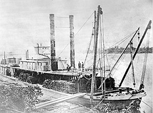
Far West was a shallow draft sternwheel steamboat (or riverboat) plying the upper Missouri and Yellowstone Rivers in the Dakota and Montana Territories, in the years from 1870 to 1883. By being involved in historic events in the Indian Wars of the western frontier, the Far West became an iconic symbol of the shallow draft steamboat plying the upper Missouri and Yellowstone Rivers in the era before railroads dominated transport in these areas. The Far West was light, strong and speedy.

Dr. John H. Stumberg House
Historic house in Missouri, United States
Distance: Approx. 335 meters
Latitude and longitude: 38.78138889,-90.48333333
Dr. John H. Stumberg House is a historic home located at St. Charles, St.

Old City Hall (St. Charles, Missouri)
United States historic place
Distance: Approx. 344 meters
Latitude and longitude: 38.78083333,-90.48166667
Old City Hall, also known as the Market House, is a historic city hall located at St. Charles, St. Charles County, Missouri.
Stone Row
United States historic place
Distance: Approx. 534 meters
Latitude and longitude: 38.77916667,-90.48222222
Stone Row is a historic building located at St. Charles, St. Charles County, Missouri.

Midtown Neighborhood Historic District
Historic district in Missouri, United States
Distance: Approx. 196 meters
Latitude and longitude: 38.78333333,-90.48333333
Midtown Neighborhood Historic District is a national historic district located at St. Charles, St. Charles County, Missouri.
City of St. Charles School District
School district in Missouri
Distance: Approx. 613 meters
Latitude and longitude: 38.78805556,-90.48583333
City of St. Charles School District is a School district in St. Charles, Missouri.
Weather in this IP's area
clear sky
-13 Celsius
-19 Celsius
-15 Celsius
-13 Celsius
1033 hPa
56 %
1033 hPa
1012 hPa
10000 meters
2.68 m/s
4.47 m/s
126 degree
2 %


