Country:
 USA
USARegion:
City:
Latitude and Longitude:
Time Zone:
Postal Code:
IP information under different IP Channel
ip-api
Country
Region
City
ASN
Time Zone
ISP
Blacklist
Proxy
Latitude
Longitude
Postal
Route
IPinfo
Country
Region
City
ASN
Time Zone
ISP
Blacklist
Proxy
Latitude
Longitude
Postal
Route
MaxMind
Country
Region
City
ASN
Time Zone
ISP
Blacklist
Proxy
Latitude
Longitude
Postal
Route
Luminati
Country
USRegion
mi
City
livonia
ASN
Time Zone
America/Detroit
ISP
123NET
Latitude
Longitude
Postal
db-ip
Country
Region
City
ASN
Time Zone
ISP
Blacklist
Proxy
Latitude
Longitude
Postal
Route
ipdata
Country
Region
City
ASN
Time Zone
ISP
Blacklist
Proxy
Latitude
Longitude
Postal
Route
Popular places and events near this IP address

Livonia, Michigan
City in Michigan, United States
Distance: Approx. 3209 meters
Latitude and longitude: 42.39722222,-83.37361111
Livonia ( lə-VOHN-yə) is a city in Wayne County, Michigan, United States. A western suburb of Detroit, Livonia is located roughly 20 miles (32.2 km) northwest of downtown Detroit. As of the 2020 census, the city had a population of 95,535.
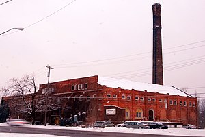
Farmington Winery (Michigan)
Winery
Distance: Approx. 3549 meters
Latitude and longitude: 42.45643,-83.35766
The Farmington Winery was the former LaSalle Winery which was operated in the converted Detroit United Railway Powerhouse in Farmington, Michigan. Production ceased in the late 1960s and the building was used primarily as a distribution center. Later, the St Julian Winery purchased the LaSalle brand.
Livonia Marketplace
Shopping mall in Michigan, United States
Distance: Approx. 2082 meters
Latitude and longitude: 42.42775,-83.33680556
Livonia Marketplace is an open-air shopping mall in the Detroit suburb of Livonia, Michigan. Opened in 2010, the center is anchored by Kohl's and Walmart. It occupies the site of the former Livonia Mall, which was an enclosed mall built in 1964.
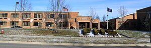
Adlai E. Stevenson High School (Livonia, Michigan)
Distance: Approx. 2216 meters
Latitude and longitude: 42.412169,-83.382754
Adlai E. Stevenson High School is a public high school located in Livonia, Michigan, a suburb west of Detroit.
Farmington High School (Michigan)
Public high school in Farmington, Michigan, United States
Distance: Approx. 4363 meters
Latitude and longitude: 42.46388889,-83.36138889
Farmington High School is a public high school located in Farmington, Michigan. The school was established in 1888, and the first sections of the current building were built in 1953, with several renovations and additions occurring since then. As of the 2022–2023 school year, the school educates a student body of 1,400.
Waza FC
Indoor soccer team
Distance: Approx. 2551 meters
Latitude and longitude: 42.43,-83.392
The Waza FC (also known as Detroit Waza) is an American professional arena soccer team based in Metro Detroit competing as a charter member of the Major League Indoor Soccer (MLIS). The team's nickname, "Waza", is both a Japanese word that means "good technique" (技) and a Swahili word meaning "to think clearly".
Beaumont Hospital, Farmington Hills
Hospital in Michigan, USA
Distance: Approx. 3961 meters
Latitude and longitude: 42.44658333,-83.32377778
Beaumont Hospital - Farmington Hills, formerly known as Botsford Hospital, is a 330-bed teaching hospital with level II trauma center status. Founded in 1965, the hospital is affiliated with Beaumont Health. The hospital earned three year accreditation from the American Osteopathic Association's Healthcare Facilities Accreditation Program in 2008.

Glen Eden Lutheran Memorial Park
Cemetery in Michigan
Distance: Approx. 3380 meters
Latitude and longitude: 42.43655556,-83.39966667
Glen Eden Lutheran Memorial Park is a non-profit cemetery in Livonia, Michigan and Macomb Township. Glen Eden began serving the community when a small group of investors started the cemetery in 1929. In 1932, a twist of fate transferred ownership and operation of the cemetery to four Lutheran churches.
Bentley High School (Livonia, Michigan)
Public high school in Livonia, Michigan, United States
Distance: Approx. 3462 meters
Latitude and longitude: 42.39361111,-83.36083333
George N. Bentley Senior High School, also referred to as Bentley High School, was a public high school in the city of Livonia, Michigan, a western suburb of Detroit. The first public high school in the Livonia Public Schools district, it was open from September 1947 through June 1985. The school's first graduating class in June 1950 had 95 students.
Farmington Central High School (Michigan)
Distance: Approx. 3881 meters
Latitude and longitude: 42.45805556,-83.34805556
Farmington Central High School is a public high school in Farmington, Michigan, which serves students ages 16–19 in an alternative setting while meeting the FPS benchmarks. The school is part of Farmington Public Schools. Central High is a consolidated version of Farmington Alternative High School and Farmington Community School.

Botsford Inn
United States historic place
Distance: Approx. 3834 meters
Latitude and longitude: 42.44388889,-83.32305556
The Botsford Inn is a nineteenth century inn and tavern located at 28000 Grand River Avenue in Farmington, Michigan. It was listed on the National Register of Historic Places in 1979.

First United Methodist Church (Farmington, Michigan)
United States historic place
Distance: Approx. 4499 meters
Latitude and longitude: 42.46416667,-83.37361111
The First United Methodist Church is a church located at 33112 Grand River Avenue in Farmington, Michigan. It was listed on the National Register of Historic Places in 2014.
Weather in this IP's area
clear sky
7 Celsius
7 Celsius
6 Celsius
9 Celsius
1020 hPa
92 %
1020 hPa
995 hPa
10000 meters
0.45 m/s
0.45 m/s
270 degree
6 %
07:06:36
19:55:39