209.112.77.159 - IP Lookup: Free IP Address Lookup, Postal Code Lookup, IP Location Lookup, IP ASN, Public IP
Country:
Region:
City:
Location:
Time Zone:
Postal Code:
IP information under different IP Channel
ip-api
Country
Region
City
ASN
Time Zone
ISP
Blacklist
Proxy
Latitude
Longitude
Postal
Route
Luminati
Country
Region
ga
City
atlanta
ASN
Time Zone
America/New_York
ISP
SHIFT-HOSTING-LLC
Latitude
Longitude
Postal
IPinfo
Country
Region
City
ASN
Time Zone
ISP
Blacklist
Proxy
Latitude
Longitude
Postal
Route
IP2Location
209.112.77.159Country
Region
louisiana
City
harvey
Time Zone
America/Chicago
ISP
Language
User-Agent
Latitude
Longitude
Postal
db-ip
Country
Region
City
ASN
Time Zone
ISP
Blacklist
Proxy
Latitude
Longitude
Postal
Route
ipdata
Country
Region
City
ASN
Time Zone
ISP
Blacklist
Proxy
Latitude
Longitude
Postal
Route
Popular places and events near this IP address

Harvey, Louisiana
Census-designated place in Louisiana, United States
Distance: Approx. 1563 meters
Latitude and longitude: 29.89111111,-90.06916667
Harvey is a census-designated place (CDP) in Jefferson Parish, Louisiana, United States. Harvey is on the south side (referred to as the "West Bank") of the Mississippi River, within the New Orleans–Metairie–Kenner metropolitan statistical area. The 2020 census determined 22,236 people live in Harvey.

Gulf Intracoastal Waterway
Portion of the Intracoastal Waterway located along the Gulf Coast of the United States
Distance: Approx. 896 meters
Latitude and longitude: 29.90888889,-90.08388889
The Gulf Intracoastal Waterway (GIWW) is the portion of the Intracoastal Waterway located along the Gulf Coast of the United States. It is a navigable inland waterway running approximately 1,300 mi (2,100 km) from Saint Marks, Florida, to Brownsville, Texas. The waterway provides a channel with a controlling depth of 12 ft (3.7 m), designed primarily for barge transportation.
KKNO
Radio station in Gretna, Louisiana
Distance: Approx. 1883 meters
Latitude and longitude: 29.8875,-90.08416667
KKNO (750 AM) is a commercial radio station broadcasting an urban gospel radio format. Licensed to Gretna, Louisiana, the station serves the New Orleans metropolitan area. The station is currently owned by Robert C. Blakes Enterprises, Inc.
WFNO (AM)
Radio station in Gretna, Louisiana
Distance: Approx. 1883 meters
Latitude and longitude: 29.8875,-90.08416667
WFNO (1540 kHz) is a commercial AM radio station licensed to Gretna, Louisiana, and serving the New Orleans metropolitan area. The station is owned by Crocodile Broadcasting and airs a Spanish-language hot adult contemporary radio format. The transmitter is on Industry Street in Harvey, Louisiana.

12th Ward of New Orleans
Distance: Approx. 1906 meters
Latitude and longitude: 29.909862,-90.058952
The 12th Ward or Twelfth Ward is a division of the city of New Orleans, Louisiana, one of the 17 Wards of New Orleans. The Ward was formerly part of the old Jefferson City annexed by New Orleans in 1870.
Immaculata High School (Marrero, Louisiana)
Defunct private high school in Louisiana, USA
Distance: Approx. 1900 meters
Latitude and longitude: 29.901321,-90.096758
Immaculata High School was a Catholic high school in Marrero, Louisiana. Immaculata High School opened in 1956 as a part of Immaculate Conception Parish. Immaculata answered a growing need for Catholic secondary education on the Westbank.
Academy of Our Lady (Louisiana)
Private, all-girls school in Marrero, Jefferson Parish, Louisiana, United States
Distance: Approx. 1887 meters
Latitude and longitude: 29.90166667,-90.09666667
The Academy of Our Lady is a private high school for girls on the west bank of Jefferson Parish, Louisiana. It is located in the Roman Catholic Archdiocese of New Orleans.
West Jefferson High School (Louisiana)
Public secondary school in Harvey, Louisiana, United States
Distance: Approx. 299 meters
Latitude and longitude: 29.9033,-90.0741
West Jefferson High School, also known as WJHS, and West Jeff is a public high school located in Harvey in unincorporated Jefferson Parish, Louisiana, United States, just outside New Orleans. It was founded in 1955. This is one of the schools in Jefferson Parish that offered the Laptop one to one initiative program.

New Orleans Lager and Ale Brewing Company
Distance: Approx. 1958 meters
Latitude and longitude: 29.9200402,-90.0834235
New Orleans Lager and Ale Brewing Company, commonly called "NOLA Brewing Company," is a brewery in New Orleans, Louisiana, USA. The brewery is located in a converted old warehouse building at the corner of Tchoupitoulas and Seventh Streets in Uptown New Orleans. Following the closure of the Dixie Brewing Company facility after Hurricane Katrina in 2005, no commercial brewery operated in New Orleans until NOLA Brewing Company produced its first craft beer in 2009. They celebrated their 7th year of production in 2016 with special releases.
Grand Isle School
School in Louisiana, United States
Distance: Approx. 1054 meters
Latitude and longitude: 29.909725,-90.069177
The Grand Isle School is a PreK-12 school in Grand Isle, a community in unincorporated Jefferson Parish, Louisiana. It is a part of Jefferson Parish Public Schools.

Gretna Historic District
Historic district in Louisiana, United States
Distance: Approx. 1920 meters
Latitude and longitude: 29.91546,-90.06309
Gretna Historic District is a historic district in downtown Gretna, Louisiana, United States, roughly bounded by 1st Street, Amelia Street, 9th Street, Gulf Drive, 4th Street and Huey P. Long Avenue. The 130-acre (53 ha) area comprises a total of 737 buildings and structures, of which 553 are considered contributing properties, and 4 are also listed on the National Register of Historic Places as individual properties. Building dates vary from c.1845 to 1935 and are mostly creole cottages, shotgun houses, bungalows and corner commercial buildings.

Old Jefferson Parish Courthouse
United States historic place
Distance: Approx. 1856 meters
Latitude and longitude: 29.91638889,-90.06527778
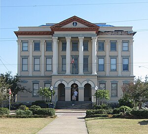
The Old Jefferson Parish Courthouse is a historic three-story building in Gretna, Louisiana. It was designed in the Renaissance Revival style by architect R.S. Soule, and built in 1907. It was the parish courthouse until 1956.
Weather in this IP's area
few clouds
14 Celsius
13 Celsius
13 Celsius
15 Celsius
1016 hPa
61 %
1016 hPa
1015 hPa
10000 meters
1.34 m/s
1.25 m/s
183 degree
19 %