Country:
 USA
USARegion:
City:
Latitude and Longitude:
Time Zone:
Postal Code:
IP information under different IP Channel
ip-api
Country
Region
City
ASN
Time Zone
ISP
Blacklist
Proxy
Latitude
Longitude
Postal
Route
IPinfo
Country
Region
City
ASN
Time Zone
ISP
Blacklist
Proxy
Latitude
Longitude
Postal
Route
MaxMind
Country
Region
City
ASN
Time Zone
ISP
Blacklist
Proxy
Latitude
Longitude
Postal
Route
Luminati
Country
USRegion
mi
City
gaylord
ASN
Time Zone
America/Detroit
ISP
AGRI-VALLEY
Latitude
Longitude
Postal
db-ip
Country
Region
City
ASN
Time Zone
ISP
Blacklist
Proxy
Latitude
Longitude
Postal
Route
ipdata
Country
Region
City
ASN
Time Zone
ISP
Blacklist
Proxy
Latitude
Longitude
Postal
Route
Popular places and events near this IP address

Otsego County, Michigan
County in Michigan, United States
Distance: Approx. 4933 meters
Latitude and longitude: 45.02,-84.61
Otsego County ( ot-SEE-goh), formerly known as Okkuddo County, is a county located in the U.S. state of Michigan. As of the 2020 census, the population was 25,091. The county seat is Gaylord.

Bagley Township, Michigan
Civil township in Michigan, United States
Distance: Approx. 3475 meters
Latitude and longitude: 44.98305556,-84.65944444
Bagley Township is a civil township of Otsego County in the U.S. state of Michigan. The population was 5,867 at the 2020 census.

Gaylord, Michigan
City in Michigan, United States
Distance: Approx. 1358 meters
Latitude and longitude: 45.02472222,-84.67666667
Gaylord ( GAY-lərd) is a city in the U.S. state of Michigan. It is the county seat of Otsego County, and is the only city within the county. Gaylord had a population of 4,286 at the 2020 census, an increase from 3,645 at the 2010 census.
Livingston Township, Michigan
Civil township in Michigan, United States
Distance: Approx. 5900 meters
Latitude and longitude: 45.06583333,-84.67777778
Livingston Township is a civil township of Otsego County in the U.S. state of Michigan. The population was 2,652 at the 2020 census.

Roman Catholic Diocese of Gaylord
Diocese of the Catholic Church in Michigan, United States
Distance: Approx. 2483 meters
Latitude and longitude: 45.0336,-84.684
The Diocese of Gaylord (Latin: Diœcesis Gaylordensis) is a Latin Church ecclesiastical territory, or diocese, of the Catholic Church in the northern region of the lower peninsula of Michigan in the United States. The diocese is a suffragan diocese in the ecclesiastical province of the metropolitan Archdiocese of Detroit.

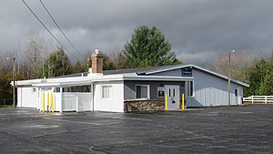
Gaylord Regional Airport
Airport
Distance: Approx. 2474 meters
Latitude and longitude: 45.01305556,-84.70333333
Gaylord Regional Airport (IATA: GLR, ICAO: KGLR, FAA LID: GLR) is a county-owned, public-use airport located one nautical mile (2 km) southwest of the central business district of Gaylord, a city in Otsego County, Michigan, United States. It is included in the Federal Aviation Administration (FAA) National Plan of Integrated Airport Systems for 2017–2021, in which it is categorized as a local general aviation facility.

St. Mary Cathedral High School (Michigan)
Private, coeducational school in Gaylord, Michigan, United States
Distance: Approx. 2003 meters
Latitude and longitude: 45.03055556,-84.6775
St. Mary Cathedral High School is a private, Roman Catholic high school in Gaylord, Michigan. It is located in the Roman Catholic Diocese of Gaylord.

Gaylord High School
Public secondary school in Gaylord, Michigan, United States
Distance: Approx. 3730 meters
Latitude and longitude: 45.0465,-84.6711
Gaylord High School (GHS) is a public secondary school in Gaylord, Michigan. It serves grades 9-12 for Gaylord Community Schools. As of the 2024-25 school year, the principal is former GIS assistant principal Sean Byram.
Alpenfest
Annual event
Distance: Approx. 1358 meters
Latitude and longitude: 45.02472222,-84.67666667
The Alpenfest is an annual celebration in Gaylord, Michigan. For over 50 years the Alpenfest has been a tradition for the townspeople and its visitors. It is held the third week of July.
St. Mary, Our Lady of Mount Carmel Cathedral (Gaylord, Michigan)
Church in Michigan, United States
Distance: Approx. 2446 meters
Latitude and longitude: 45.0335,-84.6831
St. Mary, Our Lady of Mount Carmel Cathedral, also known simply as St. Mary Cathedral, is a Catholic cathedral and parish church located in Gaylord, Michigan, United States.

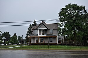
Frank A. and Rae E. Harris Kramer House
Historic house in Michigan, United States
Distance: Approx. 1870 meters
Latitude and longitude: 45.02972222,-84.67416667
The Frank A. and Rae E. Harris Kramer House is a private house located at 221 North Center Avenue in Gaylord, Michigan. It was designated a Michigan State Historic Site in 1993 and listed on the National Register of Historic Places in 2003.
James A. and Lottie J. (Congdon) Quick House
Historic house in Michigan, United States
Distance: Approx. 1681 meters
Latitude and longitude: 45.02805556,-84.67361111
The James A. and Lottie J. (Congdon) Quick House is a private house located at 120 North Center Avenue in Gaylord, Michigan. It was listed on the National Register of Historic Places in 2016.
Weather in this IP's area
broken clouds
15 Celsius
14 Celsius
13 Celsius
17 Celsius
1012 hPa
68 %
1012 hPa
965 hPa
10000 meters
3.13 m/s
9.72 m/s
160 degree
60 %
07:23:56
19:40:01