208.89.5.48 - IP Lookup: Free IP Address Lookup, Postal Code Lookup, IP Location Lookup, IP ASN, Public IP
Country:
Region:
City:
Location:
Time Zone:
Postal Code:
IP information under different IP Channel
ip-api
Country
Region
City
ASN
Time Zone
ISP
Blacklist
Proxy
Latitude
Longitude
Postal
Route
Luminati
Country
ASN
Time Zone
America/Chicago
ISP
TELOV-FL-TPA
Latitude
Longitude
Postal
IPinfo
Country
Region
City
ASN
Time Zone
ISP
Blacklist
Proxy
Latitude
Longitude
Postal
Route
IP2Location
208.89.5.48Country
Region
florida
City
tampa
Time Zone
America/New_York
ISP
Language
User-Agent
Latitude
Longitude
Postal
db-ip
Country
Region
City
ASN
Time Zone
ISP
Blacklist
Proxy
Latitude
Longitude
Postal
Route
ipdata
Country
Region
City
ASN
Time Zone
ISP
Blacklist
Proxy
Latitude
Longitude
Postal
Route
Popular places and events near this IP address
Howard W. Blake High School
Public magnet high school in Tampa, Florida
Distance: Approx. 803 meters
Latitude and longitude: 27.95833333,-82.46694444
Howard W. Blake High School is a public magnet high school, with an emphasis on the arts, in Tampa, Florida, United States. It is operated by the School District of Hillsborough County. Originally opened in 1956 as a school for African-Americans, it was integrated as a junior high school after the end of segregation.

North Franklin Street Historic District
Historic district in Florida, United States
Distance: Approx. 430 meters
Latitude and longitude: 27.95416667,-82.46027778
The North Franklin Street Historic District is a U.S. historic district (designated as such on March 28, 2002) located in Tampa, Florida. The district is bounded by Florida Avenue, East Fortune, Tampa, Franklin and East Harrison Streets. It contains 8 historic buildings.

S. H. Kress and Co. Building (Tampa, Florida)
United States historic place
Distance: Approx. 778 meters
Latitude and longitude: 27.95083333,-82.45944444
The S. H. Kress and Co. Building is a historic 1928 building in Tampa, Florida, United States. It was part of the S. H. Kress & Co.

Tampa Free Library
United States historic place
Distance: Approx. 325 meters
Latitude and longitude: 27.96027778,-82.46055556
For other Carnegie Libraries, see Carnegie library (disambiguation) The Old Tampa Free Public Library (also known as the Exceptional Children Education Center) is a historic building in the Tampa Heights neighborhood of Tampa, Florida. Located at 102 E. 7th Avenue, it was one of 10 Florida Carnegie libraries to receive grants awarded by the Carnegie Corporation of New York from 1901 to 1917. It was designed by Tampa architect Fred J. James and constructed from 1915 to 1917.

Oaklawn Cemetery
First public burial ground in Tampa, Florida, United States
Distance: Approx. 376 meters
Latitude and longitude: 27.95469444,-82.45730556
Oaklawn Cemetery is the first public burial ground in Tampa, Florida, United States. The location was deeded in the mid-19th century and was described as the final resting place for "White and Slave, Rich and Poor." Oaklawn Cemetery is located at the intersection of Morgan Street and Harrison Street in downtown Tampa, about two blocks South of I-275. It has approximately 1,700 graves.

Bro Bowl
Historic place in Florida, United States
Distance: Approx. 440 meters
Latitude and longitude: 27.9550236,-82.455622
The Bro Bowl is one of the last remaining skateboard parks of the 1970s and the first public skatepark to be built in Florida, United States. It is the first skatepark to be listed on any national registry of historic sites. Located at Perry Harvey Sr.

Upper North Franklin Street Commercial District
Historic district in Florida, United States
Distance: Approx. 237 meters
Latitude and longitude: 27.95954,-82.46019
Upper North Franklin Street Commercial District is a historic neighborhood in Tampa, Florida listed on the National Register of Historic Places listings in Hillsborough County, Florida. The area includes the Cafe Hey coffee shop, the Old Tampa Carnegie Free Library, (now a city office building), and the Rialto Theatre (Tampa) built in 1925 and now vacant. The Arlington Hotel and Fly Bar have reinvigorated the national historic district.

Water Works Park (Tampa, Florida)
Park in Tampa, Florida
Distance: Approx. 451 meters
Latitude and longitude: 27.9592,-82.4631
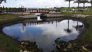
Water Works Park is a park area in Tampa, Florida. The park was redeveloped and opened to the public in August 2014. The park includes a section of the Tampa Riverwalk, and extended alongside the Hillsborough River.

Robert W. Saunders Sr. Public Library
Distance: Approx. 789 meters
Latitude and longitude: 27.95814,-82.45078
The Robert W. Saunders Sr. Public Library is a member of the Tampa-Hillsborough County Public Library System (THPL) and the Hillsborough County Public Library Cooperative (HCPLC). Located on 1505 Nebraska Avenue in Tampa, Florida, the 26,244 square foot library is one of only two African-American research libraries in Florida.
St. Peter Claver Catholic School (Tampa)
Private school in Tampa, Florida, United States
Distance: Approx. 530 meters
Latitude and longitude: 27.95652778,-82.45361111
St. Peter Claver Catholic School is a Catholic school in Tampa, Florida. It was established in 1894 to educate African Americans and is the oldest-surviving historically Black primary school in the state.
Riverfront Stadium (Tampa)
Soccer stadium in Tampa, Florida
Distance: Approx. 783 meters
Latitude and longitude: 27.9592,-82.4666
The Riverfront Stadium (Tampa) is a soccer stadium in Tampa, Florida.
Kosen (restaurant)
Restaurant in Tampa, Florida, U.S.
Distance: Approx. 745 meters
Latitude and longitude: 27.962447,-82.464252
Kosen is a Michelin-starred Japanese restaurant in Tampa Heights, a neighborhood of Tampa, Florida, in the United States.
Weather in this IP's area
broken clouds
15 Celsius
15 Celsius
14 Celsius
16 Celsius
1020 hPa
92 %
1020 hPa
1018 hPa
10000 meters
4.12 m/s
70 degree
75 %