208.85.39.121 - IP Lookup: Free IP Address Lookup, Postal Code Lookup, IP Location Lookup, IP ASN, Public IP
Country:
Region:
City:
Location:
Time Zone:
Postal Code:
IP information under different IP Channel
ip-api
Country
Region
City
ASN
Time Zone
ISP
Blacklist
Proxy
Latitude
Longitude
Postal
Route
Luminati
Country
Region
mn
City
twoharbors
ASN
Time Zone
America/Chicago
ISP
TLL-WEST
Latitude
Longitude
Postal
IPinfo
Country
Region
City
ASN
Time Zone
ISP
Blacklist
Proxy
Latitude
Longitude
Postal
Route
IP2Location
208.85.39.121Country
Region
minnesota
City
silver bay
Time Zone
America/Chicago
ISP
Language
User-Agent
Latitude
Longitude
Postal
db-ip
Country
Region
City
ASN
Time Zone
ISP
Blacklist
Proxy
Latitude
Longitude
Postal
Route
ipdata
Country
Region
City
ASN
Time Zone
ISP
Blacklist
Proxy
Latitude
Longitude
Postal
Route
Popular places and events near this IP address

Beaver Bay, Minnesota
City in Minnesota, United States
Distance: Approx. 5220 meters
Latitude and longitude: 47.25777778,-91.30055556
Beaver Bay is a city in Lake County, Minnesota, United States. The population was 120 at the 2020 census. Minnesota Highway 61 serves as a main route in the community.
Beaver Bay Township, Lake County, Minnesota
Township in Minnesota, United States
Distance: Approx. 5681 meters
Latitude and longitude: 47.32916667,-91.3125
Beaver Bay Township is a township in Lake County, Minnesota, United States. The population was 517 at the 2020 census. State Highways 1 and 61 are two of the main routes in the township.

Silver Bay, Minnesota
City in Minnesota, United States
Distance: Approx. 1180 meters
Latitude and longitude: 47.2925,-91.27277778
Silver Bay is a city in Lake County, Minnesota, United States. The population was 1,857 at the time of the 2020 census. It is the largest population center in a natural tourism area which includes Tettegouche State Park and the Split Rock Lighthouse.

Tettegouche State Park
United States historic place in Minnesota
Distance: Approx. 6357 meters
Latitude and longitude: 47.33583333,-91.19944444
Tettegouche State Park ( TET-ə-gooch) is a Minnesota state park on the north shore of Lake Superior 58 miles (93 km) northeast of Duluth in Lake County on scenic Minnesota Highway 61. The park's name stems from the Tettegouche Club, an association of local businessmen which purchased the park in 1910 from the Alger-Smith Lumber Company. The club's members protected the area until its sale in 1971 to the deLaittres family.

Palisade Head
Rock formation in Minnesota, United States
Distance: Approx. 4187 meters
Latitude and longitude: 47.31972222,-91.21638889
Palisade Head is a headland on the North Shore of Lake Superior in the U.S. state of Minnesota. It is part of Tettegouche State Park but not contiguous with the rest of that park. Palisade Head is located at milepost 57 on scenic Minnesota State Highway 61 in Lake County, approximately 54 miles (87 km) northeast of Duluth and 3 miles (4.8 km) northeast of Silver Bay.
Illgen City, Minnesota
Unincorporated community in Minnesota, United States
Distance: Approx. 7765 meters
Latitude and longitude: 47.34694444,-91.18972222
Illgen City is an unincorporated community in Beaver Bay Township, Lake County, Minnesota, United States. The community is located northeast of the city of Silver Bay at the junction of Minnesota Highway 61 and Minnesota Highway 1, on the North Shore of Lake Superior. Illgen City is also located 33 miles northeast of the city of Two Harbors.
East Beaver Bay, Minnesota
Unincorporated community in Minnesota, United States
Distance: Approx. 3541 meters
Latitude and longitude: 47.26777778,-91.28305556
East Beaver Bay is an unincorporated community in Beaver Bay Township, Lake County, Minnesota, United States. The community is located between Beaver Bay and Silver Bay on Minnesota Highway 61, on the North Shore of Lake Superior. East Beaver Bay is located 26 miles northeast of the city of Two Harbors.

Lax Lake, Minnesota
Unincorporated community in Minnesota, United States
Distance: Approx. 6767 meters
Latitude and longitude: 47.34416667,-91.30888889
Lax Lake is an unincorporated community in Beaver Bay Township, Lake County, Minnesota, United States. The community is located north of Beaver Bay and Silver Bay on Lax Lake Road (Lake County Road 31/Lake County Road 4). Lax Lake is located 32 miles northeast of the city of Two Harbors.

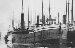
SS Hesper
Bulk-freighter steamship that sank in Lake Superior
Distance: Approx. 2779 meters
Latitude and longitude: 47.27138889,-91.27166667
Hesper was a bulk-freighter steamship that was used to tow schooner-barges on the Great Lakes. She sank in Lake Superior off Silver Bay, Minnesota, in a late-spring snowstorm in 1905. The remains of the ship are listed on the National Register of Historic Places.

Baptism River
River in Minnesota, United States
Distance: Approx. 6465 meters
Latitude and longitude: 47.3360284,-91.1976635
The Baptism River is an 8.8-mile-long (14.2 km) river of the U.S. state of Minnesota. The river source is the confluence of the East Branch Baptism River and the West Branch Baptism River just south of the community of Finland. The High Falls of the Baptism River, in Tettegouche State Park, is the highest waterfall entirely within the state of Minnesota at 60 feet (18 m).

Beaver River (Lake Superior)
River in Minnesota, United States
Distance: Approx. 4760 meters
Latitude and longitude: 47.2590891,-91.2929435
The Beaver River is a 23.4-mile-long (37.7 km) river in Lake County, Minnesota. It flows into Lake Superior. Its name comes from the large number of beaver originally found in the area.

Lax Lake (Minnesota)
Lake in the state of Minnesota, United States
Distance: Approx. 6476 meters
Latitude and longitude: 47.34583333,-91.2975
Lax Lake is a lake in Lake County, in the U.S. state of Minnesota. Lax Lake derives its name from John Waxlax, an early settler. The lake is approximately 4 miles north of Silver Bay, and about 6 miles south of Finland, Minnesota.
Weather in this IP's area
scattered clouds
-10 Celsius
-17 Celsius
-10 Celsius
-8 Celsius
1035 hPa
78 %
1035 hPa
1004 hPa
10000 meters
3.76 m/s
6.51 m/s
341 degree
39 %