Country:
Region:
City:
Latitude and Longitude:
Time Zone:
Postal Code:
IP information under different IP Channel
ip-api
Country
Region
City
ASN
Time Zone
ISP
Blacklist
Proxy
Latitude
Longitude
Postal
Route
Luminati
Country
Region
ma
ASN
Time Zone
America/New_York
ISP
CYTRACOMLLC
Latitude
Longitude
Postal
IPinfo
Country
Region
City
ASN
Time Zone
ISP
Blacklist
Proxy
Latitude
Longitude
Postal
Route
db-ip
Country
Region
City
ASN
Time Zone
ISP
Blacklist
Proxy
Latitude
Longitude
Postal
Route
ipdata
Country
Region
City
ASN
Time Zone
ISP
Blacklist
Proxy
Latitude
Longitude
Postal
Route
Popular places and events near this IP address

Fairhaven, Massachusetts
Town in Massachusetts, United States
Distance: Approx. 48 meters
Latitude and longitude: 41.6375,-70.90416667
Fairhaven (Massachusett: Sconticut) is a town in Bristol County, Massachusetts, United States. It is located on the South Coast of Massachusetts where the Acushnet River flows into Buzzards Bay, an arm of the Atlantic Ocean. The town shares a harbor with the city of New Bedford, a place well known for its whaling and fishing heritage; consequently, Fairhaven's history, economy, and culture are closely aligned with those of its larger neighbor.

Millicent Library
United States historic place
Distance: Approx. 210 meters
Latitude and longitude: 41.63572,-70.90344
Millicent Library in Fairhaven, Massachusetts was donated to the town by the family of Millicent Gifford Rogers, the youngest daughter of Abbie Gifford and wealthy industrialist Henry Huttleston Rogers. Young Millicent had died of heart failure in 1890 when she was barely seventeen years old. The library was dedicated on January 30, 1893.
WFHN
Radio station in Massachusetts, United States
Distance: Approx. 1146 meters
Latitude and longitude: 41.64,-70.917
WFHN (107.1 FM), better known as Fun 107, is a contemporary hit radio station that serves the New Bedford-Fall River, Massachusetts, market along with (to a lesser extent) the Providence, Rhode Island, market. The station is licensed to Fairhaven, Massachusetts, and is owned by Townsquare Media. The studio is located in Fairhaven, Massachusetts, shared with WBSM. The transmitter is located in New Bedford, Massachusetts, on Pope's Island on a tower shared with W243BG. The station was originally built by broadcast engineer Randy Place in 1988–1989.

Prince Henry the Navigator Park
Park in New Bedford, Massachusetts, U.S.
Distance: Approx. 906 meters
Latitude and longitude: 41.64,-70.914
Prince Henry the Navigator Park is a park on Pope's Island in New Bedford, Massachusetts. The park is dedicated to Prince Henry the Navigator. It was created in 1994, a gift to the city from the Prince Henry Society of New Bedford and the Portuguese government.

New Bedford – Fairhaven Bridge
Bridge in New Bedford to Fairhaven, Massachusetts
Distance: Approx. 1199 meters
Latitude and longitude: 41.639158,-70.917856
The New Bedford-Fairhaven Bridge is a swing truss bridge which connects New Bedford, Massachusetts with Fairhaven, Massachusetts.

Unitarian Memorial Church
Historic church in Massachusetts, United States
Distance: Approx. 453 meters
Latitude and longitude: 41.63361111,-70.9025
Unitarian Memorial Church is a historic church on 102 Green Street in Fairhaven, Massachusetts, home to the Unitarian Universalist Society of Fairhaven. The congregation was founded in 1819, moved into the Washington Street Christian Meetinghouse in 1832, and called its first minister in 1840. The Reverend María Uitti McCabe is its currently serving minister, and the Society President is Julie Sullivan.

Fairhaven Town Hall
United States historic place
Distance: Approx. 137 meters
Latitude and longitude: 41.63638889,-70.90388889
Fairhaven Town Hall is the town hall of Fairhaven, Massachusetts. It is located at 40 Center Street, between Walnut and William Streets, across Center Street from the Millicent Library. The brick and stone High Victorian Gothic hall was designed by Charles Brigham and built in 1892.

Ezekiel Sawin House
Historic house in Massachusetts, United States
Distance: Approx. 119 meters
Latitude and longitude: 41.63694444,-70.90472222
The Ezekiel Sawin House is a historic house located in Fairhaven, Massachusetts.

Fairhaven High School and Academy
Public high school in Fairhaven, Massachusetts, United States
Distance: Approx. 642 meters
Latitude and longitude: 41.64305556,-70.90611111
Fairhaven High School is a public high school in Fairhaven, Massachusetts, United States. The main school building nicknamed "The Castle on the Hill" was built in 1905 and the current addition was added in 1996. The school is the only high school the Fairhaven Public Schools district.
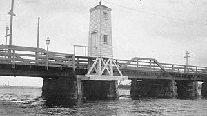
Fairhaven Bridge Light
Lighthouse
Distance: Approx. 1126 meters
Latitude and longitude: 41.63941667,-70.91691389
Fairhaven Bridge Light was a lighthouse on the bridge from New Bedford to Fairhaven, Massachusetts, at the north end of New Bedford Harbor. From 1888 to 1891 it served as the rear light of a range to guide ships past Butler Flats on the west side of the harbor entrance. The front light of the range was Palmer Island Light.
Crow Island (Massachusetts)
Distance: Approx. 579 meters
Latitude and longitude: 41.6375,-70.91055556
Crow Island is an inhabited island located in New Bedford Harbor in Fairhaven, Massachusetts.
Northeast Maritime Institute
Distance: Approx. 8 meters
Latitude and longitude: 41.6376,-70.9035
Northeast Maritime Institute (also called NMI) is a private, coeducational, maritime college offering an Associate in Applied Science in Nautical Science degree. Established in 1981, Northeast Maritime Institute is the only private degree-conferring maritime college in the US. The college is in the Town of Fairhaven, Massachusetts located in the United States and is within walking distance from the Acushnet River across from New Bedford Harbor. The college was originally established to provide an alternative to traditional maritime academy regimented-styled training and graduates of the college's Associate program are eligible to receive a United States Coast Guard Masters license upon graduation.
Weather in this IP's area
clear sky
16 Celsius
16 Celsius
15 Celsius
18 Celsius
1020 hPa
88 %
1020 hPa
1019 hPa
10000 meters
7.6 m/s
281 degree
06:21:00
16:33:26
