208.84.72.92 - IP Lookup: Free IP Address Lookup, Postal Code Lookup, IP Location Lookup, IP ASN, Public IP
Country:
Region:
City:
Location:
Time Zone:
Postal Code:
IP information under different IP Channel
ip-api
Country
Region
City
ASN
Time Zone
ISP
Blacklist
Proxy
Latitude
Longitude
Postal
Route
Luminati
Country
Region
mn
City
minneapolis
ASN
Time Zone
America/Chicago
ISP
VER
Latitude
Longitude
Postal
IPinfo
Country
Region
City
ASN
Time Zone
ISP
Blacklist
Proxy
Latitude
Longitude
Postal
Route
IP2Location
208.84.72.92Country
Region
minnesota
City
saint francis
Time Zone
America/Chicago
ISP
Language
User-Agent
Latitude
Longitude
Postal
db-ip
Country
Region
City
ASN
Time Zone
ISP
Blacklist
Proxy
Latitude
Longitude
Postal
Route
ipdata
Country
Region
City
ASN
Time Zone
ISP
Blacklist
Proxy
Latitude
Longitude
Postal
Route
Popular places and events near this IP address

Bethel, Minnesota
City in Minnesota, United States
Distance: Approx. 7017 meters
Latitude and longitude: 45.40222222,-93.27111111
Bethel is a city in Anoka County, Minnesota, United States. The population was 466 at the 2010 census.

Oak Grove, Minnesota
City in Minnesota, United States
Distance: Approx. 6735 meters
Latitude and longitude: 45.34083333,-93.33333333
Oak Grove is a city in Anoka County, Minnesota, United States. It is north of Minneapolis. The population was 8,929 at the 2020 census.

Stanford Township, Isanti County, Minnesota
Township in Minnesota, United States
Distance: Approx. 5413 meters
Latitude and longitude: 45.44527778,-93.37805556
Stanford Township is a township in Isanti County, Minnesota, United States. The population was 2,075 at the 2000 census.

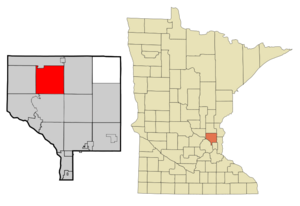
St. Francis, Minnesota
City in Minnesota, United States
Distance: Approx. 2051 meters
Latitude and longitude: 45.39555556,-93.38666667
St. Francis is a city in Anoka and Isanti counties, Minnesota, United States. The population was 8,142 at the 2020 census.
KPXM-TV
TV station in St. Cloud, Minnesota
Distance: Approx. 7277 meters
Latitude and longitude: 45.33663889,-93.392
KPXM-TV (channel 41) is a television station licensed to St. Cloud, Minnesota, United States, broadcasting the Ion Television network to the Minneapolis–Saint Paul area. The station is owned and operated by the Ion Media subsidiary of the E. W. Scripps Company, and maintains a sales office on 176th Street NW near Big Lake; its transmitter is located in Nowthen, Minnesota.
KQQL
Radio station in Anoka–Minneapolis–St. Paul, Minnesota
Distance: Approx. 7019 meters
Latitude and longitude: 45.338861,-93.391056
KQQL (107.9 FM, "KOOL 108") is a commercial radio station serving the Minneapolis-St. Paul radio market and is licensed to suburban Anoka. It plays classic hits and is owned by iHeartMedia, Inc.

Lake George (Anoka County, Minnesota)
Lake in Anoka County, Minnesota
Distance: Approx. 4979 meters
Latitude and longitude: 45.35694444,-93.33611111
Lake George is a small lake in Anoka County, Minnesota, located within the city of Oak Grove, 12 miles (19 km) north of the city of Anoka. Minnesota's Department of Natural Resources tracks the lake by the name George and the identifier 02-0091-00. The USGS tracks the lake by the ID 644081 and the coordinates of 45°21′25″N 93°20′10″W Roughly circular in shape with two marshes encircling Greenwald Island on the Southern shore, Lake George Regional Park covers much of the North shore.
Saint Francis High School (Saint Francis, Minnesota)
Public school in Saint Francis, Minnesota, United States
Distance: Approx. 1405 meters
Latitude and longitude: 45.38805556,-93.35
Saint Francis High School (SFHS) is a high school located in St. Francis, Minnesota, United States. It is part of ISD 15 and covers about 165 square miles.
Norris Lake (Anoka County, Minnesota)
Lake in the state of Minnesota, United States
Distance: Approx. 3157 meters
Latitude and longitude: 45.37888889,-93.39027778
Norris Lake is a lake in Anoka County, Minnesota, in the United States. Norris Lake was named for Grafton Norris.
Seelye Brook
Stream in Minnesota, U.S.
Distance: Approx. 4293 meters
Latitude and longitude: 45.35972222,-93.36444444
Seelye Brook is a stream in the U.S. state of Minnesota. Seelye Brook was named for Moses Seelye, an early settler.

Riverside Hotel (St. Francis, Minnesota)
United States historic place
Distance: Approx. 1233 meters
Latitude and longitude: 45.38722222,-93.35861111
The Riverside Hotel is a historic former hotel in St. Francis, Minnesota, United States. It was originally built around 1860 as a residence, then expanded into a hotel beginning in 1891.

H. G. Leathers House
Historic house in Minnesota, United States
Distance: Approx. 1371 meters
Latitude and longitude: 45.38597222,-93.35861111
The H. G. Leathers House is a historic house in St. Francis, Minnesota, United States. It was originally built on a site near the Rum River around 1883.
Weather in this IP's area
overcast clouds
-0 Celsius
-4 Celsius
-2 Celsius
1 Celsius
1021 hPa
94 %
1021 hPa
987 hPa
10000 meters
3.26 m/s
10.2 m/s
162 degree
100 %