208.84.68.176 - IP Lookup: Free IP Address Lookup, Postal Code Lookup, IP Location Lookup, IP ASN, Public IP
Country:
Region:
City:
Location:
Time Zone:
Postal Code:
IP information under different IP Channel
ip-api
Country
Region
City
ASN
Time Zone
ISP
Blacklist
Proxy
Latitude
Longitude
Postal
Route
Luminati
Country
IPinfo
Country
Region
City
ASN
Time Zone
ISP
Blacklist
Proxy
Latitude
Longitude
Postal
Route
IP2Location
208.84.68.176Country
Region
florida
City
estero
Time Zone
America/New_York
ISP
Language
User-Agent
Latitude
Longitude
Postal
db-ip
Country
Region
City
ASN
Time Zone
ISP
Blacklist
Proxy
Latitude
Longitude
Postal
Route
ipdata
Country
Region
City
ASN
Time Zone
ISP
Blacklist
Proxy
Latitude
Longitude
Postal
Route
Popular places and events near this IP address

Estero, Florida
Village in Florida, United States
Distance: Approx. 1557 meters
Latitude and longitude: 26.42777778,-81.795
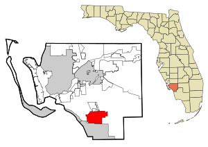
Estero (Spanish for "estuary") is an incorporated village in Lee County, Florida, United States, located directly beside the first aquatic nature preserve established in Florida: The Estero Bay Aquatic Preserve, otherwise referred to as Estero Bay Preserve State Park which is within Estero Bay, Florida. At the time of the 2010 census, Estero was an unincorporated community and census-designated place, but incorporated as a village on the last calendar date of 2014. It is part of the Cape Coral-Fort Myers, Florida Metropolitan Statistical Area.

San Carlos Park, Florida
Census-designated place in Florida, United States
Distance: Approx. 4569 meters
Latitude and longitude: 26.47444444,-81.81555556
San Carlos Park is a census-designated place (CDP) in Lee County, Florida, United States. The population was 18,563 at the 2020 census, up from 16,824 at the 2010 census. It is part of the Cape Coral-Fort Myers, Florida Metropolitan Statistical Area.

Three Oaks, Florida
Census-designated place in Florida, United States
Distance: Approx. 3073 meters
Latitude and longitude: 26.46777778,-81.79583333
Three Oaks is a census-designated place (CDP) in Lee County, Florida, United States. The population was 5,472 at the 2020 census, up from 3,592 at the 2010 census. It is part of the Cape Coral-Fort Myers, Florida Metropolitan Statistical Area.
Florida Gulf Coast University
Public university in Fort Myers, Florida, U.S.
Distance: Approx. 2917 meters
Latitude and longitude: 26.462499,-81.772898
Florida Gulf Coast University (FGCU) is a public university in Lee County, Florida, near Fort Myers. It is part of the State University System of Florida and is its second-youngest member. The university was established on May 3, 1991, and is accredited by the Southern Association of Colleges and Schools (SACS).

Hertz Arena
Multi-purpose arena in Florida, U.S.
Distance: Approx. 1046 meters
Latitude and longitude: 26.4406681,-81.7788085
Hertz Arena is a 7,181-seat multi-purpose arena in Estero, Florida, outside Ft. Myers, Florida, which is located between Miromar Lakes, Florida and Bonita Springs, Florida.

Alico Arena
Distance: Approx. 4170 meters
Latitude and longitude: 26.47111111,-81.76472222
Alico Arena is a 131,000 sq ft (12,200 m2) multipurpose arena located on the campus of Florida Gulf Coast University. It is the home of the FGCU Eagles volleyball and men's and women's basketball teams. It holds 4,633 people in basketball configuration.

Koreshan State Historic Site
State park in Florida, United States
Distance: Approx. 2852 meters
Latitude and longitude: 26.43333333,-81.81666667
The Koreshan State Historic Site is a state park in Estero, Florida located on U.S. Highway 41 at Corkscrew Road. It was also added to the National Register of Historic Places on May 4, 1976, under the designation of Koreshan Unity Settlement Historic District. It contains areas of pine flatwoods habitat and the site of a religious colony, the Koreshan Unity, whose last members deeded the land to the state in 1961.
Estero High School
Public secondary school in Estero, Florida , United States
Distance: Approx. 2301 meters
Latitude and longitude: 26.421389,-81.797244
Estero High School is a public high school located in Estero, Florida, United States. It is part of the Lee County School District and opened in 1987. The total enrollment is about 1,667 students.

Swanson Stadium
Distance: Approx. 4179 meters
Latitude and longitude: 26.47027778,-81.76333333
Swanson Stadium is a baseball park located on the campus of Florida Gulf Coast University in Fort Myers, Florida, next to Alico Arena, the school's basketball facility. Opened in 2004, the stadium was renamed in 2005 for Duane and Cookie Swanson, local civic leaders and FGCU supporters.
Gulf Coast Town Center
Shopping mall in Florida, United States
Distance: Approx. 5046 meters
Latitude and longitude: 26.48611111,-81.78805556
Gulf Coast Town Center is an outdoor shopping mall in Fort Myers, Florida, United States. Opened in phases between 2005 and 2007, the center features Bass Pro Shops, Belk, Costco, Dick's Sporting Goods, LA Fitness, Marshalls, Regal Entertainment Group, and Target as its anchor stores. It is managed by CBL & Associates Properties.
Happehatchee Center
Distance: Approx. 2025 meters
Latitude and longitude: 26.43444444,-81.80833333
The Happehatchee Center is a nature sanctuary and spiritual center operated by a non-profit organization in Estero, Florida. It is located on 4.5 acres of subtropics forest, spanning 150 feet on both sides of the Estero River. It is adjacent to the Koreshan State Historic Site and together these lands host a variety of flora and fauna along the river.

FGCU Soccer Complex
Home field for the Florida Gulf Coast Eagles men & women soccer teams
Distance: Approx. 4083 meters
Latitude and longitude: 26.46916667,-81.76333333
The FGCU Soccer Complex is the home field for the Florida Gulf Coast Eagles men's soccer team and the FGCU Eagles women's soccer team. The FGCU men's soccer team has played at the complex since the team's home debut against UNLV on September 9, 2007. The record crowd for the stadium and for the women's soccer team is 2,014, which was set when the stadium for the first time hosted a 2014 NCAA tournament women's soccer match.
Weather in this IP's area
clear sky
22 Celsius
22 Celsius
21 Celsius
23 Celsius
1018 hPa
79 %
1018 hPa
1017 hPa
10000 meters
5.14 m/s
70 degree