Country:
 USA
USARegion:
City:
Latitude and Longitude:
Time Zone:
Postal Code:
IP information under different IP Channel
ip-api
Country
Region
City
ASN
Time Zone
ISP
Blacklist
Proxy
Latitude
Longitude
Postal
Route
IPinfo
Country
Region
City
ASN
Time Zone
ISP
Blacklist
Proxy
Latitude
Longitude
Postal
Route
MaxMind
Country
Region
City
ASN
Time Zone
ISP
Blacklist
Proxy
Latitude
Longitude
Postal
Route
Luminati
Country
USRegion
ut
City
saltlakecity
ASN
Time Zone
America/Denver
ISP
1WIRE-FIBER
Latitude
Longitude
Postal
db-ip
Country
Region
City
ASN
Time Zone
ISP
Blacklist
Proxy
Latitude
Longitude
Postal
Route
ipdata
Country
Region
City
ASN
Time Zone
ISP
Blacklist
Proxy
Latitude
Longitude
Postal
Route
Popular places and events near this IP address
Rose Park, Salt Lake City
Neighborhood of Salt Lake City
Distance: Approx. 1455 meters
Latitude and longitude: 40.78333333,-111.91666667
Rose Park is a neighborhood located in the northwest area of Salt Lake City, Utah, and is among the most ethnically diverse areas in Utah. Its name comes from the area's original developer, who arranged part of the area's streets in the shape of several roses, with one of its main streets, American Beauty Drive, acting as a long rose stem. This area's original roof shingles were red or green and its street names all feature rose varieties.
Utah State Fair
United States historic place
Distance: Approx. 1850 meters
Latitude and longitude: 40.77255556,-111.91911111
The Utah State Fair is held at the Utah State Fairpark in Salt Lake City, Utah, United States. The fairgrounds are listed on the National Register of Historic Places. The fair takes place each year starting on the first Thursday after Labor Day and lasts for 11 days.
Salt Lake City Air Route Traffic Control Center
Distance: Approx. 1565 meters
Latitude and longitude: 40.7861,-111.9523
Salt Lake City Air Route Traffic Control Center (ZLC) (radio communications "Salt Lake Center") is one of 22 FAA Area Control Centers in the United States. It is located in Salt Lake City, Utah, adjacent to Salt Lake City International Airport. It was opened in 1939 and was originally located on the third floor of the old Salt Lake City International Airport terminal.
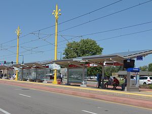
1940 West North Temple station
Distance: Approx. 1815 meters
Latitude and longitude: 40.77152778,-111.94611111
1940 West North Temple station is a light rail station in Salt Lake City, Utah serviced by the Green Line of the Utah Transit Authority's (UTA) TRAX system. The Green Line provides service from the Salt Lake City International Airport to West Valley City (via Downtown Salt Lake City), and connects with the rest of the TRAX system, as well as UTA's FrontRunner commuter rail and S Line streetcar.

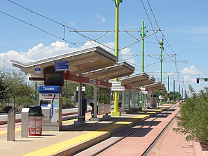
Jackson/Euclid station
Distance: Approx. 2174 meters
Latitude and longitude: 40.77152778,-111.915
Jackson/Euclid station is a light rail station in Salt Lake City, Utah serviced by the Green Line of the Utah Transit Authority's (UTA) TRAX system. The Green Line provides service from the Salt Lake City International Airport to West Valley City (via Downtown Salt Lake City and connects with the rest of the TRAX system, as well as UTA's FrontRunner commuter rail and S Line streetcar.
Fairpark station
Distance: Approx. 1685 meters
Latitude and longitude: 40.77152778,-111.92444444
Fairpark station is a light rail station in Salt Lake City, Utah, served by the Green Line of the Utah Transit Authority's (UTA) TRAX system. The Green Line provides service from the Salt Lake International Airport to West Valley City (via Downtown Salt Lake City and connects with the rest of the TRAX system, as well as UTA's FrontRunner commuter rail and S Line streetcar.
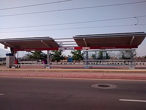
Power station (UTA)
Distance: Approx. 1489 meters
Latitude and longitude: 40.77152778,-111.93388889
Power station is a light rail station in Salt Lake City, Utah, served by the Green Line of the Utah Transit Authority's (UTA) TRAX system. The Green Line provides service from the Salt Lake City International Airport to West Valley City (via Downtown Salt Lake City), and connects with the rest of the TRAX system, as well as UTA's FrontRunner commuter rail and S Line streetcar.
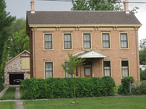
Thomas and Mary Hepworth House
Historic house in Salt Lake City, Utah, U.S.
Distance: Approx. 2288 meters
Latitude and longitude: 40.77361111,-111.91111111
The Thomas & Mary Hepworth House is a historic house in Salt Lake City, Utah.

Albert Fisher Mansion and Carriage House
Historic house in Salt Lake City, Utah, U.S.
Distance: Approx. 2307 meters
Latitude and longitude: 40.76527778,-111.925
The Albert Fisher Mansion and Carriage House, at 1206 West 200 South in Salt Lake City, Utah, United States, was designed by architect Richard K.A. Kletting and was built in 1893. It was listed on the National Register of Historic Places in 2008. In 2006, the Salt Lake City government purchased the house, which was originally the home of a prominent German brewer.
Fairpark, Salt Lake City
Neighborhood in Salt Lake City, Utah, United States
Distance: Approx. 951 meters
Latitude and longitude: 40.7770141,-111.9294547
Fairpark is a western neighborhood of Salt Lake City, Utah. It lies north of Poplar Grove and south of Rose Park. It is one of the smaller neighborhoods in Salt Lake and is often confused with Rose Park.

Utah State Library
Distance: Approx. 1486 meters
Latitude and longitude: 40.7764,-111.9474
The Utah State Library in Salt Lake City, Utah is a division of the Utah Department of Cultural and Community Engagement.
Power District Stadium
Distance: Approx. 1611 meters
Latitude and longitude: 40.77113889,-111.92788889
Power District Stadium is a proposed baseball stadium to be constructed in Salt Lake City, Utah. It will be home to an expansion/relocated team of Major League Baseball (MLB). Capacity, ownership, financing and opening are yet to be determined.
Weather in this IP's area
clear sky
26 Celsius
26 Celsius
24 Celsius
27 Celsius
1012 hPa
30 %
1012 hPa
878 hPa
10000 meters
4.63 m/s
160 degree
07:02:12
19:48:34