Country:
Region:
City:
Latitude and Longitude:
Time Zone:
Postal Code:
IP information under different IP Channel
ip-api
Country
Region
City
ASN
Time Zone
ISP
Blacklist
Proxy
Latitude
Longitude
Postal
Route
Luminati
Country
Region
il
City
auburn
ASN
Time Zone
America/Chicago
ISP
ROYELLCOMMUNICATIONSINC
Latitude
Longitude
Postal
IPinfo
Country
Region
City
ASN
Time Zone
ISP
Blacklist
Proxy
Latitude
Longitude
Postal
Route
db-ip
Country
Region
City
ASN
Time Zone
ISP
Blacklist
Proxy
Latitude
Longitude
Postal
Route
ipdata
Country
Region
City
ASN
Time Zone
ISP
Blacklist
Proxy
Latitude
Longitude
Postal
Route
Popular places and events near this IP address

Auburn, Illinois
City in Illinois, United States
Distance: Approx. 2207 meters
Latitude and longitude: 39.57638889,-89.74388889
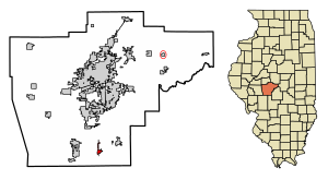
Auburn is a city in Sangamon County, Illinois, United States. The population was 4,771 at the 2010 census, and 4,681 in 2018. It is part of the Springfield, Illinois Metropolitan Statistical Area.

Divernon, Illinois
Village in Illinois, United States
Distance: Approx. 8179 meters
Latitude and longitude: 39.56611111,-89.65583333
Divernon is a village in Sangamon County, Illinois, United States. The population was 1,172 at the 2010 census, and 1,119 at a 2018 estimate. It is part of the Springfield, Illinois Metropolitan Statistical Area.

Thayer, Illinois
Village in Illinois, United States
Distance: Approx. 6540 meters
Latitude and longitude: 39.53916667,-89.76111111
Thayer is a village in Sangamon County, Illinois, United States. The population was 693 at the 2010 census. It is part of the Springfield, Illinois Metropolitan Statistical Area.

Auburn Township, Sangamon County, Illinois
Township in Illinois, United States
Distance: Approx. 3539 meters
Latitude and longitude: 39.5675,-89.76055556
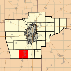
Auburn Township is located in Sangamon County, Illinois. As of the 2010 census, its population was 6,333 and it contained 2,513 housing units. It contains the city of Auburn, for which it is named, and the village of Thayer.

Chatham Township, Sangamon County, Illinois
Township in Illinois, United States
Distance: Approx. 6488 meters
Latitude and longitude: 39.65361111,-89.75583333
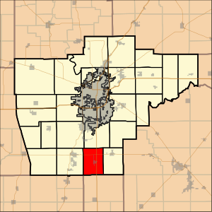
Chatham Township is located in Sangamon County, Illinois. As of the 2010 census, its population was 6,978 and it contained 2,963 housing units. Chatham Township changed its name from Campbell Township on September 2, 1863.

Divernon Township, Sangamon County, Illinois
Township in Illinois, United States
Distance: Approx. 7808 meters
Latitude and longitude: 39.56805556,-89.65944444
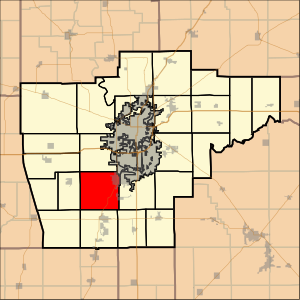
Divernon Township is located in Sangamon County, Illinois. As of the 2010 census, its population was 1,510 and it contained 677 housing units. Divernon Township formed from Pawnee Township in 1887.
Divernon High School
School in Divernon, Illinois, United States
Distance: Approx. 8469 meters
Latitude and longitude: 39.565,-89.65277778
Divernon High School was a public, community high school in Divernon, Illinois, United States. It was managed by the Divernon Community Unit School District 13.
Sugar Creek Covered Bridge
United States historic place
Distance: Approx. 8494 meters
Latitude and longitude: 39.64027778,-89.66194444
Sugar Creek Covered Bridge is a covered bridge which crosses Sugar Creek southeast of Chatham, Illinois. The Burr truss bridge is 110 feet (34 m) long and 30 feet (9.1 m) wide. The bridge was constructed by Thomas Black; sources disagree on the date of construction, placing it at either 1827 or 1880.
Interurban Trail (Sangamon County)
Distance: Approx. 9059 meters
Latitude and longitude: 39.6721,-89.7047
The Interurban Trail is a 8.3-mile (13.4 km) rail trail in Sangamon County, Illinois, United States. It was built by the Illinois Department of Transportation (IDOT) and occupies an abandoned Illinois Terminal Railroad interurban corridor. It stretches from the south side of Springfield, to the center of Chatham.
Glenarm, Illinois
Unincorporated community in Illinois, United States
Distance: Approx. 8613 meters
Latitude and longitude: 39.62361111,-89.64888889
Glenarm is an unincorporated community in Sangamon County, Illinois, United States. Glenarm is located along Interstate 55, south of Springfield. Glenarm has a post office with ZIP code 62536.
Cimic, Illinois
Unincorporated community in Illinois, United States
Distance: Approx. 7492 meters
Latitude and longitude: 39.59,-89.65583333
Cimic is an unincorporated community in Divernon Township, Sangamon County, Illinois, United States. Cimic is located on Illinois Route 104 west of its junction with Interstate 55; parts of the community have been annexed by Divernon.
Nipper Wildlife Sanctuary
Distance: Approx. 9225 meters
Latitude and longitude: 39.64934,-89.82536
The Nipper Wildlife Sanctuary is a 120-acre (49 ha) private-sector nonprofit park and wildlife sanctuary located near Loami in the U.S. state of Illinois. Operated by the Friends of the Sangamon Valley, the sanctuary commemorates its benefactors, farmers Frank and Gladys Nipper, who donated the land used to replant and endow the sanctuary. The Nipper Sanctuary specializes in the recreation of the former tallgrass prairie once common in central Illinois.
Weather in this IP's area
overcast clouds
14 Celsius
14 Celsius
14 Celsius
16 Celsius
1013 hPa
82 %
1013 hPa
991 hPa
10000 meters
3.97 m/s
5.24 m/s
215 degree
100 %
06:46:12
16:42:11
