208.79.9.188 - IP Lookup: Free IP Address Lookup, Postal Code Lookup, IP Location Lookup, IP ASN, Public IP
Country:
Region:
City:
Location:
Time Zone:
Postal Code:
IP information under different IP Channel
ip-api
Country
Region
City
ASN
Time Zone
ISP
Blacklist
Proxy
Latitude
Longitude
Postal
Route
Luminati
Country
Region
la
City
saintjoseph
ASN
Time Zone
America/Chicago
ISP
SKRC-SOUTH01
Latitude
Longitude
Postal
IPinfo
Country
Region
City
ASN
Time Zone
ISP
Blacklist
Proxy
Latitude
Longitude
Postal
Route
IP2Location
208.79.9.188Country
Region
louisiana
City
alexandria
Time Zone
America/Chicago
ISP
Language
User-Agent
Latitude
Longitude
Postal
db-ip
Country
Region
City
ASN
Time Zone
ISP
Blacklist
Proxy
Latitude
Longitude
Postal
Route
ipdata
Country
Region
City
ASN
Time Zone
ISP
Blacklist
Proxy
Latitude
Longitude
Postal
Route
Popular places and events near this IP address
Alexandria, Louisiana
City in Louisiana, United States
Distance: Approx. 4429 meters
Latitude and longitude: 31.29277778,-92.45916667
Alexandria is the ninth-largest city in the state of Louisiana and is the parish seat and largest city of Rapides Parish, Louisiana, United States. It lies on the south bank of the Red River in almost the exact geographic center of the state. It is the principal city of the Alexandria metropolitan area (population 153,922) which encompasses all of Rapides and Grant parishes.
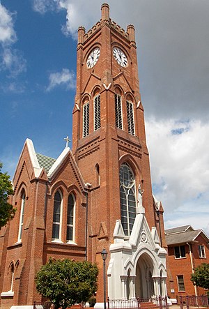
Roman Catholic Diocese of Alexandria in Louisiana
Catholic ecclesiastical territory
Distance: Approx. 4429 meters
Latitude and longitude: 31.29277778,-92.45916667
The Diocese of Alexandria in Louisiana (Latin: Diœcesis Alexandrina in Louisiana) is a Latin Church ecclesiastical territory, or diocese, of the Catholic Church in central Louisiana in the United States. It is a suffragan diocese in the ecclesiastical province of the metropolitan Archdiocese of New Orleans. The diocesan cathedral is St.

Rapides Parish Coliseum
Arena in Louisiana, United States
Distance: Approx. 463 meters
Latitude and longitude: 31.29666667,-92.50361111
The Rapides Parish Coliseum (often called the Rapides Coliseum, as noted on the sign out front) is a multi-purpose arena located on Louisiana Highway 28 West in Alexandria, Louisiana. The coliseum can seat up to 10,000 people in the 65,000-square-foot (6,000 m2) building. Additional space is in the smaller Exhibition Hall, also on the property.

Bringhurst Field
Distance: Approx. 4670 meters
Latitude and longitude: 31.286615,-92.458556
Bringhurst Field was from 1933 to 2013 a baseball stadium in Alexandria, Louisiana. Owned by the city of Alexandria, it served as the home field of the Alexandria Aces, one of the most successful independent league baseball teams, which won various championships in 1997, 1998, 2006, 2007, and 2009. It also hosted local high school games.

Kent Plantation House
Historic house in Louisiana, United States
Distance: Approx. 2103 meters
Latitude and longitude: 31.30611111,-92.48361111
Kent Plantation House is the oldest standing structure in Central Louisiana. Listed since 1971 in the National Register of Historic Places, Kent House is located in Alexandria in Rapides Parish. The plantation house is a representation of southern plantation life between 1795 and 1855.
Alexandria Garden District
Historic district in Louisiana, United States
Distance: Approx. 4368 meters
Latitude and longitude: 31.29972222,-92.45888889
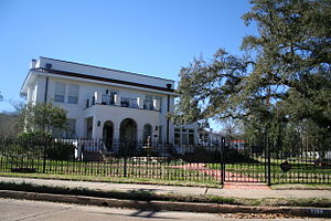
Alexandria Garden District is located in Alexandria, Louisiana. It was added to the National Register of Historic Places on April 9, 2001. Boundaries of the district are approximately described as Marye Street, Bolton Avenue, White Street, and Hynson Bayou.
Conerly House
United States historic place
Distance: Approx. 3918 meters
Latitude and longitude: 31.31277778,-92.46611111
Conerly House is located in Alexandria, Louisiana. It was added to the National Register of Historic Places on December 5, 1984. The house was relocated in 2004.
Geneva (Alexandria, Louisiana)
Historic house in Louisiana, United States
Distance: Approx. 1678 meters
Latitude and longitude: 31.31388889,-92.51333333
Geneva, also called the Vanderlick House, is a historic house near Alexandria, Louisiana. It was one of ten farm-plantation houses along Bayou Rapides that illustrate the "Neo-Classical Architecture of Bayou Rapides" on the National Register of Historic Places. As with several of the others (Eden, China Grove, Hope, Island Home, Longview), Geneva was modified by the addition of a hood along its original gallery, termed a false gallery, which provides additional protection from the rain, detracting slightly from its original appearance.
Hopson House
Historic house in Louisiana, United States
Distance: Approx. 1977 meters
Latitude and longitude: 31.31694444,-92.49638889
Hopson House is located in Alexandria, Louisiana. It was added to the National Register of Historic Places on December 5, 1984, and removed in 2016.

Melady House
Historic house in Louisiana, United States
Distance: Approx. 3469 meters
Latitude and longitude: 31.33138889,-92.51111111
Melady House is a historic house in Alexandria, Louisiana. The house is located at 5800 England Drive. It was built c. 1905 in Rapides Parish in the Colonial Revival style.

Rugg Elementary School
United States historic place
Distance: Approx. 4047 meters
Latitude and longitude: 31.295,-92.46277778
Rugg Elementary School is located in Alexandria, Louisiana. Built in 1940 it was added to the National Register of Historic Places on August 10, 2001.

Actions near Alexandria
1864 battle of the American Civil War
Distance: Approx. 4429 meters
Latitude and longitude: 31.29277778,-92.45916667
The Actions near Alexandria (April 24 – May 13, 1864) saw a Confederate States Army force commanded by Major General Richard Taylor surround a greatly superior Union Army led by Major General Nathaniel P. Banks and a United States Navy flotilla commanded by Rear Admiral David Dixon Porter at Alexandria, Louisiana. Porter's gunboats were trapped above the double falls in the Red River by low water. Banks' army was compelled to halt its retreat to keep Porter's vessels from being scuttled or from falling into Confederate hands.
Weather in this IP's area
clear sky
18 Celsius
17 Celsius
18 Celsius
19 Celsius
1025 hPa
32 %
1025 hPa
1020 hPa
10000 meters
9.77 m/s
12.35 m/s
320 degree


