208.79.164.149 - IP Lookup: Free IP Address Lookup, Postal Code Lookup, IP Location Lookup, IP ASN, Public IP
Country:
Region:
City:
Location:
Time Zone:
Postal Code:
IP information under different IP Channel
ip-api
Country
Region
City
ASN
Time Zone
ISP
Blacklist
Proxy
Latitude
Longitude
Postal
Route
Luminati
Country
Region
pa
City
mars
ASN
Time Zone
America/New_York
ISP
IDEALCLOUD
Latitude
Longitude
Postal
IPinfo
Country
Region
City
ASN
Time Zone
ISP
Blacklist
Proxy
Latitude
Longitude
Postal
Route
IP2Location
208.79.164.149Country
Region
pennsylvania
City
pittsburgh
Time Zone
America/New_York
ISP
Language
User-Agent
Latitude
Longitude
Postal
db-ip
Country
Region
City
ASN
Time Zone
ISP
Blacklist
Proxy
Latitude
Longitude
Postal
Route
ipdata
Country
Region
City
ASN
Time Zone
ISP
Blacklist
Proxy
Latitude
Longitude
Postal
Route
Popular places and events near this IP address

Baldwin, Pennsylvania
Borough in Pennsylvania, United States
Distance: Approx. 1431 meters
Latitude and longitude: 40.35722222,-79.96944444
Baldwin is a borough in Allegheny County, Pennsylvania, United States. Part of the Pittsburgh metropolitan area, the borough's population was 21,510 as of the 2020 census.
Brentwood, Pennsylvania
Borough in Pennsylvania, United States
Distance: Approx. 3159 meters
Latitude and longitude: 40.37444444,-79.97611111
Brentwood is a borough in Allegheny County, Pennsylvania, United States. The population was 10,082 at the 2020 census. It is a residential suburb of the Pittsburgh metropolitan area.

Pleasant Hills, Pennsylvania
Borough in Pennsylvania, United States
Distance: Approx. 2134 meters
Latitude and longitude: 40.33222222,-79.96055556
Pleasant Hills is a borough in Allegheny County, Pennsylvania, United States. As of the 2020 census, the population was 8,504. It is a suburb of the Pittsburgh metropolitan area.

Whitehall, Allegheny County, Pennsylvania
Borough in Pennsylvania, United States
Distance: Approx. 1735 meters
Latitude and longitude: 40.36027778,-79.98638889
Whitehall is a landlocked borough in Allegheny County, Pennsylvania, United States. The population was 15,064 at the 2020 census, an increase of 1,120 since the 2010 census. It is part of the Pittsburgh metropolitan area.

Century III Mall
Defunct shopping mall in West Mifflin, Pennsylvania
Distance: Approx. 3014 meters
Latitude and longitude: 40.338,-79.944
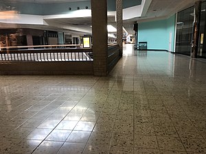
Century III Mall was an abandoned enclosed shopping mall located along Route 51 in West Mifflin, Pennsylvania, about 10 miles southeast of downtown Pittsburgh, Pennsylvania, United States. It operated from 1979 to 2019 — a period of almost 40 years. The mall was built on a former slag dump in 1979.
Baldwin High School (Pennsylvania)
Public high school in Pittsburgh, Pennsylvania, United States
Distance: Approx. 1022 meters
Latitude and longitude: 40.35528,-79.97778
Baldwin High School is a public high school in suburban Pittsburgh, Pennsylvania, United States. The district serves the communities of: Baldwin, Whitehall and Baldwin Township. It is part of the Baldwin-Whitehall School District.
Pennsylvania's 31st congressional district
Former U.S. House district in Pennsylvania
Distance: Approx. 2353 meters
Latitude and longitude: 40.33333333,-80
Pennsylvania's 31st congressional district was one of Pennsylvania's districts of the United States House of Representatives. It existed from 1903 to 1953.
Bear's Retreat
Distance: Approx. 2881 meters
Latitude and longitude: 40.3275,-79.9543
Bear's Retreat is a small Pennsylvania landmark, primarily known for its age. It is a privately owned house dating back to c. 1794, being lived in as of 2011.
Brentwood High School (Pennsylvania)
Public school in the United States
Distance: Approx. 3155 meters
Latitude and longitude: 40.3743,-79.9742
Brentwood High School is a public high school located in Brentwood, Pennsylvania, outside of Pittsburgh, that serves students in grades 9 through 12. It is part of the Brentwood Borough School District. The school building also includes Brentwood Middle School, which houses the district's students in grades 6–8.
Broughton, Pennsylvania
Unincorporated community in Pennsylvania, United States
Distance: Approx. 1979 meters
Latitude and longitude: 40.33,-79.98777778
Broughton is an unincorporated community in South Park Township, Pennsylvania, United States. Originally named Curry after Joseph Curry, a frontier physician and coroner of Allegheny County in 1810, it was renamed Broughton, to avoid confusion with the nearby Curry Hollow and the Curry in Blair County. It is located at the junction of Brownsville Road, Curry Road, and Broughton Road.
Curry, Pennsylvania
Distance: Approx. 1704 meters
Latitude and longitude: 40.33194444,-79.98555556
Curry is an unincorporated community in Allegheny County, Pennsylvania, later renamed Broughton.
Horning, Pennsylvania
Neighborhood in Allegheny, Pennsylvania, United States
Distance: Approx. 1492 meters
Latitude and longitude: 40.3375,-79.99138889
Horning is a neighborhood in the borough of Baldwin in Allegheny County, Pennsylvania, United States. It was the residence of miners of the Pittsburgh Terminal Railroad and Coal Company #4 Mine, which had a racially integrated workforce, unusual in that era.
Weather in this IP's area
moderate rain
3 Celsius
-1 Celsius
2 Celsius
3 Celsius
1013 hPa
78 %
1013 hPa
974 hPa
10000 meters
4.12 m/s
8.23 m/s
300 degree
100 %
